- Last Minute

Mont Blanc Hiking & Walking Tours

Destination
Bosnia and herzegovina, czech republic, liechtenstein, netherlands, north macedonia, switzerland, türkiye/turkey, united kingdom, bike & boat, multi-activity, vessels & boats, advanced search.
Sitting on the Italian and French border is Western Europe’s highest mountain – Mont Blanc. At 4810m, some underestimate the scale of Mont Blanc and the other 4000m+ peaks in this region of the European Alps. Whether standing on the valley floor, or crossing a panoramic pass, the magnitude and beauty of this wilderness region will definitely leave an impression on you.
Mont Blanc is permanently covered in snow and ice, hence it’s name. The literal translation for Mont Blanc is ‘White Mountain’. In French, the mountain is often referred to as La Dame blanche ("the White Lady") and in Italian Mont Blanc is often referred to as Il Bianco ("the White One").
The Mont Blanc massif was first climbed in 1786, and the ascent gave birth to modern day mountaineering. It is not only a region for climbers however, walking in Mont Blanc has become so popular that the region is now the third most visited natural site in the world. Anyone who travels here will soon see why.
Few will capture the true beauty of the European Alps’ highest peak and surrounding mountains with a fleeting visit to famous towns such as Chamonix. To truly do justice with the picture postcard views of spectacular mountain vistas and alpine landscapes a walk in the Mont Blanc region is a must.
There are a number of trails open to walkers of various fitness levels. Without doubt the most famous Mont Blanc trek is the classic Tour du Mont Blanc, however families and walkers of various abilities can choose a trail to suit their fitness level.
UTracks offers a number of treks and walks around sections of Mont Blanc, as well as the full 'Tour du Mont Blanc' circumnavigation. You can walk as part of a guided Mont Blanc walk or choose to travel from hut to hut on your own on a Mont Blanc self guided walk.
Find your Mont Blanc Walks trip
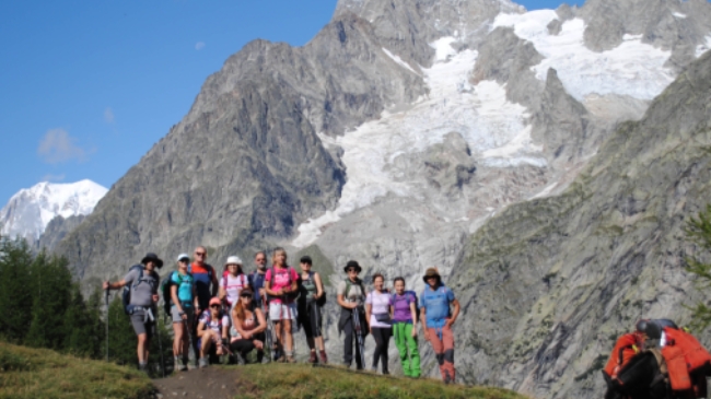
Mont Blanc Guided Walk
Moderate to Challenging
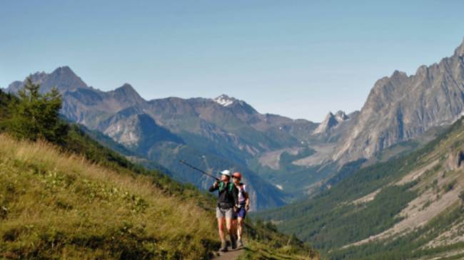
Mont Blanc Classic
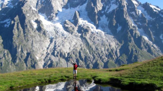
Mont Blanc Circuit
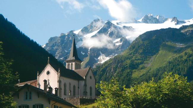
Mont Blanc Rambler
Highlights of the Tour du Mont Blanc in Comfort
Challenging
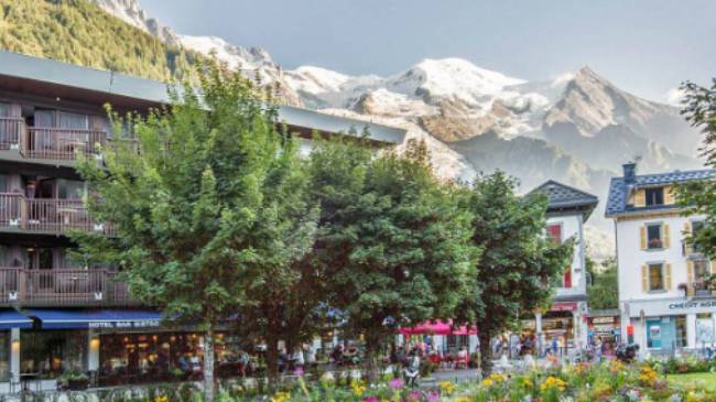
Classic Tour du Mont Blanc in Comfort
More about mont blanc walks.
- Popular activities
Mont Blanc Walks highlights
- Popular travel regions
Why travel with us
- Responsible travel
Accommodation
- Leaders in the field
- Custom made itineraries
- Related articles
Trip reviews
Essential information, popular activities in mont blanc walks.
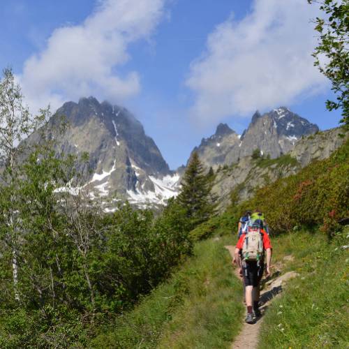
Self Guided Walking
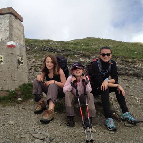
Family Walking
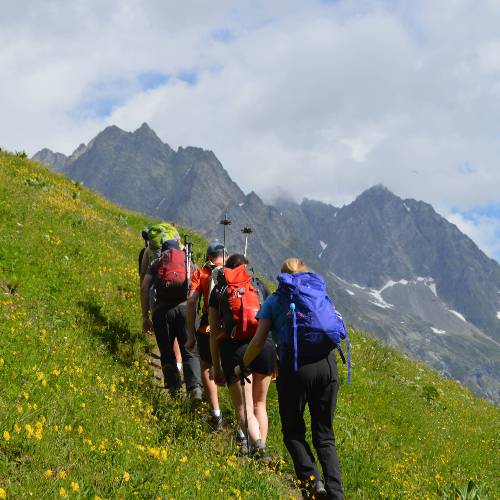
Guided Walking
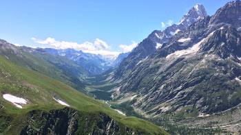
Tour du Mont Blanc
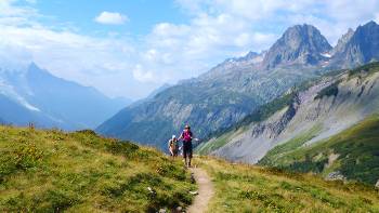
Scenic high mountain paths
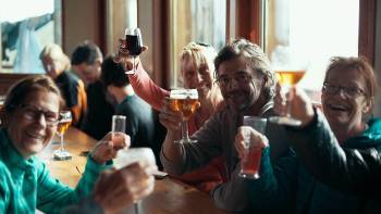
Traditional mountain refuges & gîtes
Designing Mont Blanc walks for everyone
Self guided or small group; with the family on a relaxed ramble or with friend to circumnavigate the massif; our walking options cater to more fitness levels than anyone else in the Mont Blanc region.
Making Mont Blanc affordable
Trips only include what you need like accommodation, meals, bikes on cycle trips, luggage transfers, maps and route directions on self guided trips and an experienced local guide for group trips, as well as the peace of mind that comes with complete backup and support.
Travel with experienced mountain guides
Our guided walks in the mountain regions of France are led by bilingual, experienced professionals who know the region well. Every guide is first-aid trained and carry appropriate communication devices with them in case of an emergency.
Explore Mont Blanc at your own pace
On self guided trips you can expect to receive up-to-date and well researched route notes and maps, seamless luggage transfers and competitive pricing on all essential services. Many self guided trips also have daily departure dates, allowing you to enjoy the convenience and flexibility a self guided trip offers.
Enjoy flexibility and choices
Cycling or walking, 2 star or 4 star, small groups or self guided, land or sea - we can help you explore Europe exactly the way you want.
Refuges or Gite hostels
These convivial places add to the atmosphere of your journey through the mountains. Dorms may sleep up to 40 people and the beds are often bunk beds. Linen and blankets are provided and bathrooms are shared. Private rooms maybe available (note that private gite rooms still use shared bathrooms).
Charming local hotels
On some Mont Blanc walks we use a range of 2-3 star hotels, often family run. These charming hotels provide access to local living thanks to your hosts. The hospitality is generous and their local knowledge is invaluable. Where possible, we choose hotel locations that add to your experience.
Simple yet rich in local character, the B&B’s chosen are clean, comfortable and run by hosts that help add to your experience.
Related Articles
Rating: ☆ ☆ ☆ ☆ ☆ ☆ ☆ ☆ ☆ ☆ ☆ ☆ ☆ ☆ ☆ ☆ ☆ ☆ ☆ ☆ ☆ ☆ ☆ ☆ ☆ ☆ ☆ ☆ ☆ ☆
- Where to Go & Weather
- Dialing Code
Electricity
- Health & Safety
Where to Go
Take in stunning alpine scenery around the highest peak in Western Europe including the Matterhorn & Dent Blanche.
Follow the historic route from the head of the Chamonix Valley to Zermatt on a 10-day trip.
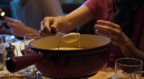
The culinary specialties such as fondue, cold cut meats & tartiflette are a true highlight on any Mont Blanc walking holiday.
Experience the exhilaration of trekking through three countries in the European Alps: France, Italy & Switzerland.
Traverse high passes or take the Haute Route on Mont Blanc.
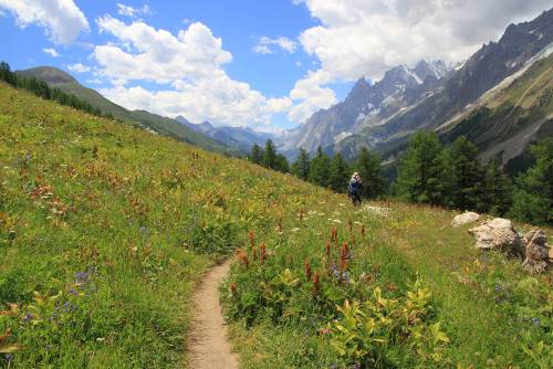
The walking season in the European Alps is short – from mid June to mid September and many of the mountain refuges are closed outside this time. Many of our alpine walks are at altitudes of over 1000m and up to around 2500m, temperatures can vary significantly. Please note at the beginning of the season you may experience snow and therefore the walking can be harder and slippery underfoot. Temperatures in summer range from around 6 degrees Celsius to 20 degrees Celsius during the day. Afternoon thunderstorms are quite common. At the higher elevations it is important to dress with layers as cold winds and possible snow falls can happen even in summer.
Time in Mont Blanc Walks
France is +2 hours ahead of GMT/UTC
French (official)
In most areas some English will be spoken
International Dialing Code
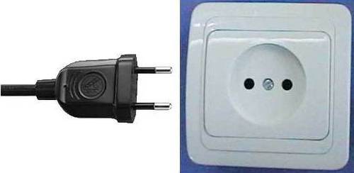
Electricity in France is 230 Volts, at 50 hertz. The most common pin type is C. (2 round prong).
Visas not required for citizens of Australia, Canada, USA and New Zealand for up to 90 days in a period of 180 days for all Schengen countries (see www.schengenvisainfo.com/schengen-visa-countries-list/ for countries part of the Schengen). Please ensure your passport is stamped on arrival in the Schengen area. For all other nationalities and for longer stays in countries covered by the Schengen Agreement (Australian New Zealand, Canadian and US passport holders), please contact the relevant embassy. Stays of longer than 90 days in the Schengen area require a long stay visa for the country you are spending most time in. However long stay visas are unlikely to be issued unless there is a valid reason (eg. studying in country). Unfortunately we cannot assist in obtaining visas for long stays due to individual country visa requirements.
Your safety is our number one concern. Our safety track record is exemplary thanks to careful management and thorough consultation with local partners. Our industry leading risk management procedures have become a skill that we continue to refine. Our leaders in the field are highly trained and have safety as their number one priority. Expert leaders, risk assessments, quality inclusions and your financial security all come standard when you travel with us.
Please refer to our Travel Advisory page for updates on recent events, travel warnings and advice.
We strongly recommend that all clients take out travel insurance at the time of booking to cover against sickness, accident, loss of baggage, unexpected alterations to travel arrangements and travel disruption, emergency evacuation, cancellations, etc. Insurance information is enclosed with your pre-departure information. Please contact us if you would like to obtain a quote for your trip duration.
We suggest that you consult your doctor, local government inoculation centre or a travel medical specialist in order to get the most current advice regarding vaccination requirements.
Money and valuables should always be stored safely when travelling. Keep your passport with you at all times and do not leave it in your main luggage. You will need it to change money and check into hotels. Where safety deposit boxes are available, we recommend that you use them. Keep jewellery and valuables to a minimum.
- Cookie Policy
- Strictly Necessary
- Performance
When you visit any web site, it may store or retrieve information on your browser, mostly in the form of cookies. This information might be about you, your preferences, your device or used to make the site work as you expect it to. The information does not usually identify you directly, but it can give you a more personalized web experience. You can choose not to allow some types of cookies. Click on the different category headings to find out more and change our default settings. However, you should know that blocking some types of cookies may impact your experience on the site and the services we are able to offer.
These cookies are necessary for the website to function and cannot be switched off. They are usually only set in response to actions made by you which amount to a request for services, such as setting your privacy preferences, logging in or filling in forms. You can set your browser to block or alert you about these cookies, but some parts of the site will no longer work. These cookies do not store any personally identifiable information.
These cookies allow us to count visits and traffic sources, so we can measure and improve the performance of our site. They help us know which pages are the most and least popular and see how visitors move around the site. All information these cookies collect is aggregated and therefore anonymous. If you do not allow these cookies, we will not know when you have visited our site.
These cookies allow the provision of enhance functionality and personalization, such as videos and live chats. They may be set by us or by third party providers whose services we have added to our pages. If you do not allow these cookies, then some or all of these features may not function properly.
These cookies are set through our site by our advertising partners. They may be used by those companies to build a profile of your interests and show you relevant ads on other sites and promotional activities through our newsletters. They work by uniquely identifying your browser and device. If you do not allow these cookies, you will not experience our targeted advertising across different websites or via newsletters.
Tour du Mont Blanc in 7 Days: Map, Stages & Accommodations
The Tour du Mont Blanc is an epic hiking experience that takes you through three countries – France, Italy, and Switzerland – in an intense week. This adventure invites you to measure yourself against the majesty of the Alps, crossing mountain passes such as the Col du Brévent, the Col de la Seigne, and the Col des Fours, while admiring the grand landscapes of Mont Blanc.
The route offers exceptional flexibility, allowing hikers to adjust the difficulty of their journey by varying the number of days. A seven-day tour represents a considerable challenge, with some long and strenuous stages, but offers unmatched rewards in terms of satisfaction and breathtaking panoramas. For those who prefer a gentler adventure, a ten-day tour provides a more relaxed alternative.
Accommodation along the route is varied and abundant, with a wide choice ranging from comfortable hotels to quaint gîtes, traditional mountain refuges , and even bivouac sites for the more adventurous. Prepare for total immersion in the wild splendor of the Alps, facing the vastness of Mont Blanc.
Day 1 (Option 1): Les Houches – Refuge de la Balme
Download the GPX track of the stage: https://www.visugpx.com/mSlFmJ4Qro
Elevation gain, altitude, and mileage of the stage

Elevation +

Elevation –

Max. Altitude

Min. Altitude
Stage Summary:
The first stage of the Tour du Mont Blanc is a 25-kilometer adventure that starts at Les Houches and ends at the Refuge de la Balme. After about 2h30 of walking from Les Houches, you will reach the Col de Voza, an initial challenge that will get you into the swing of things with about 660 meters of positive elevation gain over a distance of 6 to 7 kilometers, depending on your starting point. This first part of the route offers an impressive introduction to the beauty of the Alps and a first leg-stretcher for the rest of the tour.
After the Col de Voza, you will descend about 11 kilometers, with a negative elevation change of around 800 meters, to arrive in Les Contamines. This charming town is an ideal place to take a break, refresh with a local beer, and even spend the night if you prefer not to continue to the Refuge de la Balme. For those who choose to continue, there are still about 7 kilometers and 550 meters of positive elevation gain to reach the Refuge de la Balme. There, you can choose to sleep in the comfort of the refuge or experience a more rustic stay at the bivouac area.
Points of Interest for the Stage
Col de Voza
Where to Sleep?
Refuge de la Balme Bivouac area of Refuge de la Balme Possible to stop earlier in Les Contamines (camping or hotel)
Day 1 (option 2): Les Houches – Refuge de la Balme via the Col de Tricot variant
Download the GPX track of the stage: https://www.visugpx.com/rFQWJMXPXN
Summary of the Stage
The first stage of the Tour du Mont Blanc offers an exciting variant that goes through the Col du Tricot, adding an extra dimension to this alpine adventure. The first part of the stage remains the same as the classic route, with a walk of about 2h30 from Les Houches to the Col de Voza. This section of the route includes about 660 meters of positive elevation gain over a distance of 6 to 7 kilometers, depending on your starting point.
Once at the Col de Voza, you will have the choice of staying on the classic route or taking the variant via the Col du Tricot. If you choose the latter, you should prepare for about 600 meters of additional positive elevation gain over a distance of 6 kilometers to reach the Col du Tricot. This variant offers a more demanding hiking experience, but also more rewarding, with spectacular panoramic views of the Alps.
From the Col du Tricot, you have several options for the rest of your day. You can continue to the Refuge de la Balme to spend the night, offering a longer but also more rewarding end to the day. Alternatively, you can turn towards Les Contamines to shorten your day and spend the night there.
Col de Voza Col de tricot at 2120m
Day 2 (option 1): Refuge de la Balme > Chapieux > Les Mottets
Download the GPX track for the stage: https://www.visugpx.com/pubLJ5t1su
The second stage of the Tour du Mont Blanc begins at the Refuge de la Balme and ends at the Refuge des Mottets. It follows the classic route of the tour.
The departure from the Refuge de la Balme leads to a climb of 650 meters of elevation gain over a distance of 4 kilometers to reach the Col du Bonhomme. Once at the pass, you will continue on the classic route of the tour, without taking the variant via the Col des Fours.
After the Col de la Croix du Bonhomme, you will begin a descent of 4 kilometers with a negative elevation change of 800 meters to arrive at Chapieux. From there, you will continue calmly for about 6 kilometers to the Refuge des Mottets. Along the way, you can stop at the Ville des Glaciers, where it’s possible to stop at the alpine pasture to stock up on local cheese, a true delicacy of the region.
Once arrived at the Refuge des Mottets, you will have completed this stage of the tour. This is your last stop before crossing into Italy the next day. It is recommended to book in advance if you plan to sleep in the refuge. It is important to note that it is forbidden to bivouac on the refuge property, which is quite large. However, you can pitch your tents before the refuge at the level of the ruins (about 5/10 minutes before the refuge) or after starting the ascent towards the Col de la Seigne, just behind the first “peak” that is visible from the refuge.
Col du bonhomme Col de la croix du bonhomme
Refuge des Mottets Bivouac before the Refuge des Mottets at the level of the ruins. Set up your tents quickly as it fills up very fast. Bivouac after the Refuge des Mottets (directly after the first ascent towards the Col de la Seigne)
Day 2 (option 2): Refuge de la Balme > Col des Fours > Les Mottets
Download the GPX track for the stage: https://www.visugpx.com/URWmZQHWLG
The beginning of the stage is the same as the classic route, starting from the Refuge de la Balme and ascending 650 meters of elevation gain over 4 kilometers to reach the Col du Bonhomme.
Continuing towards the Col de la Croix du Bonhomme, you will then choose the variant that leads to the Col des Fours. This variant takes you to an altitude of 2665 meters, offering spectacular views of the surrounding mountains. Before embarking on this variant, it is essential to check the weather and the trail conditions in advance. Depending on the season, there can be a lot of snowfields, making some passages dangerous even in summer.
Once at the Col des Fours, you will begin a descent of 5 kilometers with a negative elevation change of 900 meters to arrive at the Ville des Glaciers. You can stop at the alpine pasture to stock up on local cheese, a true delicacy of the region, before continuing to the Refuge des Mottets.
The Refuge des Mottets is your last stop before crossing into Italy the next day. It is recommended to book in advance if you plan to sleep in the refuge. It is important to note that it is forbidden to bivouac on the refuge property, which is quite large. However, you can pitch your tents before the refuge at the level of the ruins (about 5/10 minutes before the refuge) or after starting the ascent towards the Col de la Seigne, just behind the first “peak” that is visible from the refuge.
Day 3: Les Mottets > Courmayeur
Download the GPX track for the stage: https://www.visugpx.com/Twvax7D6iA
The third stage of the Tour du Mont Blanc will take you from France to Italy, crossing spectacular alpine landscapes. The stage begins at the Refuge des Mottets, and after only 4 kilometers and about 600 meters of positive elevation gain, you will reach the Col de la Seigne. This pass, perfect for waking up, marks your entry into Italy and offers breathtaking panoramic views of the surrounding mountains.
After the Col de la Seigne, you will continue for about 9 to 10 kilometers through the beautiful Italian valley. This part of the route takes you through varied landscapes, including the picturesque Lake Combal and several mountain refuges. Each step of this stage offers a new view of the Alps, with constantly changing panoramas and opportunities for memorable photos.
Finally, you will begin a descent of 11 kilometers with a negative elevation change of 1260 meters to arrive in Courmayeur. This Italian town is a welcome resting place after this long stage. Courmayeur is full of hotels, perfect for recharging and preparing for the next stage of your adventure. Whether you choose to relax in a spa, taste local Italian cuisine, or simply rest, Courmayeur offers a perfect end to the day for this third stage of the Tour du Mont Blanc.
Col de la Seigne Lake Combal
Hotels in Courmayeur
Campings outside Courmayeur
Day 4: Courmayeur > Refuge Elena
Download the GPX track for the stage: https://www.visugpx.com/B3MhnslfBa
The fourth stage of the Tour du Mont Blanc is a day that offers a mix of challenges and relaxation. Your day begins with a climb of about 800 meters of positive elevation gain over a distance of 4 to 5 kilometers, depending on your starting point. This initial climb is an excellent way to wake up and prepare for the day ahead.
Once this climb is completed, the rest of the day is relatively “quiet” compared to other stages. You will continue for about 12 kilometers, with 330 meters of positive elevation and 600 meters of negative elevation. This part of the route takes you through the beautiful Italian valley, offering spectacular views and a relaxing hiking experience.
Before arriving at the Refuge Elena, you will have about 2 kilometers and about 300 meters of positive elevation gain left. This last climb is a final challenge before ending the day. The Refuge Elena is a popular place to spend the night, offering spectacular views of the surrounding mountains.
It is important to note that you will need to book in advance to sleep at the Refuge Elena, as it fills up quickly and there are not many sleeping options in the vicinity. In Italy, bivouacking is prohibited below 2500 meters in altitude, so it is essential to plan ahead. This fourth stage of the Tour du Mont Blanc offers a balanced hiking experience, with physical challenges, beautiful landscapes, and moments of relaxation.
Italian Valley
Where to sleep?
Refuge Elena
Day 5: Refuge Elena > Champex
Download the GPX track for the stage: https://www.visugpx.com/v4RKRYwRg3
The fifth stage of the Tour du Mont Blanc, from the Refuge Elena to Champex-Lac, is a hiking day that offers both challenges and moments of relaxation. Although this stage is quite long and some parts may not be the most attractive of the tour, it nevertheless provides a rewarding hiking experience.
The day begins with a beautiful climb of about 500 meters of positive elevation over 2 kilometers to reach the Grand Col Ferret. This ascent marks your crossing into Switzerland, a moment to celebrate, but also to consider for your phone’s internet data, as Switzerland may not be included in your European plan depending on the operator.
From the Grand Col Ferret, a descent of about 20 kilometers and 1600 meters of negative elevation awaits you. This descent brings you closer to Champex-Lac, your destination for the night. It’s worth noting that part of this stage can be done by bus by taking the shuttle at Ferret or La Fouly, which can be an attractive option for those wishing to save some energy.
You then have 6 kilometers and 600 meters of positive elevation remaining to reach the Relais de l’Arpette, where you will spend the night. It is also possible to sleep at the Camping des Rocailles in Champex, which is located about 45 minutes before the Relais de l’Arpette.
Grand Col Ferret (Italy/Switzerland border) Option to take the shuttle at Ferret to Champex and avoid walking for 4 hours Supermarket in La Fouly to restock if needed
Relais de l’Arpette Camping des rocailles (in Champex)
Day 6 (option 1): Champex > Col de Balme (via La Forclaz) > Tré le Champs.
Download the GPX track for the stage: https://www.visugpx.com/f8P8nDc8xt
The sixth stage of the Tour du Mont Blanc, from Champex to Tré le Champ, is a quite hard hiking day even without taking the variant via the Fenêtre d’Arpette. This stage also marks your return to France.
Your day begins with a climb towards the Col de la Forclaz, followed by another ascent to the Col de la Balme. The Col de la Balme is a highlight of this stage, offering spectacular views of the surrounding mountains. The refuge here is a beautiful place to take a break and enjoy the scenery. The passage at the Col de la Balme also marks the border with France, another significant milestone of your journey.
After enjoying the Col de la Balme and a drink at the refuge, you will begin a descent of about 6 kilometers with 700 meters of negative elevation to reach Tré le Champ and the Auberge de la Boerne. This descent offers another opportunity to enjoy the alpine landscapes while approaching your destination for the night.
It’s important to note that you need to book your night at the Auberge de la Boerne in advance, as it fills up quickly. The bivouac area is not the largest, so it’s advised to set up your tents quickly. Once settled, you can enjoy a wonderful meal at the inn and take advantage of the showers if you wish.
Col de la Forclaz Col de la Balme
Auberge de la Boerne (hostel) Auberge de la Boerne (camping)
Day 6 (option 2): Champex > Col de Balme (via Fenêtre d’Arpette) > Tré le Champs
Download the GPX track for the stage: https://www.visugpx.com/iIoAINv20C
The sixth stage of the Tour du Mont Blanc, from Champex to Tré le Champ with the variant via the Fenêtre d’Arpette, is considered one of the hardest of the Tour, but also one of the most beautiful and rewarding.
Starting from Champex, you’ll begin a climb over 6 kilometers with an elevation gain of 1100 meters. This ascent is a challenge in itself, with some complicated passages to reach the Fenêtre d’Arpette, and the trail can be difficult to follow. It’s essential to be cautious on the way, check the weather and trail conditions beforehand carefully. Some passages may still be snow-covered and dangerous if the weather is not favorable.
Once you reach the Fenêtre, take the time to rest and savor your accomplishment. You then have a descent of about 4 kilometers with 1000 meters of negative elevation before arriving at the Chalet des Glaciers. Here, you can reward yourself with a cheese crust and a good beer.
After a well-deserved break, you’ll embark on another ascent to the Col de la Balme, about 2 kilometers with approximately 600 meters of elevation gain. The view and refuge here are magnificent, and it’s recommended to make the most of it.
Finally, you have “only” 6 kilometers and 800 meters of negative elevation to reach Tré le Champ. As always, make sure to book your night in advance, whether in a refuge or bivouac, as these places fill up quickly. The bivouac area is not the largest, so it’s advised to set up your tents quickly. Once settled, you can enjoy a wonderful meal at the inn and take advantage of the showers if you wish. This stage of the Tour du Mont Blanc offers an unforgettable hiking experience, with physical challenges, breathtaking views, and well-deserved moments of relaxation.
Fenêtre d’Arpette Col de la Balme
Day 7: Tré le Champs > Les Houches
Download the GPX track for the stage: https://www.visugpx.com/3kIaPa8PzP
Congratulations! You’ve reached the seventh and final stage of the Tour du Mont Blanc, from Tré le Champ to Les Houches. It’s a flexible day, adaptable to your needs and desires, whether in terms of accommodation, transport, or difficulty level.
If you choose to descend to Les Houches, prepare for a full day. However, many “exits” are available along the way, allowing you to adjust your day according to your physical condition and desires.
You have the option to take the cable car from La Flégère to Chamonix, offering a quick descent and a stunning view of the valley. Another option is to take the cable car from Brévent to Chamonix, another way to enjoy the view without the effort of descending.
If you feel up to it, you can also choose to walk down to Chamonix before the ascent of Brévent. This option allows you to fully enjoy the natural beauty of the route, while offering one last physical challenge.
During this day, you will pass through the Aiguillette d’Argentière and its ladders, as well as the Col du Brévent. Both points offer spectacular views and are highlights of this final stage.
Whichever option you choose, this last stage of the Tour du Mont Blanc is an opportunity to celebrate your achievements, enjoy the last beautiful views, and finish your adventure in style.
Aiguillette d’Argentière Col du Brévent
Les Houches Chamonix Option to take the cable car from La Flégère to Chamonix Option to take the cable car from Brévent to Chamonix Option to walk down to Chamonix before the ascent of Brévent (expect 1h30 to 2h of steep descent)
Submit a Comment
Your email address will not be published. Required fields are marked *
Please enter an answer in digits: 12 − eight =
Submit Comment
- Follow Follow
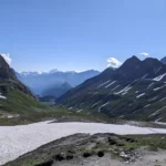
This article was written by Hugo, a hiking enthusiast and co-creator of TMB-Guide.com. This site is your gateway to your adventure on the Tour du Mont Blanc. We strive to share as much information as possible about the Tour to help hikers prepare for their trips.
- Where to stay – Chamonix
- Geneva Airport to Chamonix
- Itineraries
- Tour du Mont Blanc Refuges
- Refuges ebook

CLASSIC TMB - 11 DAYS
This classic Tour du Mont Blanc 11 day itinerary follows the traditional route of the TMB. Trek every step of this glorious 170km trail through France, Italy and Switzerland basking in the magnificent scenery of this once in a life time long distance trek.
Our Tour du Mont Blanc 11 day itinerary eases you into the trail with a nice easy first day on the spectacular variant stage 1 and then takes the remaining stages day by day.
Choose from carrying everything on your back or booking a luggage transfer so that for the most part where possible, you carry just a day sack.
This itinerary is perfect for trekkers who want to complete the entire circuit. However with an accumulated elevation higher than Everest do not underestimate the 11 day itinerary – it’s still tough trekking this 170km trail! For those who have time and want to enjoy the trail drinking in the views without feeling rushed and to have a day off consider a 12-14 day itinerary. For those who want a day off and happy to to trek full days then our 10 day itinerary might be better, making it 11 with a day off half way round.

Classic TMB – 11 days
Start point: Les Houches, France End point: Les Houches, France Length: 11 days
- Day 1 Les Houches – Refuge Miage / Auberge du Truc
- Day 2 Refuge Miage – Refuge Croix du Bonhomme / Les Chapieux
- Day 3 Refuge Croix du Bonhomme / Les Chapieux – Val Veny
Day 4 Val Veny – Courmayeur
- Day 5 Courmayeur – Val Ferret (Refugio Bonatti or alternative accommodation)
- Day 6 Val Ferret – La Fouly
Day 7 La Fouly – Champex-Lac
Day 8 champex-lac – la peuty/trient, day 9 la peuty/trient – tré-le-champ.
- Day 10 Tré-le-Champ – Refuge de la Flégère
- Day 11 Refuge de la Flégère – Les Houches
timings, distances, elevation
Timings for this itinerary are approximate and non-stop , meaning you should add extra time for stopping to take photos, rest stops and your lunch break. Expect this to always be more than you imagine. Consider adding 2 hours onto your timings per day (for a full day). Remember it’s best to set off early and arrive early – thunderstorms commonly occur around 4pm each afternoon in the peak summer months on the TMB trail.

Day 1 Les Houches – Refuge Miage/Auberge du Truc
1445m up / 740m down / 14.7km / 5-6hrs, this itinerary takes the variant 1 stage via the col du tricot which is the only variant safe to take early season from mid june. most trekkers now take this variant – more spectacular for not that much more effort it’s a winner. in bad weather however the traditional trail through the woods must be taken, route overview:.
Today is an easy first day to ease into the trek. Ascend on foot up to the Col du Voza and then follow path along parallel to the train tracks to the Bellevue train station where the variant Col du Tricot trail leads down to the right.
Bellevue cable car saves the day!
Did you know that you can bypass the first 7km of the TMB by taking the Bellevue cable car from Les Houches. It’s a godsend to those who want to omit the first 2 hours of up (680m/7km) on the Tour du Mont Blanc. This section doesn’t have fabulous views so for me it’s a no brainer to take the cable car – its perfect for the variant Col du Tricot trail as it drops you off just five minutes away from the trail. I always take this cable car when it’s operating (early June to approx 10 Sept). Of course many others would prefer to trek this section and I begrudgingly do so if I’m trekking later in September (which is a glorious time to trek!)
If you don’t want to take it easy on the first day, you can stay overnight in the town of Les Contamines. It’s a further 2-2.5 hours on the trail. Refuge Miage has private rooms but Auberge du Truc does not. If Miage is full and you want a private room we would alter the itinerary for you to stay in Les Contamines. This would make for an easy day 2. If you are booking our self guided option for this itinerary speak to one of the team & they can easily tweak this itinerary for you.
Taking the Bellevue cable car you’ll reach the Bellevue Plateau in minutes. It’s then just a 5 minute walk (very well signposted) to pick up the variant trail. Cross the railway tracks and follow the path for Col du Tricot. After traversing the alpine meadows with views of the spectacular Bionnassay glacier you’ll cross the iconic Himalayan suspension bridge. After a short climb you’ll come to a clearing with several large boulders – the view of the glacier is a good one from here and it’s great spot to have lunch. If you look carefully here you’ll find wild bilberry bushes everywhere.
You can now see the top of the Col du Tricot before you. It’s a steady climb up to the grassy saddle. Spend some time here to admire the views over the Miage Valley and over to the Col du Bonhomme. You can spot Refuge Miage far down in the valley. If you look carefully to your left, you’ll see a stone archway on the ‘smugglers route’ to Refuge Plan Glacier (see our adventure itinerary ).

The descent down is STEEP and takes around an hour. Take it easy and use your poles. Reaching the valley floor follow the signs to reach Refuge Miage in just 5 minutes. This cluster of farm buildings in set in an idyllic rural setting and is charmingly French. Refuge Miage is a good place to stay as a family as children receive a discounted price (not the case in high mountain refuges). You can even book tiny chalets around the refuge which are well worth the money for extra privacy. The view of the Dômes de Miage (3600m) from the refuge is outstanding.
how can I make today easier?
At Les Houches most trekkers opt to take the Bellevue cable car (open normally first week of June to approximately 10 Sept) instead of hiking up from the valley floor. This saves around 2 hours and slashes around 7km off your day. The Bellevue cable car costs €17.50 one way for an adult (2023 prices) and takes just five minutes.
lunch stops
As today is a nice short day, it’s probably best to pick up something in Chamonix or Les Houches to take with you for lunch. If you take the Bellevue cable car the trek is only approximately 4 hours today
accommodation on your first night
Accommodation on your first night on this itinerary is at either Refuge Miage or Auberge du Truc. They are approximately 45 minutes apart. Refuge Miage does have private rooms however these book out incredibly fast so if you want a private room contact us before September so we have a good chance o getting this for you. If you are booking this itinerary self guided just add this into the special notes during the booking process.
Alternatively if you want a private room and are happy with a longer day, we can arrange for you to stay in the town of Les Contamines in private room 2-3 hours further.

Day 2 Refuge Miage – Refuge de la Croix du Bonhomme
1361m up / 635m down / 16.9km / 5-6hrs.
If departing from Refuge Miage you’ll have an initial short climb from the Miage Valley up and over to Auberge du Truc. You may well have stayed in this humble, authentic refuge if Refuge Miage was full. Just before here on the left is a ‘pointe du navigation’ which shows the names of each of the peaks you can see.
From Auberge du Truc it’s a long steady descent through the forest into Les Contamines. Have a leisurely coffee in this small French town before walking along the river to Notre Dame de la Gorge where the trail heads out into the wild once more. If you’re trekking in July or August you can pick up the free shuttle bus ( navette ) outside the Les Contamines Tourist Office to Notre Dame de la Gorge.
Take a moment to visit the beautiful Notre Dame de la Gorge chapel next to the gushing water before setting out on the well marked path. Warning – the trail is VERY steep here along an ancient slabbed Roman road to Refuge Nant Borrant but pleasantly flanks the bubbling racing gorge for much of the ascent. Be sure to look out for the pont naturel sign leading to a natural arch on the river, just a few minutes from the trail (navigate down a steep, mud track – I normally leave my backpack at the top!). Cross the roman bridge, take in the rushing gorge below. Expect to hike for around an hour from Notre Dame de la Gorge to Refuge Nant Borrant which makes an excellent lunch stop.
This afternoon you’ll make the climb over two mountain passes Col du Bonhomme (2329m) and Col de la Croix du Bonhomme (2483m). You’ll stay in the cavernous Refuge de la Croix du Bonhomme, a high mountain refuge with epic views. This is one of the most remote high mountain huts on the trail so bring your adventure spirit with you. Bunks and storage are excellent & dinner is unforgettable served by candle light to save solar power.
snow on the Col du Bonhomme
You can expect to have a stubborn patch of snow on the Col du Bonhomme well into the end of July. This is normal and as there is no exposure this is really just a novelty. You will not need hiking crampons if you are trekking from the end of the first week July
If you are trekking early season (14 June – 7 July) then there could be a considerable amount of snow on the TMB trail still. In this case yes you do need to bring hiking crampons. During this period it’s very important that the only variant trails you undertake is only variant stage 1 via the Col du Tricot. This is the only safe variant early season. You can read my article on trekking the TMB early season here .
shuttle bus in July & August
In July and August you can catch the free shuttle bus (navette) from outside the Les Contamines Tourist Office to Notre Dame de la Gorge instead of walking along the river on the flat path. This saves around 45 minutes as it approximately 1 hour to walk whist the bus takes 15 minutes (leaves approximately very 45 – 60 minutes or so throughout the day. Find out more about taking this short cut here .
You can either order a packed lunch (pique-nique) from Refuge Miage or Auberge du Truc for today or eat in one of the many restaurants or cafes in Les Contamines. There are also three small supermarkets and a bakery in Les Contamines in case you want to pick up your own provisions.
accommodation on your second night
Accommodation on your second night is at Refuge Croix du Bonhomme. Perched at 2443m this high mountain refuge commands a spectacular position on the trail. With provisions delivered by helicopter or carried up on backpacks, this is one of the most remote refuges on the Tour du Mont Blanc route. It’s not luxury, there are no private rooms and sometimes there are no showers. However if you bring your sense of adventure & come with more realistic expectations, this refuge will not disappoint. Top tip is to bring extra snacks for breakfast!
Why do I recommend Refuge Croix du Bonhomme over Les Chapieux?
Les Chapieux is the biggest bottle neck on the whole of the TMB. It books out very quickly and is then a cause of untold stress to try to get into. We would rather clients be kept on the trail than having to go down to the nearest down of Bourg St Maurice and re-join the trail in the morning. Refuge Croix du Bonhomme is the refuge before and is in our opinion the best option for staying on the trail. If you book the 10 day option or if you book the private room option by the end of the September before you trek then we can do our very best to get you into Les Chapieux.

Day 3 Refuge de la Croix du Bonhomme – Val Veny
1032m up / 1288m down / 18.7km / 5-6hrs.
Today you’ll descend from Refuge de la Croix du Bonhomme to the hamlet of Les Chapieux and then embark on the steady climb up to the top of the Col de la Seigne – the border between France and Italy! From here, in good weather, you can once again see the gleaming white dome of Mont Blanc with an exceptional view down into this Italian valley.
Dropping down into the Vallée Lee Blanche you’ll marvel at this wide U shaped valley with the fortress of the Mont Blanc Massif dominating to your left. It’s all downhill from here to Refugio Elisabetta – a cavernous refuge perched on a spur just below two glaciers. You’ll either stay at Refugio Elisabetta or 1 hour further in Cabane Combal.
Les Chapieux shuttle bus
From Les Chapieux you can pick up a shuttle bus to Ville des Glacier (or Refuge Mottets parking) which cuts the trail to only 14.9km today. Highly recommended! The shuttle bus costs €4 and leaves frequently throughout the day. Taking this shuttle is reflected in the shorter hike time of 14.9km 6-7.5 hours.
side trip today
A brilliant side trip just minutes from the trail today is a visit to a tiny cheese farm that produces the delicious local cheese – Beaufort. Read my post Don’t Miss: La Ville des Glaciers cheese farm .
A great place to stop for lunch today is Refuge Mottets.
If you want to buy a packed lunch, it’s worth mentioning that the Refuge de la Croix du Bonhomme has a very basic packed lunch (just a sandwich and an extra optional cereal chocolate bar). I would pick up lunch at the deli in Les Chapieux (a great shop with fresh sandwiches, coffee, wine, snacks, fruit) which is a 2.5 hour descent from Refuge de la Croix du Bonhomme or stop and eat at Refuge Mottets.
accommodation on your 3rd night
Accommodation is limited in the Val Veny so you will be either stay in Refugio Elisabetta or Cabane Combal, whichever has availability. Refugio Elisabetta is one hour before Cabane Combal. Refugio Elisabetta is a large cavernous refuge perched on a spur with not one but two glaciers dripping down behind her. It’s large & busy but does offer private rooms. Cabane Combal is a smaller affair with small dorms with en-suite bathrooms (no private rooms).

540m up / 1532m down / 15.7km / 4-5hrs
Todays hike takes you up out of the Val Veny floor climbing steadily up to the highest point, a spur from Mont Favre. Looking back you can see the monstrous moraine of Glacier Miage dwarfing Cabane Combal and on a clear day all the way back to Col de la Seigne. From here you’ll trace the contours of the south flank of the Val Veni, following the rise and fall of the mountain side with jaw dropping views of sawtooth peaks and Monte Bianco opposite before descending down into the Italian town of Courmayeur.
From Refugio Maison Vielle during peak season (Aug & Sept) you can opt to take the chair lift and connecting cable car down to Dolonne which is a 10 minute saunter into Courmayeur. The descent from Maison Vielle is brutal so if you’re weary or just want to spend longer in the lovely Italian town of Courmayeur this is definitely a good option.
exit point at Cabane Combal
Should you be mildly injured, not feeling well, in the case of severe weather or perhaps you have not been able to secure accommodation in Val Veny – there is an exit point from the trail at the bridge just before Cabane Combal. Turn right after crossing the bridge & walk down the Cabane Combal access road to the village of La Visaille. It takes between 45-60 minutes to descend. There is a free bus that runs from La Visaille to Courmayeur in July & August. The bus stop is immediately on the right after crossing the last bridge. If you are not hiking in July or August you can call a taxi to meet you at the bus stop. (there is a barrier across the access road so no traffic can drive up to Cabane Combal).
During July and August you can cut off the 2-2.5 hour descent from Refugio Maison Vielle to Courmayeur by taking the Maison Vielle chair lift and the Dolonne cable car. Read more about this short cut in my post here.
If you’re trekking in June or September and would prefer to not do this brutal descent, perhaps you have bad knees or perhaps your itinerary is very long that day then its possible to walk a further 30 minutes from Maison Vielle and organise a taxi pick up.
Either organise a packed lunch from your refuge or if you set off early you could have lunch at Refugio Maison Vielle.
accommodation on your 4th night
Accommodation will be in the Italian town of Courmayeur. You can choose to upgrade your hotel to a 4 or 5 star. Add requests to your online booking in the notes or speak to a member of our team.
It’s worth noting that Courmayeur is the natural place to have a day off if you want a rest day during your Tour du Mont Blanc trek. This itinerary does not have a day off built in but this is easy to organise with our team.

Day 5 Courmayeur – Val Ferret
1088m up / 263m down / 12.1km / 4-5hrs, you will sleep preferabl y in the coveted refugio bonatti hut high above the val ferret..
Today starts with a push up to the Bertone hut for a late morning Italian coffee. Here, if the weather is good and it’s not early season (14 June – approximately July 7th) you can take the Mont Saxe variant to incorporate an extra peak: it takes a bit longer but it really is a stunning day – not many people, breathtaking scenery and avoids the crowds on the traditional balcony route.
You’ll reach the delightful Rifugio Bonatti hut, where you will either stay (based on availability) or make the easy 30 minute descent down to the valley floor to make your way to the hotel there, or back to Courmayeur for your accommodation.
Unfortunately there are no short cuts today!
I would suggest picking up lunch provisions in Courmayeur as there are no refuges to stop at for lunch today.
accommodation on your 5th night
Accommodation will be at Refugio Bonatti (preferably book with us by the September before the summer you want to trek!), Hotel Lavachey, Hotel Chalet Val Ferret or Courmayeur. If booking late, expect to stay in your Courmayeur hotel again for a second night (which some clients love as it stage 5 becomes a day hike with a small pack!)

Day 6 Chalet Val Ferret – La Fouly
907m up / 1331m down / 18.6km / 5-6hrs.
Today you’ll climb over the Grand Col Ferret and cross into Switzerland! The gentle Swiss alpine meadows are in stark comparison to the jagged wild landscapes you’ve trekked through in Italy and France. Take it easy as the gentle trail gradually descends to Ferret and the La Fouly.
La Fouly sits at the foot of two mighty mountains, Tour Noir (3, 836m) and Mont Dolent (3,823m) which incredibly is the tri-point where all three of the Tour du Mont Blanc countries, France, Switzerland and Italy’s borders meet!
skipping La Fouly to stay in Champex Lac
A quick note here on skipping stage 7 between La Fouly and Champex Lac. Now this
There is no real short cut worth taking today. There is a bus that picks up in Ferret that stops in La Fouly. This would save you 45 minutes at the end of the day.
I would recommend taking a packed lunch today or face the crowds to eat the Refugio Elena. Another option for a late lunch is Alpage de la Peule on the swiss side
accommodation on your 6th night
Accommodation will be in a gîte or hotel in either Ferret or La Fouly

578m up / 709m down / 14.8km / 3-4hrs
Today is the most gentle day of all the TMB stages. There is no col to climb and the route meanders easily through the valley past Swiss mountain pastures. Drink in the delightful scenes of rural life in Switzerland as you potter leisurely along this stage.
Many trekkers actually choose to omit this stage opting to take the bus but for trekkers who are intent to complete the entire route this is a lovely day that your tired legs will be grateful for.
Champex-Lac, your home for the night is a beautiful little town next to a pretty lake. Nicknamed ‘Little Canada’ it’s not hard to imagine why – this beautiful lakeside town is surrounded by hills of pine and is genuinely a beautiful spot.
How can I make today easier?
You can take the bus all the way to Champex-Lac if you want to skip today or only part of the way if you’d like to walk for less hours today.
I would pick up something from the well stocked shop at La Fouly or order a packed lunch (pique-nique) from your accommodation as there are little options to eat out for lunch today.
accommodation on day 7
Accommodation in Champex Lac can be as lavish or as basic as you’d like. There are plenty of accommodation options at varying levels of budget and comfort from 5 star to a basic gîte. Warning though, Champex-Lac does book up quickly even though it’s a town with numerous places to stay.

856m up / 1052m down / 16.7km / 4-5hrs
Today you’ll leave the serenity of beautiful Champex-Lac and take the Bovine route to the Col de la Forclaz and then drop down into the Swiss village of Trient, famous for it’s pink church, to spend the night.
The variant route via the Col du Fenêtre can be considered instead of the Bovine route but only in good weather, and only in peak season (not to be attempted in June, possibly in first week of July). Note this route is technically the most difficult on the entire TMB trail – the trail can be hard to follow and crosses a boulder field. It’s a much more difficult route however much more spectacular.
There are no transport options or short cuts on this day. In the case of severe weather it is possible to take public transport around to Trient.
If you choose to take the variant across the Fênetre d’Arpette you will need to organise a packed lunch as there is no-where to eat on the trail until Buvette du Glacier which is too late in the day. This section is particularly dry so you will need to carry extra water with you.
If you are trekking the traditional route (Bovine) you can stop to have lunch at the wonderful L’Alpage du Bovine, one of the most authentic experiences on the trail. If it is raining it may not be possible to eat here without a prior reservation as their interior is tiny (only 20 seats). In good weather there is plenty of exterior seating.
accommodation on your 8th night
Accommodation this evening is either in the Hotel Col de la Forclaz or further down in the village of Trient, famous for its pink church. Trient is slightly off the trail but has two large hotels. The fourth option is to stay at Refuge Le Peuty.
The end of this stage has very limited accommodation which gets booked up very quickly. If all accommodation options are full, then it is possible to get public transport to Vallorcine or back to the Chamonix Valley.

1151m up / 1024m down / 13.9km / 4-5hrs
Today you’ll ascend from Trient up the Col du Balme. It’s a gradual climb and not too taxing.
From Refuge Col de Balme perched on the Swiss side, you’ll have a splendid view of the entire Chamonix Valley – well done you’ve almost completed the circuit! You can now see where you set off from down the other end of the valley and Mont Blanc will be ever present with her snowy dome to the left of the valley.
Descend down into France to the saddle of Col des Posettes before ascending the rock spine ridge to L’Aiguillette des Posettes (2201m). L’Aiguillette des Posettes forms the beginning of the impressive northern flank of the Chamonix Valley. In good weather the 360 degree panorama here will take your breath away – the icy dome of Mont Blanc, the iconic spire of the Drus, the Aiguilles Verte as well as Glacier du Tour Lac Blanc and the Lac d’Emosson dam over your shoulder in Switzerland. Bear in mind this high route along the Posette ridge should never be taken in bad weather – the ridge is known for lightning strikes.
The descent down to Tré-le-Champ is brutal. Take your time. Home for the night is at the historical Auberge de la Bœrne.
There is no short cut or transport options today unless you want to miss out the whole stage in which case you can take public transport around to Chamonix.
I like an early lunch at Refuge Col du Balme, just because the location is outstanding with magnificent views back along the Chamonix Valley and crazy views of Mont Blanc. I suggest setting off 45-60 minutes later on this morning, have a leisurely breakfast and set off a little later. By the time you’ve ascended up to Refuge Col du Balme it will almost be 12 noon when they will start serving lunch. Don’t forget to order a refreshingly cold beer, make your way to the back of the refuge and plonk yourself in the grass to soak up that just so incredible view. For me its a pinch me moment – you can see Les Houches in the distance where you set off all those days ago and for me, it’s one of the most euphoric moments of the trek, even more so than crossing the finishing line!
accommodation on day 9
Accommodation on day 9 is in the lovely Auberge la Boërne in Tré-le-Champ. For those who would prefer private rooms, its a short distance on the bus or train to the village of Argentière.

Day 10 Tré-le-Champ – Refuge La Flégère
997m up / 510m down / 8.2km / 3-4hrs, for those who would prefer private rooms its possible to take the cable car down from refuge la flégère directly down to a hotel in the village to les praz or a short bus ride to chamonix centre.
The well marked trail has a knee jarring descent from the L’Aiguillette des Posettes eventually meandering through the forest to pop out on the main road winding up to the Col des Montets. From here you’ll begin the 3 hours climb up to Lac Blanc. The route climbs steadily for between 1.5-2 hrs until you reach the infamous TMB ladders – a series of 13 ladders and metal ware built into the rock. It’s the most exciting physical aspect of the entire Tour du Mont Blanc – teenagers will love it! This is the Aiguille Rouge National Park so look out for chamois or bouquetin – there’s a good chance of seeing them, often just on the trail.
A further hour up brings you to Tête aux Vents, a large cairn (2132m) which borders the national park. From there you can choose to deviate from the trail and ascend a further 1hr 30 mins to reach stunning Lac Blanc (2,352m) or turn down to follow the trail to Refuge La Flégère, a further 60-90 minutes.
Today is a short day and is the day of the infamous TMB ladders! Yay! If you suffer from vertigo and are sure you absolutely do not want to tackle the ladders on the traditional route, there is an alternative route which takes around an hour longer.
Lunch at Refuge Lac Blanc is a good option today. It takes around 3 hours on the traditional route up to Refuge Lac Blanc and around 4 hours on the alternative non-ladder route up to Lac Blanc. Aim for a late-ish lunch so take your time with breakfast today. Refuge Flégère is only a 1.5 hour descent from Lac Blanc so there’s no need to rush. You can allow plenty of time to walk around the lake and hopefully spot the plentiful chamois and ibex that live in this protected area of natural beauty.
Note that stage 10 is a very dry section and Refuge Lac Blanc cannot re-fill water bottles as there is no potable water available. You can buy bottled water if needs be (cash in euros only) but we would recommend carrying extra water for today.
accommodation on day 10
Accommodation on day 10 will be at Refuge Flégère. We can arrange for those who would prefer private rooms to descend via the cable car at Refuge Flégère to stay in the village of Les Praz or Chamonix and return to the trail the following morning.

Day 11 Refuge La Flégère – Les Houches
811m up / 1682m down / 17.4km / 4-5hrs.
Today you’ll continue along the Balcon Sud with it’s staggering views of Mont Blanc to reach Le Brévent. Choose to take the cable car up to the peak or hike the route that ascends behind that entails a couple of ladder sections. Soak in the magnificent views of Mont Blanc from the top of Le Brévent – undoubtedly the best viewing point of the highest point in Western Europe!
From here you’ll descend on the stony trail along the ridge line to Refuge Bellachat – a great spot for a refreshment with again insane views of Mont Blanc from their lovely sunny terrace. The descent into Les Houches is brutally long – watch those knees! However the pink wild azaleas that line the path are beautiful and there’s a high chance of spotting chamois and bouquetins as you descend.
For those looking to cut some kilometres today (yes it is a long day) you can cut the Col du Brévent off the trail by taking the cable car from the mid station Plan Praz to the summit Le Brévent. Those trekking early season are advised to do this as snow can linger on the Col du Brévent in June and can be difficult to pass.
Lunch at Refuge Bellachat is a good option. Bellachat has a lovely terrace facing Mont Blanc. Note that stage 11 is a very dry section and Refuge Bellachat cannot re-fill water bottles as there is no potable water available. You can buy bottled water if needs be but we would recommend carrying extra water for today.
Read my Chamonix and Les Houches accommodation guide here
Tour du mont blanc hike, privacy overview.
- Gondolas, cable cars & trains open May 2024 in Chamonix
- End winter season at Grands Montets Freeride day Sunday 5 May 2024
- Mont Blanc Tunnel closed night of 2/3 May 2024
- Festival 'Montagne en Scène' this Thursday 2 May 2024 in Chamonix
- Mont Blanc Tunnel closed from 2 Sept to 16 Dec 2024
At the foot of Mont Blanc (4808m or 15,770ft), the highest mountain in western Europe, Chamonix's alpine town atmosphere

The resort of Chamonix has three 5 star hotels, eleven 4 star hotels, twenty two 3 star hotels, thirteen 2 star hotels

TransferFix, we help you find your Chamonix transfer

Since 1934, Snell Sports has been the largest mountain shop in the Chamonix Valley.

Compare & Book Online with Chamonix.net
Tour du mont blanc hiking - routes, maps and itineraries.
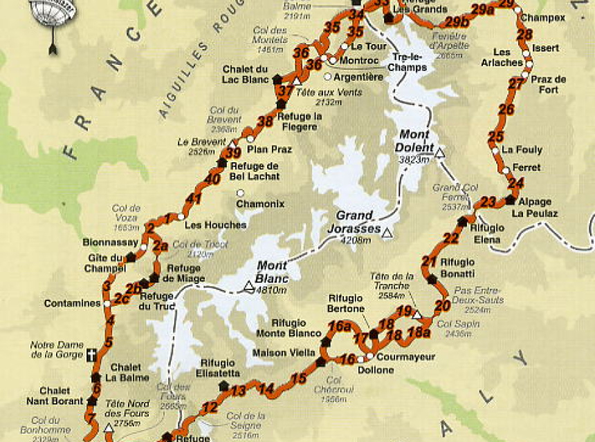
The Tour du Mont Blanc (TMB) is a 170 km trek that encompasses the whole of the Mont Blanc Massif; with nearly 10 000m of cumulative descent and ascent it is usually completed in a number of days.
The TMB has a variety of accommodation facilities along the route (hotels and mountain huts with possibility for vehicle support) that allow you to really enjoy the scenery, take lots of photos and walk each day with just a light pack.
Alternatively, the TMB can be done completely self-sufficiently: you carry all your own food and camping gear. This gives you a better sense of freedom and the ability to go where you please whenever you want.
Tour of Mont Blanc General Information
Mont Blanc Tour mountain huts are open, in general, from mid-June until the first or second week in September. It is advisable to reserve a bed, particularly in the high season of mid July to mid August.
Early in the season is the quietest and most beautiful, but beware of old snow on the higher paths which could be icy and dangerous and would make an ice axe essential.
For additional safety or to just show you the way you could hire an Independent Trek Leader .
Wildlife on the Tour du Mont Blanc
Have a look at the Chamonix.net nature, fauna and flora page for more information on wildlife you might encounter on the Tour of Mont Blanc. Chamois, deer, eagles and a range of beautiful alpine flowers can all be seen and photographed.
Tour du Mont Blanc Maps, Kit List and Equipment
Lightweight boots and shorts are sufficient as long as there are warm clothes in your backpack. Waterproofs are essential and trekking poles useful. Here are some of the best mountain equipment shops in Chamonix .
Do not forget sunglasses, skin and lip protection. Always carry drinking water and check the Chamonix weather forecast before starting your journey.
Maps for the Tour of Mont Blanc:
Tour of Mont Blanc - Route Descriptions
You have plenty of options: from 4 day sportive hikes to leisurely 12 day cultural experiences; there is not only one way to do the Tour of Mont Blanc. Here are a couple of different suggestions which may help you make up your mind on your particular style.
- You can go on your own with your own GPS track, or benefit from a mountain leader's experience
- You can carry your own gear or hike with a light pack with vehicle support
- You can sleep and eat in the refuges or carry a tent
Here is a list of contact information for the various mountain huts .
4 day trip: Not quite racing - but fast enough: For the hardcore hiker
This itinerary follows pretty much in the footsteps of the Ultra Trail race (which varies slightly from year to year). This is for very fit hikers and is done with only a light day pack, eating and sleeping in huts and is basically the run/walking version of the Tour du Mont Blanc. The times noted are for fit spandex-wearing (not obligatory!) hikers.
7 day trip: Hiking the Tour of Mont Blanc - hiker
Start with the previously mentioned itinerary and break up the days a bit depending on where you would like to spend the night.
For people who carry their own gear, plan on a 7 day trip.
9 to 11 day trip: Taking the time to look at the scenery
Of course if you really do have time, you can expand the experience. Here's an example of a slower pace, with time to veer a little off the path. This is described as an 11 day trip, but it would be really easy to knock off the first and last days as those days are dedicated to trekking in the Chamonix Valley.
Each year, in the last days of August, the trails around the Mont Blanc get really busy. This is because of one of the most amazing human competitions ever organized on this planet - The Ultra Trail du Mont Blanc - so keep this in mind when planning your hike of the Tour du Mont Blanc.
Social Networks

Latest News

Sending email...
Email sent!
You are using an out of date browser and this website will not function properly.
Please upgrade to Edge or Chrome browsers.

+33 (0)781586903
montblanctreks
- Dates & Prices
Tour du Mont Blanc Map

If you look at a map of the area, the Mont Blanc range forms a compact mass of complex mountain structures, passable via a circular route making use of its surrounding valleys and relatively low level cols or mountain passes.
Traditionally, the Tour du Mont Blanc starts and finishes in the Chamonix Valley and moves anti-clockwise through France, Italy and Switzerland and returns in to the Chamonix valley for the last few days of the trek.
Over time, all manner of variants have been included. For example, Col de Tricot from Les Houches to Contamines or Fenetre d'Arpette from Champex-Lac to Trient. Often these variants make the Tour du Mont Blanc more challenging with more height gain and descent and tougher terrain.
The Tour du Mont Blanc full circuit is often undertaken in reverse and can seem very different when done in the opposite direction.
Scroll down to view the full circuit, easterly and westerly routes.
Tour du Mont Blanc Full Circuit Map
Approximately 170 kilometres in length with an accumulation of 9,500m of height gain. The Tour du Mont Blanc full circuit starts and finishes in the Chamonix valley the route circumnavigates the Mont Blanc Massif taking in some of the most spectacular alpine scenery through France, Italy and Switzerland.
Click the route sections on the map for more info
Chamonix to Les Houches
Distance: 13k | Height gain: +700m | Descent: -1500m
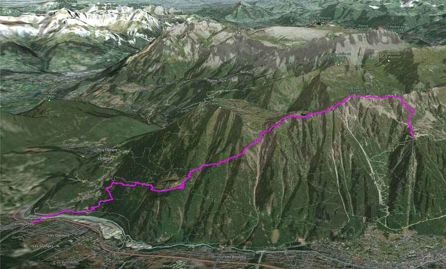
We commence the Tour Mont Blanc full trek from Chamonix taking the cable car to the Planpraz at 2000m, from here we take the TMB route to the Col du Brevent, Brevent 2525m and descend along the stunning ridge to Refuge Bel Lachat. From the refuge, we make the long and tough descent via Parc Merlet to Les Houches and our hotel accommodation for the night.
Accommodation
3* Hotel, private en-suite rooms, evening meal & breakfast
Guide notes:
This day often feels one of the toughest on the trek generally because people are not fully acclimatised. The descent can be punishing & is probably the most difficult during the trek due 1500m sustained down hill & at times rocky terrain. Walking poles are recommended to save the knees!
Les Houches to Les Contamines
Via Bionnassay: Distance: 15k | Height gain: +100m | Descent: -700m Via Col du Tricot: Distance: 13k | Height gain: +800m | Descent: -1300m
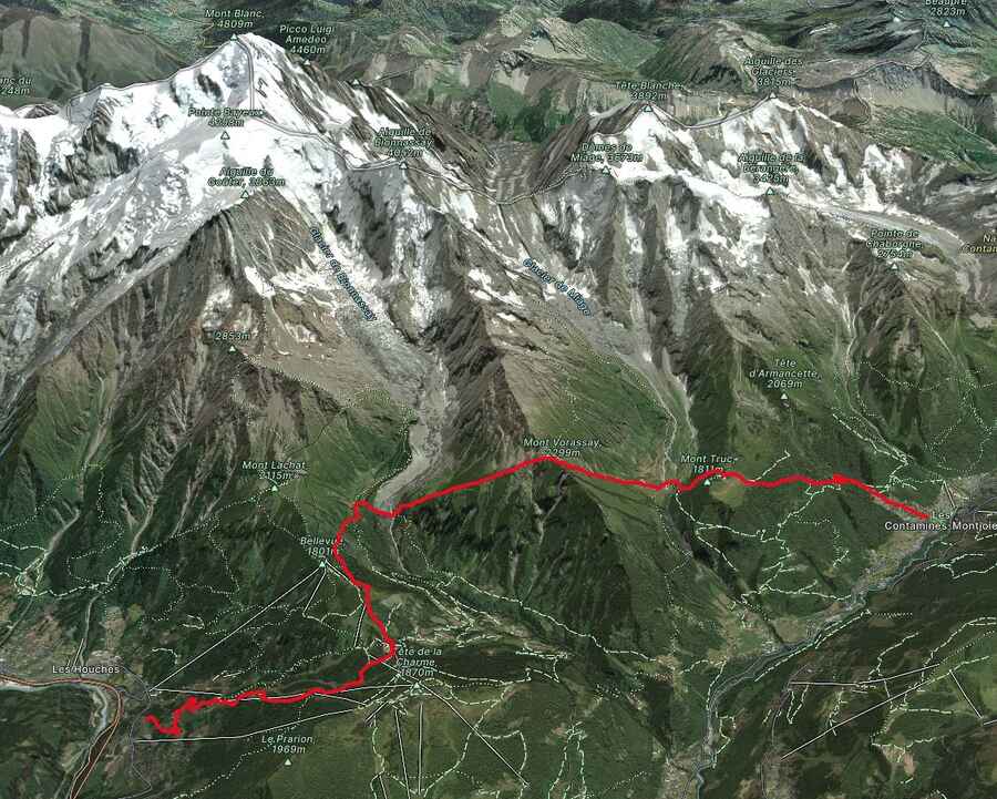
Our day starts with a cable car ride to the Bellevue 1802m with stunning views of the Mont Blanc range from high above the westerly end of the Chamonix valley. We then have a choice of routes to Les Contamines via Bionnassay and Chapel or the Col du Tricot and Chalets des Miage.
3* Hotel, private en-suite rooms, evening meal and breakfast
Day two and you are probably feeling a little tiered from the first day. The terrain is very different today, less rugged and more green as you will be trekking though high altitude pastureland. If you are trekking via the Col du Tricot check out the Blueberry pie at the Chalets des Miage, very memorable and delicious!
Les Contamines to Refuge Mottets
Distance: 20k | Height gain: +1500m | Descent: -900m
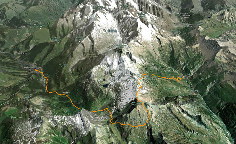
A great day ahead awaits and we make our ascent through three cols, Col du Bonhomme, Col de la Croix du Bonhomme and the Col des Fours 2665m. Descending steeply through the wild and remote landscape to Ville des Glaciers and our rest stop for the night at the atmospheric Refuge Mottets.
Dormitory (upgrade possible), evening meal & breakfast
On paper this looks like one of the longest and toughest days on the trek but don’t worry its very doable. There is a fair amount of height gain but it is integrated with sections of gentle terrain, which make the day more manageable. The key is to start early & allow plenty of time.
Refuge Mottets to Courmayeur
Distance: 14k | Height gain: +700m | Descent: -700m
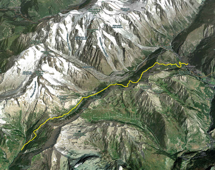
By staying at the Refuge Mottets it gives us a great position below the Col du Seigne 2516m, although we climb steeply at times we soon find ourselves over the col and across French/Italian border into Italy. We then make a descent into the stunning Val Veny with easy walking through the hanging valleys to Lac Combal. From here we descend La Visaille and take the shuttle bus to Courmayeur.
3* Hotel, private en-suite rooms, B & B
One of my favourite days on the Tour du Mont Blanc, the views from the Col du Seigne is second to none! Once you are at the col and if the weather is right rest for a while and take in the far-reaching views in to Italy & Switzerland, just wonderful!
Courmayeur to Refuge Bonatti
Distance: 17k | Height gain: +750m | Descent: -50m
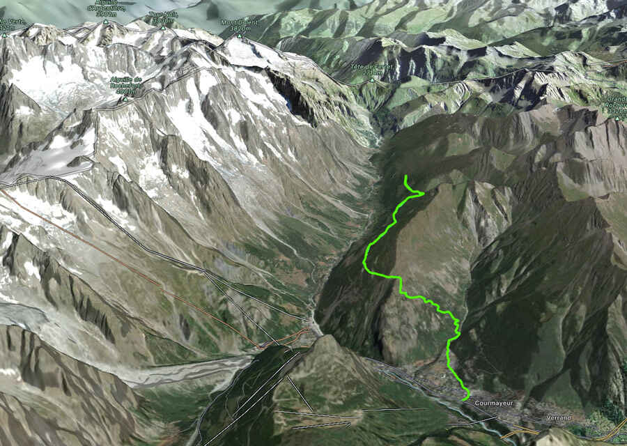
Fully refreshed we make our ascent to the Refuge Bertoni and enjoy amazing views of Mont Blanc and Courmayeur down below. We spend the rest of the day on a lofty traverse from high above the Val Ferret with stunning views of the Italian side of the Mont Blanc before reaching our accommodation at the beautiful Refuge Bonatti 2056m.
A steep but steady climb up to the Refuge Bertoni, it’s worth it because the coffee is fabulous & the views just stunning, elevenses’ here is a must! Fabulous views of some of the most famous peaks in the European Alps including Mont Blanc and the Grand Jorasses. And for the refuge Bonatti... its just fabulous, if the night is clear go our side after dinner and just 'be' in this impressive location.
Refuge Bonatti to La Fouly
Distance: 20k | Height gain: +900m | Descent: -1400m
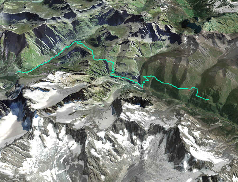
An early start and a new country awaits, we continue through the Val Ferret to Arnuva before making our long ascent to the Grand Col Ferret 2537m via the Refugio Elena and the Italian/Swiss border. We then make a relatively easy and enjoyable descent via la Peule, Ferret to La Fouly and our hotel accommodation for the night.
3* Hotel private en-suite rooms, evening meal & breakfast
Again this day looks tough but the hard bits are nicely spaced with less challenging terrain & once at the Col stare in wonder at the view looking back at your last 3 days of trekking towards the Col du Seigne & over the boarder into Switzerland. The descent is long but at an easy angle & the path is good. Plenty of opportunity to stop for refreshments at Arnurva, Refuge Elena & La Peule.
La Fouly to Champex Lac
Distance: 18k | Height gain: +750m | Descent: -950m
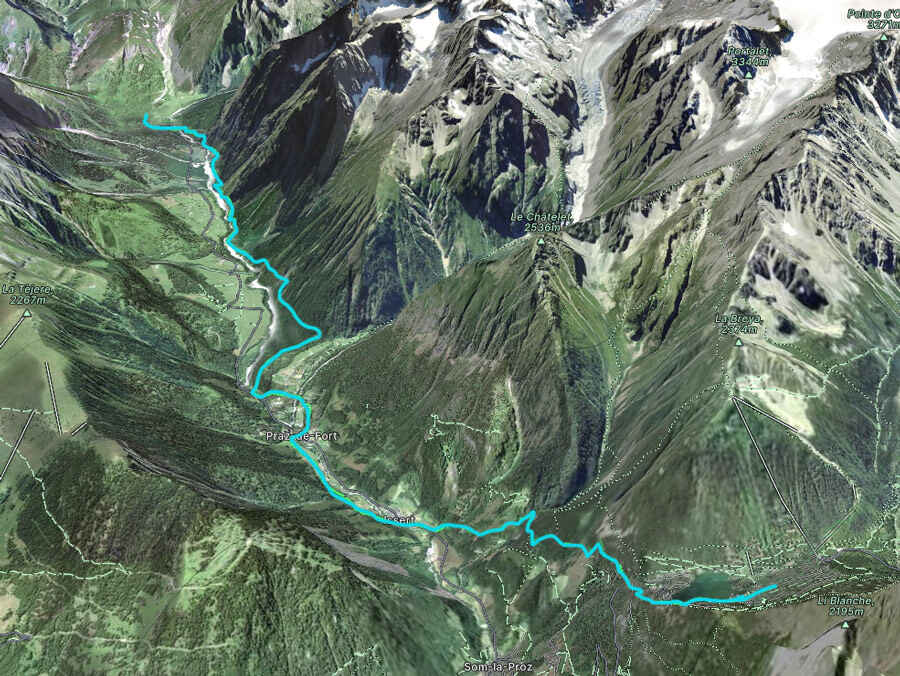
An easy day in comparison walking in the beautiful Swiss Val Ferret. We then pass through the Swiss villages of Praz de Fort and Issert before make our ascent to the charming village of Champex-Lac and our resting place for the evening.
Auberge with private rooms & shared facilities, evening meal & breakfast
The Bovine route is a fabulous day not too tricky over lovely terrain. Lunch stop at the high alpine farm at Bovine is a must, you can purchase local food or even eat your own picnic on the terrace as long as you buy a drink. Amazing views across to Lac Leman & down the Rhone valley.
Champex Lac to Trient
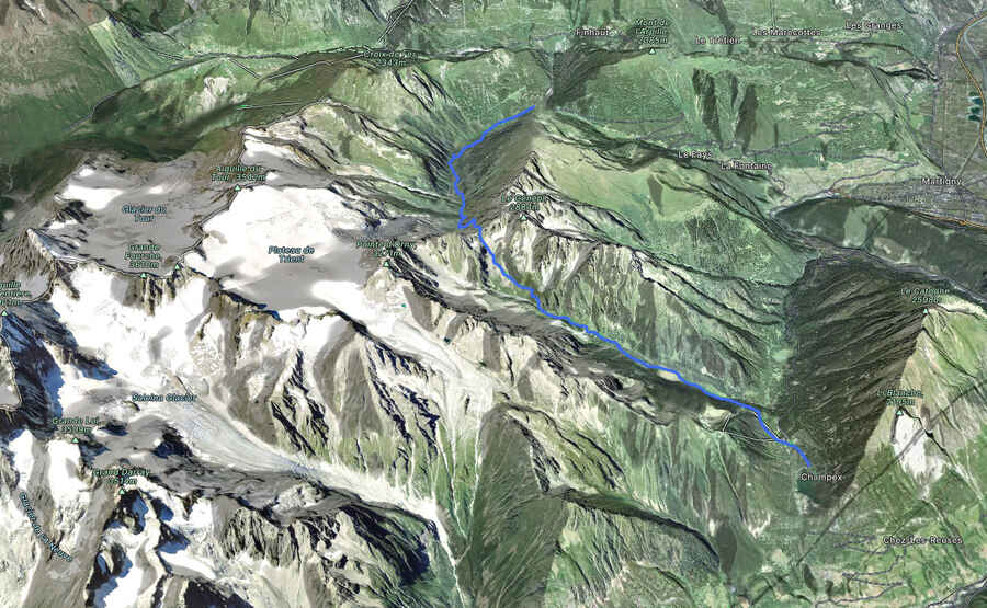
An initial easy start to the day is to be had as we wind our way on easy paths to Plan de l'Au. We then climb up steadily to the Alpage Bovine 1987m and enjoy fabulous views over Martigny and the Swiss Valais. We spend the rest of the day making our descent to the Col du Forclaz 1526m with a final descent to Trient.
Auberge with private rooms and shared facilities, evening meal and breakfast
The Bovine route is a fabulous day not too tricky over lovely terrain. Lunch stop at the high alpine farm at Bovine is a must, you can purchase local food or even eat your own picnic on the terrace as long as you buy a drink. Amazing views across to Lac Leman and down the Rhone valley.
Trient to Argentière
Direct via the Col du Balme: Distance: 13k | Height gain: +900m | Descent: -900m Via Catogne & the Col du Balme: Distance: 15k | Height gain: +1000m | Descent: -1000m
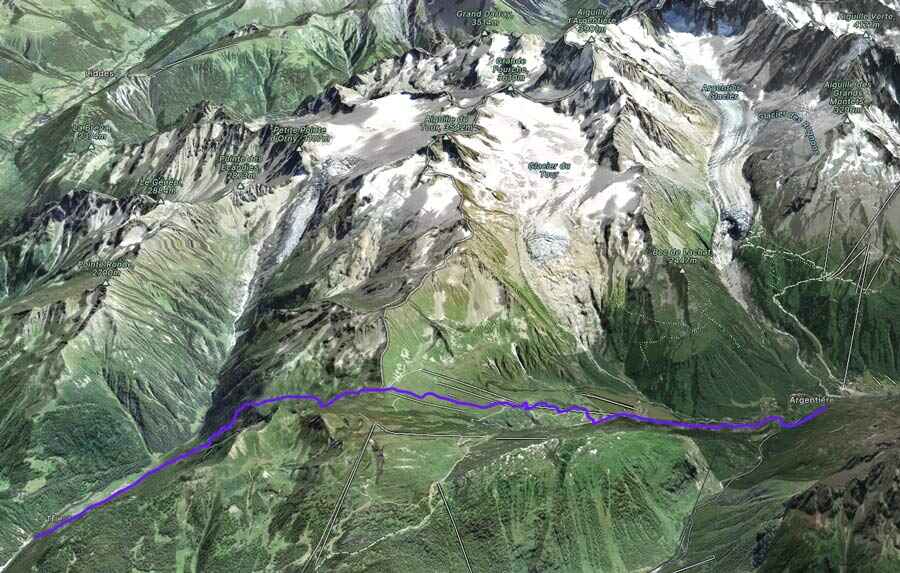
Today we have two options as we can take the route directly to the Col du Balme from Trient or through alpine woodland to the Alpage of Tseppes, Catogne and on to the Col du Balme 2191m and the Swiss/French border. From the Col, we then make our descent to the hamlet of Le Tour and across pastureland to the village of Argentiere and our hotel accommodation for the evening.
4* Hotel private en-suite rooms, B & B
Personally unless the weather is bad take the route via Catogne, the views are far superior as one up high you take a lofty traverse with excellent views over towards Emossom dam & the Aiguille Rouges nature reserve.
Argentière to Chamonix
Distance: 14k | Height gain: +1200m | Descent: -500m
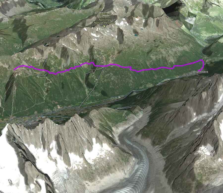
Our final day and a fitting end to the trek takes us back into the Aiguille Rouges to the stunning Lac des Cheserys and Lac Blanc 2352m. We then make a descent to Flegere and take the balcony path traversing high above the Chamonix valley to Planpraz at our starting point 11 days earlier completing the circuit. A final decent via the cable car back to Chamonix in time for a celebratory drink as you have just completed the Tour du Mont Blanc, one of the best multi day treks in the world. In the event of lift closures, we make our descent back to Chamonix via Flegere.
3* Hotel private en-suite rooms, B & B
A fitting end to the trek back in the Aiguille nature reserve with pristine views of the Mont Blanc massif and all its peaks and glaciers. Visiting the iconic Lac Blanc is a must and stop for refreshments in the refuge. It gets busy with day walkers in August so make an early start if possible.
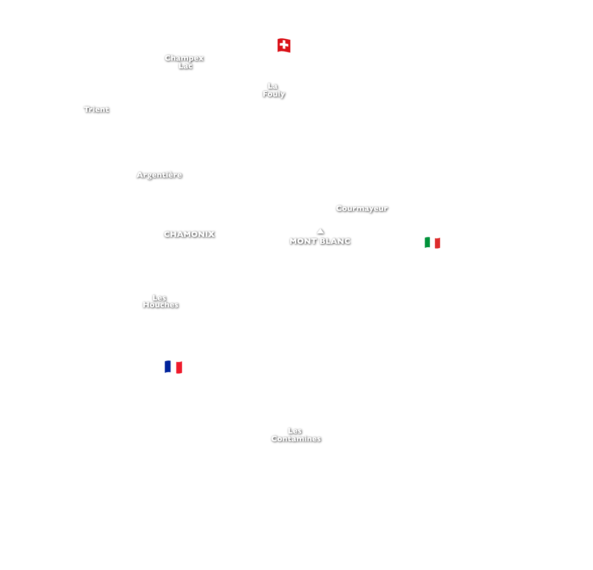
- 1. Chamonix to Les Houches
- 2. Les Houches to Les Contamines
- 3. Les Contamines to Refuge Mottets
- 4. Refuge Mottets to Courmayeur
- 5. Courmayeur to Refuge Bonatti
- 6. Refuge Bonatti to La Fouly
- 7. La Fouly to Champex Lac
- 8. Champex Lac to Trient
- 9. Trient to Argentière
- 10. Argentière to Chamonix
Tour du Mont Blanc Easterly Circuit Map
The Tour Mont Blanc easterly trek starts in Courmayeur and takes in half of the classic route anti-clockwise to Chamonix. It is a 6 day trek that covers approximately 100 kilometers through the Italian, Swiss and French alps. This walking holiday in the alps is ideal for those wanting to experience the Tour du Mont Blanc in a shorter period of time.
We make our ascent to the Refuge Bertoni and enjoy amazing views of Mont Blanc and Courmayeur down below. We spend the rest of the day on a lofty traverse from high above the Val Ferret with stunning views of the Italian side of the Mont Blanc before reaching our accommodation at the beautiful Refuge Bonatti 2056m.
- 1. Courmayeur to Refuge Bonatti
- 2. Refuge Bonatti to La Fouly
- 3. La Fouly to Champex Lac
- 4. Champex Lac to Trient
- 5. Trient to Argentière
- 6. Argentière to Chamonix
Tour du Mont Blanc Westerly Circuit Map
The Tour du Mont Blanc westerly route starts in Chamonix and takes in half of the classic Tour du Mont Blanc route anti-clockwise to Courmayeur. The route covers approximately 70 kilometers through the French and Italian alps. This trekking holiday in the alps is ideal for those wanting to experience the Tour du Mont Blanc in a shorter period of time.
We commence the Tour Mont Blanc westerly trek from Chamonix taking the cable car to the Planpraz at 2000m, from here we take the TMB route to the Col du Brevent, Brevent 2525m and descend along the stunning ridge to Refuge Bel Lachat. From the refuge, we make the long and tough descent via Parc Merlet to Les Houches and our hotel accommodation for the night.
This day often feels one of the toughest on the trek generally because people are not fully acclimatised. The descent can be punishing and is probably the most difficult during the trek due 1500m sustained down hill & at times rocky terrain. Walking poles are recommended to save the knees!

Tour du Mont Blanc Profile

Sign up to Our Newsletter
Marketing permissions.
Mont Blanc Treks will use the information you provide on this form to be in touch with you and to provide updates and marketing. Please let us know if you are happy to receive emails from us by checking the box below.
You can change your mind at any time by clicking the unsubscribe link in the footer of any email you receive from us, or by contacting us at [email protected]. We will treat your information with respect. For more information about our privacy practices please visit our website. By clicking below, you agree that we may process your information in accordance with these terms.
We use Mailchimp as our marketing platform. By clicking below to subscribe, you acknowledge that your information will be transferred to Mailchimp for processing. Learn more about Mailchimp's privacy practices here.

- Trip Search
- Trip Calendar
- T&T Blog
Tour du Mont Blanc Complete
Trip Notes for Tour du Mont Blanc Complete
- Map & Itinerary
Accommodation
Trip information.
- Dates & Prices
Walk the full Tour du Mont Blanc
- Panoramic complete Tour of Mont Blanc
- Trek through 3 Alpine countries - France, Italy and Switzerland
- Hike to Lac Blanc & along the Grand Balcon Sud
- Enjoy two nights in Courmayeur, Italy
- Excellent accommodation & luggage transfers provided
- Hike to the summit of Le Brevent
- Professional International Mountain Leader
The Tour du Mont Blanc (TMB) is one of the world's classic trekking journeys, covering 166km (104 miles) and around 10,000 metres (32,800 feet) of up and down. At the heart of the European Alps, the massif of Mont Blanc straddles the borders of France, Italy and Switzerland and includes some spectacular mountain scenery. Our route covers a complete circuit of the Tour du Mont Blanc in all its glory!
With its rich mountaineering history and unsurpassed cultural diversity, this corner of Europe has been an irresistible attraction for the world’s adventurers, climbers and hikers. Mont Blanc itself, at 4810 metres (15,781 feet), is the high point of the range and the highest peak in Western Europe. When viewed from the French town of Chamonix, the capital of world mountaineering, the snowy bulk of this commanding peak exerts a strange fascination.
Streams of cloud trailing from its summit bear witness to the fact that Mont Blanc stands high above the surrounding, and in some respects more dramatic, rocky peaks. The trekker and mountain walker is spoiled for choice in this part of the world, but one obvious challenge is to complete a circuit of the Mont Blanc massif. The well-known long distance walk (or Grand Randonée ) known as the Tour du Mont Blanc does just that.
Trip Photos
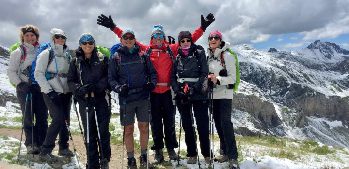
Trips you might also like
Walkers haute route: chamonix to zermatt, tour de monte rosa, hiking the italian alps.
Your trip starts in the world famous mountain town of Chamonix , in France. Chamonix has a rich history as a climbing and hiking destination having attracted mountain lovers for many centuries. It is perhaps most famous for its incredible mountain views of glaciers and summits which are dominated by the highest mountain in Western Europe, Mont Blanc which today sits at 4810m (15,777ft). Ever since Mont Blanc was first climbed in August 1786 it has inspired the climbers who come to Chamonix throughout the summer months with their dreams of ascending the 'mighty Blanc'.
Hotel rooms are usually available from approximately 1600 hrs, but if you arrive early you will be able to leave your bags at the hotel and perhaps enjoy exploring the town. Your guide will meet you at your hotel this evening, at approximately 1800 hrs, to brief you on the days ahead and to answer any questions you might have about the trip.
A stunning first day with glorious views of the Mont Blanc range - its glaciers, jagged spires and peaks, and an introduction to the history of the Tour du Mont Blanc. From Chamonix we transfer by taxi or bus to the village of Les Houches. We then have a relaxed and speedy ascent to the mountains via the Bellevue Cable Car. We arrive at the Col de la Voza and begin a brief descent through the forest to the Bionassay torrent which we cross on a suspension bridge. Always a major photo opportunity! There are views along the way of the Bionassay Glacier and the Aiguille de Bionassay mountain towering above the valley. We climb steadily to reach our first ‘Col’ or mountain pass the Col de Tricot at 2120m (6954ft) where we have views to the historic Refuge de Miage where we plan to stop for lunch. A pastoral valley where herds of cows, and sheep are to be found grazing on the alpine wild flowers. The Refuge has been in the Orset family for several generations, and family members played a major part in the French Resistance movement. After another brief ascent, we are on our way down to the lovely alpine village of Les Contamines where we will spend the night.
Ascent: 680m (2230ft) Descent: 1300m (4264ft) Distance: 14km (8.7 miles) Duration: 7h00-8h00
We begin today with an easy riverside trail to the impressive Notre Dame de la Gorge chapel. Leaving the river, our route then climbs steeply for a short section following the ancient ‘paved’ road to reach a bridge which was constructed in Roman times. You can definitely feel the history under your feet today as we make our way towards the Beaufortain region following these old trade routes. After a while our trail eases as we pass through meadows and pastures of grazing cows to reach the refuge at La Balme, perfectly located for a morning coffee stop before the ascent to the Col du Bonhomme. This long, steady climb often has snow patches early in the season, but they present little difficulty. At 2469m (8098ft), this pass is considerably higher than yesterdays Col de Tricot, and offers wonderful views to distant mountains such as those of the Vanoise National Park. With the main climb complete we can enjoy traversing around and just slightly further up to our second col for today, the Croix du Bonhomme. Our Tour du Mont Blanc now climbs on a less frequented trail across the Col des Fours, at 2655m (8708ft) before descending into the beautiful Vallée des Glaciers. We will often stop to chat to Bernard, the diary farmer, who has a large herd of Tarines and take the chance to buy some Beaufort direct from the producer. If the weather is inclement we may descend directly to Les Chapieux, 1553m (5093ft), and follow the lower valley route.
Ascent: 1600m (5248ft) Descent: 940m (3083ft) Distance: 22km (13.7 miles) Duration: 08h00 - 09 h00
Today starts with a steady climb as we leave behind the ‘Ville des Glaciers’, a tiny farming community. In winter, this entire valley is cut off by snow, but in the summer it offers some of the finest grazing for the chestnut coloured Tarine cows which provide the milk for the world-famous Beaufort cheese . The view ahead is dominated by the Aiguille des Glaciers, a dramatic 3,816m (12,516ft) peak. Our trail is easy for now as it meanders upwards at a gentle angle to our next hight point at the Col de la Seigne at 2516m (8252ft). This is a significant col as we take our first steps into Italy! The panoramic views from the col are unforgettable as we see not only the impressive Brenva face of Mont Blanc, but all the way to Switzerland and the massive white peak of the Grand Combin. We can then enjoy a descent past the Elizabetta Refuge under the impressive ridge of the infamous Aiguille Noire de Peuterey. Our ultimate TMB then climbs to Vieille Maison Refuge on the Col Checrouit (1960m) where we can enjoy a cake and coffee. We now descend on a narrow path that skirts the ski runs which drop down through the forest to Courmayeur. If your legs are tired you can take the chair lift down (at your own expense). We then arrive in the vibrant town and mountaineering centre of Courmayeur where we will spend two nights.
Ascent: 1200m (2843ft) Descent: 1850m (3329ft) Distance: 24km (10.7 miles) Duration: 08h00 - 09h00
Leaving Courmayeur we wander past ancient chalets until we reach a steep but steady forest trail which takes us to the stunningly positioned Rifugio Bertone . Today is without doubt a wonderful high level alpine walk, through flower meadows, amongst wildlife, passing herds of cows, and sheep, and with a lovely summit for our lunch spot. Once we gain our goal, the Monte de la Saxe ridge, we are rewarded with first-class views of many famous peaks of the Mont Blanc massif; the Grandes Jorasses, Dent du Geant, and Mont Dolent where Italy, France and Switzerland all meet on the summit! After lunch our trail leads us down from the Tête de la Tronche to the Col Sapin where we make our way down to the Armina valley, before our final climb over the Col Entre Deux Sauts and into the Malatra Valley. We then walk down this beautiful valley through the meadows to the famous Rifugio Bonatti where we can enjoy afternoon tea and cake with stunning views Mont Blanc. The Rifugio is dedicated to Walter Bonatti , one of our most famous alpine climbers and photographers. A short descent from the hut brings us to the road head where we take the local bus back to Courmayeur for a second night.
Ascent: 1584m (5195ft) Descent: 1220m (4002ft) Distance: 19km (11.8 miles) Duration: 07h00 - 08h00
Leaving Courmayeur we return to the Ferret Valley and the tiny community of Arnuva to pick up the Tour du Mont trail. Enjoying views both back to France and on towards our next destination, Switzerland. Amazing views, stunning flowers, and often local cow herds guarding their cattle as they graze on the slopes amidst the brilliant pink of the Alpenrose bushes. We climb up to the Rifugio Elena for our final Italian coffee, and any refreshments needed before our big climb of the day to the Grand Col Ferret. The is one of the highest cols on the trip at 2537m (8321ft) and is on the border of Italy and Switzerland. Here we are rewarded with stunning views of the Val Ferret, the Grand Combin and Mont Dolent , the summit of which is the only one bordering France, Switzerland and Italy. If we’re doing well for time we might stop for second refreshments at the farm at La Peule where the farmers spend the summer making cheese. Here we leave the signposted 'TMB' and head to La Fouly via a gorgeous balcony path used by the farmers. La Fouly is an alpine village with traditional Swiss “chocolate box” chalets. We are reunited with our bags as we check into a hotel in the village centre.
Ascent: 900m (2952ft) Descent: 1050m (3442ft) Distance: 15km (9.3 miles) Duration: 06h00 - 07h00
By this time in the trek we are usually happy to have a gentler day, and our walk to the high alpine village of Champex is exactly right in terms of a relaxed wander along the valley through some truly ancient settlements. We will leave La Fouly and start off with a walk that makes its way gently downhill through woodland, and meadows by the riverside. This is a great day for enjoying the typical Swiss mountain villages with their extraordinary architecture dating back centuries. The wood used to build some of the chalets is so ancient it has become almost 'black' in colour, a true sense of walking through history. We usually stop at a local cafe for refreshments before the climb to Champex. The climb itself is very enjoyable as we make our way along the ‘Sentier de Champignons’ which means the 'mushroom trail'. There are also many wooden sculptures of animals and flowers by the side of the trail which add to the experience. Eventually we gain Champex where we leave the forest behind us and enter a high lakeside valley where you can enjoy a drink by the jade green waters.
Ascent: 711m (2332ft) Descent: 855m (2804ft) Distance: 17.2km (10.7 miles) Duration: 5h00
Today we have two route options and your guide will make a decision on the best trail given the group fitness and ability, and the weather.
A challenging day today as we take a route which is a variant of the TMB and head for the pass known as the Fenêtre d’Arpette, which sits at 2670m (8757ft). The Fenêtre d’Arpette is perhaps one of the most demanding days of the tour, but there are compensations. On reaching the rocky col we will have earned the spectacular view across the Trient Glacier lying below. We often have lunch here as we take our time to fully appreciate this unique position, looking down towards a veritable sea of seracs and crevasses. We then make the long descent into the Trient valley and stay either at the Col de la Forclaz or Trient itself.
Ascent: 1480m (4854ft) Descent: 1760m (5772ft) Distance: 15.4km (9.6 miles) Duration: 7h00 - 8h00
Note that sometimes the Fenêtre d’Arpette can be affected by trail erosion and if this is the case we can take the route via the alpage known as the Bovine. An alpage is the name given to the summer grazing grounds and the Bovine provides one of the highlights of the trek taking us through the pastures of the Race d'Hérens . This particular breed of cow is famous as the Swiss Fighting Cow! The females have been used for centuries for the cow-fights which we would describe as resembling 'sumo wrestling' for cows. The two cows in the ring push and shove each other until the loser is the one who runs away first! They are rarely hurt, and the fights have been part of farming life in these mountains for hundreds of years. On our way we will stop to visit the farmer, Nathalie and her family, to sample her homemade cakes!
Ascent: 570m (1869ft) Descent: 570m (1869ft) Distance: 15km (9.4 miles) Duration: 5h00 - 6h00
Leaving our overnight stop in the hamlet of Trient, or the Col de la Forclaz if we have spent the night there, we have two options to reach our next high point at the Col de Balme. We prefer to go via the quieter trail of Les Grands, or Les Tseppes since this allows us to savour views of the Trient Glacier and better appreciate the exposed position of the Fenêtre d’Arpette from the previous day. This is quite a climb today and although the forest trail rises steeply and at times can seem daunting it is very efficient and we gain height quickly. Both routes ensure flower strewn meadows and stunning mountain views before we reach our high point on the frontier between France and Switzerland. It was on this frontier in the year 1845 that English writer Charles Dickens penned a wonderful description of the views down to Chamonix Valley and Mont Blanc. "...Gothic pinnacles, deserts of ice and snow, forests of firs on mountain sides..waterfalls, avalanches, pyramids and towers of ice, torrents, bridges, mountain upon mountain." You too can have the same experience as Dickens on the Tour du Mont Blanc! Once we have enjoyed the views we descend to Argentière via the hamlet of Tré-le -Champ to our accommodation for the night. The village of Argentière takes its name from the French word for 'silver', as in past times there was a small silver mine here.
Ascent: 1200m (3936ft) Descent: 1500m (4920ft) Distance: 18km (11.3 miles) Duration: 07h00 - 08h00
We start our hike from the middle of Argentière village as we head towards the Cheserys rock climbing area where we can marvel at the tiny figures clinging to the rock faces. First we make our way through the larch forests before we arrive under the cliffs of the Cheserys where ibex are often to be found seeking shade from the sun. These mountain animals are incredibly well adapted to their environment and are without doubt natures own rock climbers performing amazing moves on the cliffs and crags of the alps. Today's walk is truly stunning and your guide will decide which route to take to gain the high ground. If conditions allow, we plan to use a series of easy, short ladders with handrails to skirt the rocky landscape. This is a straightforward ascent without difficulty, and is in fact often a highlight of the tour for many. We then make our way to the Lac des Cheserys where the brave have been known to strip off and dive in, and then it's a short climb to Lac Blanc with some of the most famous views in the world. After a picnic lunch by the lake we descend on rocky ground to reach the Flégère cable car and make a quick descent to Les Praz. We finish today with a stroll into town along the riverbank into Chamonix. A lovely end to another stunning day.
Ascent: 1000m (3280ft) Descent: 650m (2132ft) Distance: 12km (7.5 miles) Duration: 7h00 - 8h00
A fabulous finale to our trip today as we save some of the best views to last! We complete our Tour du Mont Blanc by taking a cable car up to the mid-station of Planpraz where it will deposit us high above the town of Chamonix with incredible views to the massif of Mont Blanc offering a window on a world of tumbling ice, sparking glaciers, and jagged summits. After taking in the spectacle we begin our hike with steep climb on a rocky trail all the way up to the Col du Brévent at 2368m, (7767ft) where ibex can often be seen playing on the rocks. Then it's up to the Brévent summit at 2525m (8282ft) and the perfect photo opportunity for shots of Mont Blanc in all its glory. The walk along the ridge provides a stunning panorama of the Mont Blanc glaciers, more so than at any other time on the trip. You will feel as though you can almost 'touch' the ice! After enjoying the skyline ridge, we descend steeply via the spectacularly located Refuge Belachat and the Merlet animal park before reaching the valley floor at Les Houches, the starting point of our trip. We will take a transfer back to our Chamonix hotel for a second night, and enjoy a celebratory meal to mark the completion of our tour.
Ascent: 870m (2853ft) Descent: 1770m (5805ft) Distance: 14.8km (9.3 miles) Duration: 7h00 - 8h00
The holiday package ends after breakfast. Please contact us if you’d like any extra days added to your trip.
It is always our aim to complete the proposed itinerary outlined above, however, it may be necessary for our guides/instructors to adjust the daily itinerary based on the weather conditions, group safety and enjoyment.
Due to the demand for accommodation on this particular trip we sometimes have to transfer at the end of our hiking day to the nearest available hotel in local towns and villages. The transfer is usually never more than 20 minutes of driving. There is the possibility that we have to use dormitory accommodation, but that is rare. If this is the case those guests who booked first will be given priority when allocating bedrooms.
We always aim to accommodate our guests in well-situated, clean, characterful, family run accommodation. All of our trips are based on two people sharing a bedroom, what we call a 'twin' means two single beds in one bedroom. If you are booking as a single traveller you will share with someone of the same gender. In many cases a single room is available for a supplementary fee, but these can be in short supply and require early booking. Note that it is very rare to have air conditioning in European mountain areas, and most bedrooms do not have this facility. If you have any questions about the accommodation please contact us.
Chalet Hôtel le Prieuré, Chamonix
The 4* Chalet Hôtel Le Prieuré has a chalet style to the interior making it a warm and welcoming place to spend time in Chamonix. Step onto your balcony and you have amazing views to the mountains. Your meals will be taken in the light and modern restaurant, with its glass frontage. Whether it be the start or end of your holiday a visit to the hotels pool and spa will help you relax and unwind.
In the Middle Ages, Le Prieuré was the name given to the center of the village of Chamonix. It was referred to as the Prieuré of Chamonix valley. In 1928, Doctor Chabanolles enlarged the building to accommodate children suffering from tuberculosis. In 1960, after extensive renovations, a 'Le Prieuré' opened its doors in Chamonix. It was run by the Morand family, who named it L'Hôtel le Prieuré in reference to its history. In 2015, the hotel was completely renovated while retaining its history and authenticity.
Chalet Hôtel La Chemenaz
We have worked with this family run hotel for a number of years. The 4**** Chemenaz is a modern hotel in Les Hameaux du Lay on the outskirts of Les Contamines. The Hotel, which has a swimming pool, offers 36 bedrooms and 4 suites. The bedrooms have en suite facilities, and are non-smoking. The hotel is in a great location for the start of our most challenging day, in that it gains us some km's first thing in the morning as we have less distance to walk to join the first climb of the day.
Chalet de Roseland, Beaufort
Chalet de Roseland is a hidden gem situated at 1605m (5264ft) close to the Tour du Mont Blanc trail on the road to Beaufort. It's a small family run hotel with just 12 rooms offering fabulous panoramic views of the Roseland Lake, Roc du Vent and Mont Blanc. Enjoy an authentic warm welcome from Nicolas & Isabelle who pride themselves in offering quality home cooked local produce inspired by the specialities of our mountains.
A 20 minute transfer up from Les Chapieux to the Col de Méraillet gains wonderful views for this nights stay - often said to be one of the best nights stay on the Tour du Mont Blanc. The hotel has a range of rooms, and singles are available with early booking.
Maison Saint Jean, Courmayeur
The owners of the Maison Saint Jean have been welcoming guests for over 60 years. The recently renovated hotel is in the centre of the town of Courmayeur and with easy access to the main shopping area. The hotel is proud of its wine list which comes from the owner's personal collection. The hotel has a very cosy lounge to enjoy a glass, and there is a small spa to ease any aching muscles. The hotel has twenty bedrooms with handcrafted furniture in local mountain style.
Hotel Edelweiss, La Fouly
In La Fouly we spend our overnight at the Hotel Edelweiss , like all our other hotels it is family run, cosy and comfortable. There is a bar with a terrace where you can enjoy a drink in the afternoon sun. All the bedrooms are traditional in style with lots of 'wood'. Most of the rooms have en suite facilities, however on some occasions it's necessary for us to book two rooms (classed as a family room) with an adjoining bathroom. There is a dining room with lovely views, and breakfast is served buffet style.
Hotel Splendide, Champex
The Hotel Splendide sits high in the mountains with great views from the terrace down to the valley below. This historic hotel was built between 1934 and 1938 by the grand-father of the owner. Please note that not all of the rooms here are en suite but we do book as many as possible. For example, in some cases single rooms share a bathroom located on the same floor. There are some large family rooms available with adjoining rooms with en suite bathrooms which make a twin. We eat dinner in the lovely old-fashioned dining room, a real touch of history to be found in this family run hotel.
During the Second World War the army from the nearby artillery fort were stationed at the hotel. Those perfect views down the valley were appreciated by more than just the tourists! It gave the army an excellent position of strength for protecting the route through to Italy.
Hotel Col de la Forclaz
This historic coaching inn has been in the same family for generations. Today it is run by Sophie who is the 6th generation! It was in around 1830 that her ancestor Joseph Gay-des Combes opened the first inn at the summit of the Col de la Forclaz with his wife. The hotel has a range of bedrooms, but due to the traditional nature of the building not all of them are en suite.
Hotel de la Couronne, Argentière
Our hotel in Argentière is the most historic in the village build in 1865 when there was an influx of mountaineers and therefore a demand for accommodation. With the first ever Winter Olympics held in the valley in 1924 tourism continued to grow and the Hotel de la Couronne has played its part ever since. In the 1930's the hotel was one of the first to install central heating, and it has continued its modernisation every since.
The Hotel de la Couronne is the only hotel of the nineteenth century in the Chamonix valley that has not changed activity since its construction. Right in the heart of the village it is ideal for exploring the characterful bars and shops, and for the start of our hike the next morning.
Chamonix, France is easily reached from other European and worldwide destinations by road, rail, coach or plane.
If travelling by train we recommend booking through RailEurope or Trainline . For coach travel we recommend using Flixbus . For more information on travelling by public transport, please see our travel blog .
If travelling by plane, Geneva is the closest international airport, only 1h15 by road which makes shared transfers, buses or trains easy to arrange.
A range of travel options to reach the Chamonix valley can be found on the Chamonix Tourist Office website.
Reaching Chamonix from Geneva airport is straightforward with many transfer companies operating this route throughout the day. Either consider a scheduled bus which will drop you at Chamonix Sud Bus Station, such as easybus.com , or use a private transfer company such as Haute Transfer , or Mountain Drop-Offs which will drop you at your accommodation. If booking with Mountain Drop-Offs you receive a small discount on the route by using our company code of TAT01. This code only applies to transfers in ’normal’ working hours. It does not apply to early morning, or late evening transfers.
Please contact us if you need further advice on your specific travel requirements.
When booking a trip we ask you to acquire insurance to cover you for the following:
Mountain Rescue Insurance
It is a condition of booking that you are insured against medical expenses, injury, illness, death, mountain rescue, cost of repatriation and personal accident risks. Please ensure that your insurance covers you to the maximum altitude given on your trip itinerary. The maximum altitude for any trip can be checked on the 'At A Glance' box on each trip page. Most of our trips have a maximum altitude of 3,000 metres. If you are unsure or are joining a bespoke trip, then please ask us for specific details.
Trip Cancellation/Curtailment Insurance
You should also have insurance to cover trip cancellation and curtailment. Please note that your deposit and balance payments are non-refundable, unless it is Tracks and Trails who cancel the trip due to a failure to reach the required minimum numbers. In this case we will offer you a refund or the option of transferring to another trip if one is available. We also advise that you should have insurance which covers baggage loss/equipment damage as Tracks and Trails will not be held responsible for loss/damage to baggage/equipment.
COVID-19 Insurance
As well as medical cover, we recommend that you have appropriate travel insurance so that if you fall ill and test positive for COVID-19 prior to (or during) your trip, you will be financially covered for cancelling your trip. You should also consider booking a policy that covers you if you have to cancel or curtail your holiday because you have to self-isolate. If you choose to cancel, cancellation charges will be payable, but if the reason for your cancellation is covered under the terms of your insurance policy, you may be able to reclaim these charges. Please read the clauses below detailing trip cancellation and curtailment.
Travel Insurance covering COVID-19 is now available from a number of suppliers, Campbell Irvine, Trailfinders and Staysure . Please check their websites for the latest information on what is and isn't covered. It is likely that more companies will offer COVID related cover in the future.
All of the above insurances are detailed in our Terms and Conditions .
If you are joining a trip in the UK helicopter/mountain rescue insurance is not required as this is a free service.
For further details, please read the Insurance section on our website.
Summer mountain weather in the European Alps can vary considerably, and in this respect it is no different to any mountain environment where the terrain influences the weather and it can change from valley to valley.
However, in the summer months it is generally good in the Alps, but it can deliver everything from glorious sunshine, to rain, fog, high winds and even snow. Temperatures can reach over 30°Celsius (86°F) in July and August, but can drop to 5°Celsius (41°F) on the high passes, or 'Cols' as they are known in the Alps. Essentially, as with all mountain journeys, you should be prepared for any eventuality. The average temperatures range from 15-25°Celsius (59-77°F) in the valleys and 5-15°Celsius (41-59°F) on the passes.
Even in mid-summer we can be faced with overnight snow especially when we have spent the night in a mountain refuge/rifugio/hut at higher altitude.
When packing for a trip in the mountains it is important to have appropriate equipment and clothing. This kit list features items we believe are necessary for the weather you might encounter and accommodation you will be staying in. If you have any questions with regards to what to bring, do not hesitate to get in touch with us.
- Walking boots - comfortable & waterproof, with a good tread. We have no objection to ‘low cut mountain walking shoes’ if they have a stiff sole for rough terrain. Be aware that early season snow can remain on the high passes and boots may be necessary!
- Walking Poles – optional, but highly recommended
- Rucksack – 30-35 litres, ideally with a chest and waist strap, try using it loaded before your trip
- Rucksack liner or cover - to keep the contents of your rucksack dry
- Water container - 1 to 1.5 litres, or hydration system
- Short gaiters – useful, but not essential
- Umbrella - useful for shade on very hot days/rain showers
- Waterproof jacket - this MUST be waterproof. We can encounter heavy rain in the mountains and you need to be able to stay dry and warm
- Waterproof over trousers - we consider these vital items for the reason given above. We reserve the right to ask you to purchase waterproof trousers if we deem them necessary, or to ask you to miss a day of the trip if you are not properly equipped for the weather
- Trousers - comfortable walking trousers allowing free movement
- Shorts/skort
- Hat - sunhat
- Gloves x 2 - one thick, one thin
- Base layer e.g. t-shirt, thermal tops
- Fleece jacket/shirt
- Socks - technical walking socks 2/3 pairs
- Duvet jacket/second warm jacket
- Thermal leggings - optional
- Sunglasses - eye protection is essential
- Antibacterial hand wash - small bottle
- Swimwear - optional, we sometimes swim in lakes/rivers
- Supplementary snack bars/chocolate/trail mix
- Book/Kindle/Music
Documentation
- Passport, plus a paper copy
- Mountain Rescue Insurance - compulsory
- Travel Insurance
- Credit Card
- Cash - Euros/Swiss Francs
- Waterproof bag for documents
- GHIC - if travelling from UK for medical cover
Personal First Aid
- Personal medication - if required
- Antiseptic cream/spray
- Painkillers/anti-inflammatories
- Glucose tablets
- 2 x Rehydration sachets – like Dioralyte
- A few throat lozenges
- Blister plasters
- Blister tape eg. Strappal
- Bandaid plasters
Items for the night at Rifugio Bonatti
- Sheet sleeping bag 'liner' - lightweight ‘silk or cotton liner’ to be used under the blankets/duvet provided. You can hire if necessary at the Rifugio
- Ear plugs - optional, but advised
- Head torch - plus batteries
- Teabags – optional, tea is expensive, whereas ordering hot water is less so
- Toiletries – miniature soap/toothpaste etc
Additional Items
- Slippers for use in accommodation
- Clothing for use at accommodation
- AirTag or similar device to track luggage
- Travel Kettle - if required
- Hair dryer - if required
- Padlock - for luggage being transferred
- Toiletries – soap/shower gel; not all accommodation supplies these
- 1 Medium sized - kit bag/holdall/suitcase
Your luggage will be moved each day by a taxi driver. The legal maximum weight limit is 15kg (33lbs) per person. If your luggage exceeds this limit it will not be collected. You can take only ONE luggage bag on the trip. Not all hotels have 'lifts' and you must be able to carry your luggage upstairs.
**Supplementary snacks if you follow a gluten free or coeliac diet**
Leaders are all first aid trained and will carry their own first aid kit
On many of our trips there will be an element of 'group kit' which will be shared amongst our guests. As mountain people you will be used to team work and working together to the mutual benefit and safety of the group.
The 'group kit' will be minimal and usually just a case of sharing a few lightweight 'survival shelters'. For example on a week-long trip you may carry a small shelter for just one day before passing it on to the next person.
If you are booking a trip in winter there will be a few additional safety items. These will be distributed in such a way that no one is over burdened.
Other group items necessary for safety and comfort will be carried by your guide/instructor.
For each of our trips a minimum number of guests is required before we can confirm that your trip will go-ahead. The minimum and maximum number of guests on your trip is displayed in the 'At a Glance' box on the righthand side of the trip page.
We strongly advise you do not book travel until we have confirmed your trip is 'guaranteed' to run. If you book travel before we have confirmed it is 'guaranteed' we cannot be held responsible for any financial loss if the trip does not go ahead.
When booking a holiday as a solo traveller a twin bedded room comprising of two single beds, is booked as standard. This will be with someone of the same gender unless you request to pay extra for your own room. Single rooms are often limited in supply so if you would like to pay a supplement for a single room we urge you to get in touch as soon as possible. The single supplement for this trip is £995.
Tracks and Trails go to great lengths to work with first class guides and instructors who are passionate about their work. They are all fully qualified, insured, and hold the correct documentation for the countries that they work in.
Note your guide has complete discretion to make a daily decision on whether or not to take the advertised route based on the weather and the ability of the members of the group. They have our authority to make any route changes they believe are necessary in the interests of safety and enjoyment.
Your hiking guide will be a fully qualified and experienced International Mountain Leader . International Mountain Leaders are not only qualified to ensure the safe management of the group, but are also a source of knowledge about the local flora and fauna, and traditions of the area which you are visiting. You can learn more about our guides and instructors on the About Us page.
This classic walking route is all on good trails. The average daily distance covered each day is 15 kilometres (9.5 miles) with approximately 1000m of ascent and descent so this trip is suitable for regular hikers or those with a good level of fitness. Your luggage will be transferred between hotels, except to the Bonatti Refuge, which means that you need carry no more than a small daypack. Carrying only a daypack and staying in comfortable valley hotels, makes this trip quite relaxed for its DEMANDING grade.
Your luggage will be transferred daily to the next accommodation and you only need carry a small/medium sized 'rucksack' for items you need during the course of the day. Please refer to the kit list for guidance on the size of rucksack required.
Your luggage, ONE bag per person, will be moved along the route by taxi and should not exceed the legal maximum weight of 15kgs (33lbs). If your luggage exceeds this weight limit it will not be collected and will be left behind.
Be aware that you will have to carry your luggage to your bedroom, which may involve climbing several flights of stairs as not all hotels have elevators. Luggage on wheels is generally a good idea, and the taxi companies prefer a soft bag. They cannot accept responsibility for damage to any hard-shell suitcases. You are asked to avoid leaving valuables in your luggage, fragile items, personal medication or official documents, such as passports.
If your trip begins and ends at the same hotel in Chamonix it is possible to leave extra luggage at the hotel for your return. However, we cannot guarantee at this point in time that we will be using the same hotel at the beginning and end of your journey as it depends on availability. Contact us for details.
Your bags will be collected each morning at 0800 hrs and if your bag is not ready it will not be collected. The bags will be delivered by 1730 hrs to your next accommodation. Earlier delivery cannot be guarantee due to the volume of luggage moving around the Tour du Mont Blanc.
We recommend that you consider a device such as an "AirTag" which allows you to track your luggage in the event of it being misplaced.
We do not include lunches in your trip fee for various reasons, the most important of which is food waste . In general our guests have particular tastes and requirements for 'trail' or 'hill' food and it is better you purchase your own snacks rather than throw away items from the picnic lunch which we would supply.
Lunches on our trips are 'picnic' style lunches, in other words you take a packed lunch with sufficient snacks, food and fluid to sustain you throughout the day. Buying snacks and trying local specialities is a great way to inter-act with local people and to practise your language skills.
If there is the possibility of lunch being taken at a restaurant/farm/cafe beside the trail, your guide/instructor will advise you of this. Each evening you can order a picnic or a sandwich from the hotel, or your guide/instructor will advise you of other options such as a local shop or market. In all cases we would ask you to settle any 'bill' for lunch or drinks the evening before you depart, and not in the morning when there may be a queue.
On your itinerary you will find an indication of the amount of ascent and descent you can expect each day. This offers a guideline to how much effort might be expended each day and allows you to decide, based on previous experience, if your fitness and stamina are correct for the trip.
We make every attempt to ensure these statistics are as accurate as possible, but ask you to note that the most modern of technology used to record these details can show considerable variations in terms of ascent, descent, and in particular distance. In other words no two people using GPS devices on the same route will have exactly the same details recorded at the end of the day.
The statistics given should be used as a 'general' indication of the effort required.
Your leader will carry the correct maps and you are not expected to navigate, but if you would like to have maps of the itinerary you will find that those listed below cover the route:
IGN 89025: Tour du Mont Blanc 1:50,000
IGN 3630 OT: Chamonix Massif du Mont Blanc 1:25,000
IGN 3531 ET: St Gervais-les-Bains Massif du Mont Blanc 1:25,000
It is useful to arrive at your destination with some cash in the local currency, however, on most occasions it is relatively easy to visit a 'cash machine' after arrival and withdraw money on a credit or debit card. Some of our locations are an exception to this in particular Norway, where the accommodation will often have no facilities for withdrawing cash, but they will take a credit card.
On many of our trips we will visit remote cafes/farms where it is wonderful to enjoy a drink and a cake, at places such as these they will often only accept payment in the local currency in cash.
We encourage you to experience local tastes and dishes and for this reason many of our accommodation options will be family run with a reputation for traditional food and where the menu reflects the best that the region provides.
The hotels to there best to accommodate the dietary needs of our guest . If you are vegetarian this is not a problem as the hotel is used to being asked for vegetarian meals. If you have a 'special' diet because of an allergy or intolerance which will make you ill then the accommodation will cater for this as best they can but we would ask that you make it clear on your booking form of any food intolerance so that we can discuss your needs with the hotel at the earliest point possible. When using remote mountain huts the staff are usually able to offer breakfast and dinner which meet with the clients needs. Packed lunches can be more problematic and so we do suggest that, if you do have a specific dietary requirement, you bring a range of suitable snacks to supplement the lunches. If you would like to discuss the suitability of a trip for a vegan diet, gluten or lactose intolerance contact us .
We request that you do not CHANGE your dietary requirements during the trip as we will have pre-ordered your meals.
The countries we visit all have tap water which is drinkable. If for any reason a particular hotel or mountain hut is having a problem with a remote mountain water supply they will normally post a sign over the tap indicating that you must not drink the water.
At all times you are welcome to ask your guide/instructor if the water can be drunk. We would ask, for environmental reasons, that you avoid using single-use plastic bottles, and bring a water bottle that can be used repeatedly.
A passport with 6 months remaining validity at the end of your stay is generally required. Please check the relevant embassy or consulate for the country you are visiting, paying attention to your citizenship. It is your responsibility to ensure that you have the correct travel documents and visas for your holiday. Visa requirements and charges are subject to change without notice.
We ask that you carry a paper copy of your passport with you on your trip. We suggest keeping your passport in your rucksack, and a paper copy of your passport in any luggage you might have. If your trip is without luggage transfers then keep a paper copy somewhere in your rucksack, separate from your original document.
We recommend you check if you require an adaptor for your electrical items at:
Plug, Socket & Voltage by Country
Note that if your trip involves staying in a mountain refuge/rifugio/hut that electric sockets may be in short supply and for that night you may not be able to charge any items. Although the accommodation will have electricity this will often be supplied by solar panels or a generator and limited to use by the staff. For this reason we advise that carrying a small slimline and lightweight 'battery pack' can be very useful for recharging phones which many of you will also use as your camera.
Before booking consider whether you expect to be in the appropriate physical condition on the date of your departure to allow you to fully participate in and enjoy your holiday. If you have any doubts because of an illness or injury it would be advisable to check with your doctor.
For UK residents travelling to an EU country you should obtain and bring with you a free Global Health Insurance Card (GHIC). This entitles you to state provided medical treatment in certain European countries, but is not a substitute for medical travel insurance.
If you have a UK European Health Insurance Card ( EHIC ) it will be valid until the expiry date on the card. Once it expires, you’ll need to apply for a GHIC to replace it. The UK Global Health Insurance Card ( GHIC ) lets you get state healthcare in Europe at a reduced cost or sometimes for free. Please check this before departing. We advise that you always carry your insurance documents with details of the Emergency Medical telephone number for your insurance provider, and your policy number.
We feel strongly about protecting the environment and do not encourage the use of single-use plastic items. We would ask that you arrive with a ‘water bottle’ or ‘hydration system’ that can be used repeatedly. We would point out that we operate a ‘zero tolerance’ for rubbish, and would ask you to remove all your rubbish items from the mountain even those you consider to be bio-degradable. In particular we ask that you remove any toilet tissue.
You can read our full policy here.
Working across international boundaries, and with various currencies means that the price of our trips can change overnight. We have, however, undertaken to guarantee that once you have paid your deposit the price of your trip is fixed. In this respect we urge you to book early to ensure that you receive the price advertised on our website. The website price may increase due to currency fluctuations, but we guarantee that the price advertised on the date of your booking will be maintained in your individual case.
Trip Dates and Prices
Prices may vary depending on date.
What's Included
- Services of a professionally qualified, English-speaking International Mountain Leader
- Quality hotel accommodation for 10 nights based on twin or double rooms
- 1 night in traditional mountain hut style dormitories
- All breakfasts and dinners during the trip
- All transfers and cable cars as part of the itinerary
- Baggage support every day
What's Not Included
- Airport transfers
- Transfers and cable cars not part of the itinerary
- Personal expenses such as drinks, alcohol, souvenirs etc.
Grade: Expert
At a glance, experience the famous tour of mont blanc.

A stunning trip through three countries along the route of the world famous TMB.
Why book with T&T?
- Highly professional guides
- Personal service guaranteed
- Attention to detail throughout
- Explore off the beaten track
- Single rooms on request
- No surcharge guaranteed
Related Articles
Ballad of the tour du mont blanc.
16 August 2010
Hiking or Running? There's an App for That!
11 August 2017
Walking Boots versus Walking Shoes
11 April 2013
Headtorches for Running and Hiking
02 December 2018
Chamonix Mont Blanc - A Destination Guide
27 May 2020

Tour du Mont Blanc: A guide to the trek
The Tour du Mont Blanc is a walking trail in the French, Italian and Swiss Alps making a 180km (112 miles) circuit of Mont Blanc, starting and finishing in Les Houches near Chamonix.
The highest point reached by the standard route is 2,584m (8,478ft) and the height gain (and therefore loss) around the whole Tour is around 10,600m (35,000ft).
Trekkers typically take 11 days to complete the circuit, give or take a day or two.
Our clients say... We ask our TMB clients which stages they enjoyed most. Often the voting is in favour of the two stages above the Chamonix valley from Argentiere to Les Houches. We agree!
With good weather this section reveals the most stunning views of Mont Blanc on the trek, across the deep Arve valley, with the panorama from Le Brevent at 2,525m (8,284ft) being particularly good.
On a typical trek starting in Les Houches, these two stages have the end in sight and the 'home' valley of Chamonix waiting below.
Other highlights Other stages on the Tour have their own attractions. For calming, pastoral beauty the relatively easy stage from La Fouly to Champex in the Swiss Val Ferret is hard to beat in all of the Swiss Valais region, not just along the Tour du Mont Blanc.

Names - a brief note
Tour du Mont Blanc is the proper French name for the trek and is often shortened to TMB or to the Tour when in context. Tour of Mont Blanc would be the English equivalent. Tour de Mont Blanc, the most popular name among English-speakers, isn't quite right. Mont Blanc Tour or Mont Blanc Circuit are readily understood. In Italian it's the Giro di Monte Bianco.
Is it for me?
The joy of trekking There is great satisfaction in completing stages of a long-distance trek, even more so when it's a famous one like the TMB. There might be times when the climb seems too much effort, and when you encounter bad weather; at such times the goal keeps you going. Equally there should be days when you feel all-powerful, tackling the mountain trails as if they were paths in the park!
One of the best feelings on trek can be nearing the end of a stage, once you're well into the walk, knowing that you've ticked off another leg of the quest. At such points you've also got an evening in a new village to look forward to. Travelling in a self-sufficient manner through the culturally and linguistically diverse terrain of the TMB, this all makes for a thoroughly enjoyable and satisfying holiday.

Can I manage it? The TMB is manageable for normal fit mountain walkers who are happy to walk for between 5h and 7h 30m per day along a long-distance trail. It will greatly help your enjoyment of the trek to arrive fit at the start, used to walks of similar distance and height gain to those that you are about to face.
One tough stage for many trekkers is the 21km (13 miles) walk from Les Contamines to Les Chapieux. This involves a total ascent of 1,430m (4,692ft) to cross the Col de la Croix du Bonhomme at 2,479m (8,133ft). The next-toughest stage can be the walk from Courmayeur to Rifugio Bonatti.
The villages and huts used determine the distances each day, of course, and we book many variations on our schedules according to how our clients want to approach the TMB. If you'd like a fast dash or a trip that minimises the longest days, please contact us to chat about the options.
For those wary of walking the TMB in one go, there are many towns and villages along the route suitable for rest days. Our normal schedule spends a rest day in Courmayeur, a superb little Italian town and in many ways a counterpart to Chamonix. Our favourite spots for second rest day would be Champex, a quaint Swiss lakeside village surrounded by mountains and a perfect place to relax, or Argentiere in the Chamonix valley, home to so many outdoor activities.
Of course, the TMB can also be tackled over two holidays each fitting into a week. We offer both the North and the South halves and we enjoy booking these in as excellent trips in their own right.
Long weekends are possible too, as indeed are trips of any length. Please contact us and we'll plan a trek for you over a suitable section of the TMB.
What's it like underfoot? Underfoot you will experience a variety of tracks and trails on the TMB. The mountainous sections most often run on single-track paths that can be rocky in places, sometimes with steps but mostly just the bare earth. Mud is not a problem in the same way as on paths in the UK, for example! Tracks are also common - perhaps gravel forest roads, ski pistes, or rough tracks for vehicles over agricultural land. There are some sections of country lanes, of which the longest is one 4.5km stretch near the tiny hamlet of les Chapieux.
Is the route obvious? The TMB is waymarked well throughout its length. Waymarks vary between countries, the Swiss signage being the clearest and most comprehensive by a small margin. However, it is essential for all parties on the TMB to have at least one competent navigator with a map and compass, for those situations where the route is not marked at a turning or where the clouds have closed in. The best maps for the route unfortunately still have mistakes, in a few places superimposing the TMB route along the wrong footpath, and being behind the times with changes to the routing. Our routecards, notes and maps give you all you need to complete the circuit under your own steam.
During each summer season, snow falls on typically two or three or more occasions. It tends to go away equally quickly and tends not to be deep at the altitude of the TMB, but for the time it remains it can make navigation even more challenging. Under a cover of snow, ground features are hidden and reliance on map and compass skills is key.
Is it technically difficult? The TMB is first and foremost a walk. There is no glacier walking, no via ferrata and no rock climbing. There are however some sections where the path crosses rocky and steep ground. In particular there are three sections on the standard route, all on the two stages above the Chamonix valley, where metal ladders or steps have been installed to make the route easier across rocky ground. The hardest two of these sections can be avoided by alternative routes, but none of them should present problems to regular hillwalkers. Please contact us and we'll be happy to describe these spots in more detail. Your joining notes contain detailed information about likely hazards on the trail.
Some of the variants on the standard TMB route cross steeper, looser and more technical walking ground than the main route. Of particular note are the Col des Fours and Fenetre d'Arpette, both of which cross steep and rocky cols requiring good balance and foot placement. Our routecards describe these variants to the trail in detail.
Unseasonal weather The typical summer's day in the Alps brings hot sun, perhaps with occasional rain or afternoon storms, but in any case paths that are clear of snow. However, fresh snowfalls occur each summer on a handful of occasions. Most often, these leave a coating of an inch or two on higher passes only, and they disappear in a day or two. However, sometimes the snow stays for longer periods and is deeper. While the TMB should be approached as a summer Alpine trek, with snow quite unlikely, it is wise to know that snow can fall even in summer.
We show this photo in order to be clear what an unseasonally wintry day can mean for the terrain underfoot. This is the TMB under a very light covering of fresh snow. It's falling, and more snow will mean white terrain everywhere.
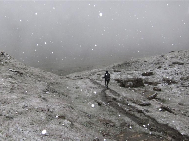
When to go? Our Tour du Mont Blanc season runs from the start of July to the middle of September.
This short season is imposed by the weather: the chance of late-Spring snow patches remaining into late June across the higher passes, and the chance of the weather deteriorating into late September. Because we can't predict the weather for the coming summer, we have to set these dates in advance.
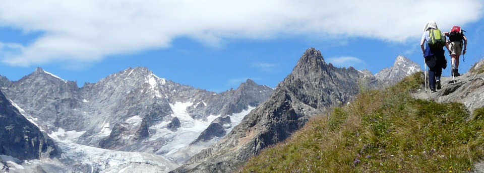
Where to stay
The TMB's accommodation is a major attraction of the route. At various points there are choices of mountain huts, campsites, luxurious hotels, more modest hotels, and auberges with a mix of rooms and dormitories.
Most accommodation is family-run, even in the larger places such as Courmayeur. Our TMB clients often volunteer how much they enjoy the variety of the places we book for them; we aim to give a true experience of the Alps and of the Tour du Mont Blanc. In Chamonix we book as standard our friendly and central hotels, for an unforgettable finish to the trip.
The huts on the TMB follow a common Alpine pattern, catering for big numbers of hikers in a practical and comfortable way. Dormitories are common, but private rooms are available in many of the huts too, subject to availability. (We will advise on the sleeping arrangements according to your particular schedule.) Showers are available, sometimes with a token system for a small extra payment to the warden. For food, expect a simple menu of large portions and plenty of cake, beer, coffee and soft drinks. Our standard Tour du Mont Blanc trip uses 4 welcoming huts, but we are always happy to put together 'hutty' schedules if you would like to see more of this side of the world of Alpine hiking!

City breaks after trekking
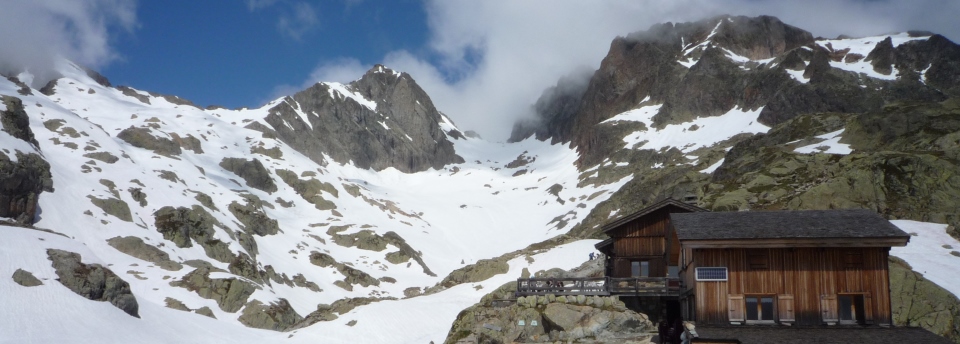
Here's a brief guide to the places and experiences on the TMB, on our normal 11-stage schedule.
Stage One We start in Les Houches , the village at the foot of the valley not far from Chamonix . (The TMB does not pass through Chamonix itself - all travel details are included in your joining notes.) The first climb, up to Col de Voza at 1,653m (5,423ft), is not too bad in the overall scheme of things, but may be a tough start for legs that have yet to fully warm up! At the col, the main route is a gentle descent to the Montjoie valley through the villages of Bionnassay, le Champel, la Villette, la Gruvaz and Tresse before the final pull up to Les Contamines . A good alternative, harder but with close views of the Bionnassay glacier, is the high-level route over Col de Tricot at 2,120m (6,955ft).
Stage Two From Les Contamines the route plots a course due South. Follow the Torrent le Bon Nant along forest tracks to the famous church of Notre Dame de la Gorge. Here the climbing begins! An initial ascent along a steep track, built by the Romans, brings you to the flat upper valley beyond la Rollaz; higher up, pass the Refuge la Balme and complete the main part of the climb, reaching Col du Bonhomme at 2,329m (7,641ft). A traverse round to the Col de la Croix du Bonhomme at 2,479m (8,133m) finishes the climbing - relax here to take in the new views to the South over the Beaufortain mountains. All that's left now is a grassy walk downhill to the hamlet of Les Chapieux .
Stage Three The next stage climbs and then descends to Rifugio Elisabetta . Along the way, the Italian border is crossed at the Col de la Seigne. Start the walk by climbing gently along a lane in the narrow trench of the Vallee des Glaciers, reaching the Refuge des Mottets. The climb to the Col starts here and is not too demanding. Arriving at the Col at 2,516m (8,255ft) the view ahead is of the highest scenic quality. It stretches as far as the Grand Col Ferret, 3 stages away, along the lengths of the Val Veni and Italian Val Ferret. On the left hand side of these valleys is the Mont Blanc massif in all its splendour, with the best view of Mont Blanc itself since leaving Chamonix. Drop down from the col to reach the Rifugio at the lip of the Vallon de la Lee Blanche, below a trio of glaciers.
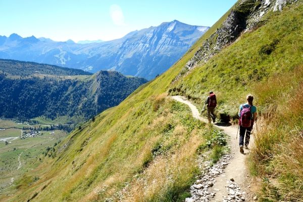
Stage Four Today's destination is the Italian resort of Courmayeur . Begin by descending towards Val Veni with the huge Glacier du Miage prominent to your left. The TMB takes a high route along the Northern slopes of Mont Favre in order to gain better views of Mont Blanc across the valley. From Col Checroui the TMB descends rapidly down steep ski runs to the village of Dolonne and then Courmayeur itself. Courmayeur is a bustling and lively town with all facilities and a noticeably Italian feel, in contrast to Chamonix and the settlements met on the route so far.
Stage Five The next stage, which has much climbing, passes Rifugio Bertone on the way to Rifugio Bonatti . Options exist to make this stage easier or harder. A highlight of the day, in fact of the whole Tour, is the traverse of the long grassy ridge of Mont de la Saxe which acts as a lookout for the Mont Blanc range opposite - while this is a variant rather than the main TMB trail, we recommend it over the lower 'Armina' route for its fantastic outlook. Cross Col Sapin at 2,436m (7,992ft) and Pas Entre Deux Sauts at 2,524m (8,281ft) before dropping down to the Rifugio. Named after the famous Alpinist Walter Bonatti this is a modern and comfortable hut known for its generous and delicious food. Its position on a grassy shelf opposite the Grandes Jorasses is enough to recommend it!
Stage Six Follow the recently re-routed TMB path from Rifugio Bonatti on a traverse of the hillside, before it begins the stiff climb to Grand Col Ferret. Glacier de Pre de Bar dominates the view to the North, flowing down from Mont Dolent on the border of France, Italy and Switzerland. At the Col at 2,537m (8,323ft) the whole of your Italian adventure can be seen, from its start at Col de la Seigne. Now you are in Switzerland. Begin by descending gently to the farm buildings of la Peule, then lower down to the Swiss Val Ferret. Pass the village of Ferret to arrive in La Fouly , a calm village amidst some of the most charming scenery of the whole trek.
Stage Seven Wander down-valley past meadows, the river (la Drance de Ferret) and through woods. Walk along the top of a wooded glacial morraine, the Crete de Saleina, arriving soon after at the village of Praz de Fort. Pass les Arlaches and Issert in the valley floor. So far today the route has been gradually downhill. Now start a gentle ascent all the way through woods to Champex and its high position in a saddle between the mountains le Catogne and la Breya. This stage is the easiest and lowest of the Tour, not crossing any passes, but it is full of charm.
Stage Eight Champex might be hard to leave with its picturesque lake and calming air. The TMB splits into two for the journey to Trient : the main route climbs through woods to the alp of Bovine at 1,987m (6,519m) while an alternative route climbs higher to the Fenetre d'Arpette at 2,665m (8,743ft). Neither route is easy, but the Fenetre route involves high, rocky walking that some will find especially tough. Arrive at Col de la Forclaz directly on the Chamonix-Martigny road, or drop to the quiet Swiss village of Trient in the valley.
Stage Nine Leaving Trient, pass the hamlet of le Peuty and begin the steep climb to Col de Balme at 2,131m (6,991ft). Once at the col the nature of the TMB changes remarkably, for now you are in the realm of Chamonix and all that that entails. The view to Mont Blanc is suddenly revealed upon reaching the Col, this time from the French side, and is one that will hopefully accompany you for the next two and a half stages. The peaks, needles and rocky spires of the massif will rearrange themselves throughout your walk to Les Houches. Back to the current stage, follow the Tour over the narrow ridge of Aiguillette des Posettes at 2,201m (7,221ft). Descend along the crest to Tre-le-Champ , a hamlet from which the views of Aiguille Verte are especially good. From here it is easy to reach Argentiere , the informal centre for the upper Arve valley.
Stage Ten The next two stages make the link to Les Houches and will see you walking high above the Chamonix valley. Climb from Tre-le-Champ into the Aiguilles Rouges nature reserve, giving one of your best chances to spot ibex (bouquetin) and chamoix. Pass the rock needle of Aiguillette d'Argentiere before climbing up the rocky hillside on ladders. Lac Blanc is a very worthwhile diversion. The climb to this famously scenic lake at 2,532m (7,717ft) can be incorporated into the stage or treated as an out-and-back. Either way, traverse further along the hillside to reach the hut and cable car station at La Flegere . This connects with Les Praz, between Chamonix and Argentiere in the valley below.
Stage Eleven Pick up the route at La Flegere and prepare yourself for a very scenic introduction to the day. For about 90 minutes your route takes you across the rocky hillside on an easy path, high above the forests on the North-West side of the Arve valley. Looking up at the hillside from the valley below, you wouldn't think it possible. The route follows the well-known Grand Balcon Sud. Reach the cable cars at Planpraz , connecting to Chamonix, and turn up towards Col de Brevent. Here the GR5 - from Lake Geneva to Nice - joins our route. The link from here to the summit of Le Brevent at 2,525m (8,284ft) is intriguing - it passes through a high rocky hollow and then along the steep hillside with a short section of ladders. The summit viewpoint is perhaps the best position yet from which to look at Mont Blanc, as well as the Col d'Anterne area to the North. The Brevent has a cable car link to Planpraz and Chamonix. The final part of the TMB is now beckoning, down rocky slopes past Refuge de Bellachat and further down into forests, arriving at Les Houches . This is the end of your trek!

The TMB in context
The TMB compared to treks in the UK Compared to most long-distance routes in the UK, the TMB has lower daily distances but more ascent. On the Coast to Coast route in England, for example, the average stage length is twice as long but most stages do not climb as much. An extra factor is that the TMB's altitude is higher throughout, as it is on most Alpine treks. (The highest point in England is under 1,000m whereas on the TMB even the valleys are around 1,000m!)
The TMB compared to the Walker's Haute Route and AV1 The TMB sits below the Alta Via 1 and the Haute Route in its difficulty. These are three of the classics of Alpine walking. Compared to the AV1, the TMB has more daily distance and elevation gain, but covers generally more hospitable terrain with fewer of the bold mountain settings and the steep drops to the side. The uphill walking tends to come in more concentrated chunks, with typical mornings being spent climbing to a pass, instead of the ascent being spread out during the day. Compared to the Haute Route, the TMB is notably less challenging, because the Haute Route is right at the top end of Alpine walking terrain.
Comparing our 5 big Alpine treks The Haute Route is substantially the toughest, suitable only for trekkers with particularly solid experience, balance and fitness.
The Via Alpina includes three rocky cols that approach the Haute Route's level of challenge, though the route as a whole is more forgiving. The same applies to the Adlerweg but in its case one col (the Eppzirlerscharte) stands above the rest as very difficult, and it can be skipped by descending and taking the train. The Adlerweg is notable for some long days on wide tracks.
The AV1 is more consistent in its difficulty but is especially demanding of good balance, with steep, rocky and wild situations calling for mountain experience.
The TMB is a superb all-rounder that mixes tough, solid mountain days with gentler ones, allowing trekkers to sample the harder terrain as at the Fenetre d'Arpette (a variant, shared with the Haute Route) while not requiring any extremes.
It's worth noting that each trek has different possible schedules, governing the physical difficulty, and on many days different variants affect the terrain difficulty.
Below we compare the stats of our 5 big trips:
Hike the Tour du Mont Blanc with Alpine Exploratory
Alpine Exploratory offers four self-guided options for the TMB, plus one guided trip. As well as the full circuit from Chamonix we offer half-routes which we call North and South. These end and start, respectively, in the roughly half-way resort of Courmayeur. Our weekend trip explores the final 3 sections of the trip high above Chamonix. We're also pleased to book shorter or longer sub-sections of the route according to your available dates. Please contact us to discuss options.
Our self-guided holidays give you what you need to complete the route under your own steam. We book your accommodation in a mix of hotels, huts and auberges and we give you our detailed routecards, the local maps, and lots of notes. Importantly we will advise on the ideal schedule and accommodation to suit your approach to the TMB. Our guided trips are similar but give you the benefit of an Alpine Exploratory leader to show the way.
Please ask us any time for more details. Please feel free to describe your walking experience and preferences, and we'll suggest which trek you might enjoy most.

Alpine Exploratory Alpine Exploratory is a system of knowledge on the best mountain trekking in our areas, giving clients superb holidays based on this exploration. About us
Trek with us in the Alps, Scandinavia, UK or Ireland. Go self-guided or join a guided trip.
We research and interpret the trail to give you the finest walking holiday.
Alpine Exploratory is a system of knowledge on the best mountain trekking.
Tour du Mont Blanc in 4 days
The tour du mont blanc in 4 days.
In our opinion, this accessible hike is without doubt the most beautiful way to discover trekking. Experience the joys of a multi-day hike in the magnificent setting of the Mont Blanc mountain range!
With views of a range of superb landscapes, contemplate the most beautiful sights the Alps have to offer. The recipe for a simple life in the open air, far from the hustle and bustle of the city.
This trek allows a gentle discovery of the Tour du Mont Blanc with its forests, mountain pastures, villages and glaciers… Get away from it all on one of the most beautiful treks in the world.
Your consultant


The advantages of the TMB in 4 days
Departure from, date of departure, accomodation, the programme in detail, day 1: les houches – bionnassay.
Today, you will meet the group and your guide in front of the Bellevue cable car at 9 am. The day begins with a climb through the forest, until you reach the summit of Prarion (1969m), from which you can enjoy a first 360° panorama.
Descent to the Fioux refuge for the night.
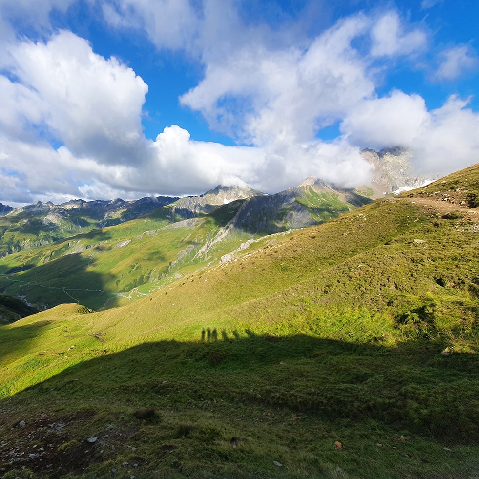
Day 2: Bionnassay – Les Contamines
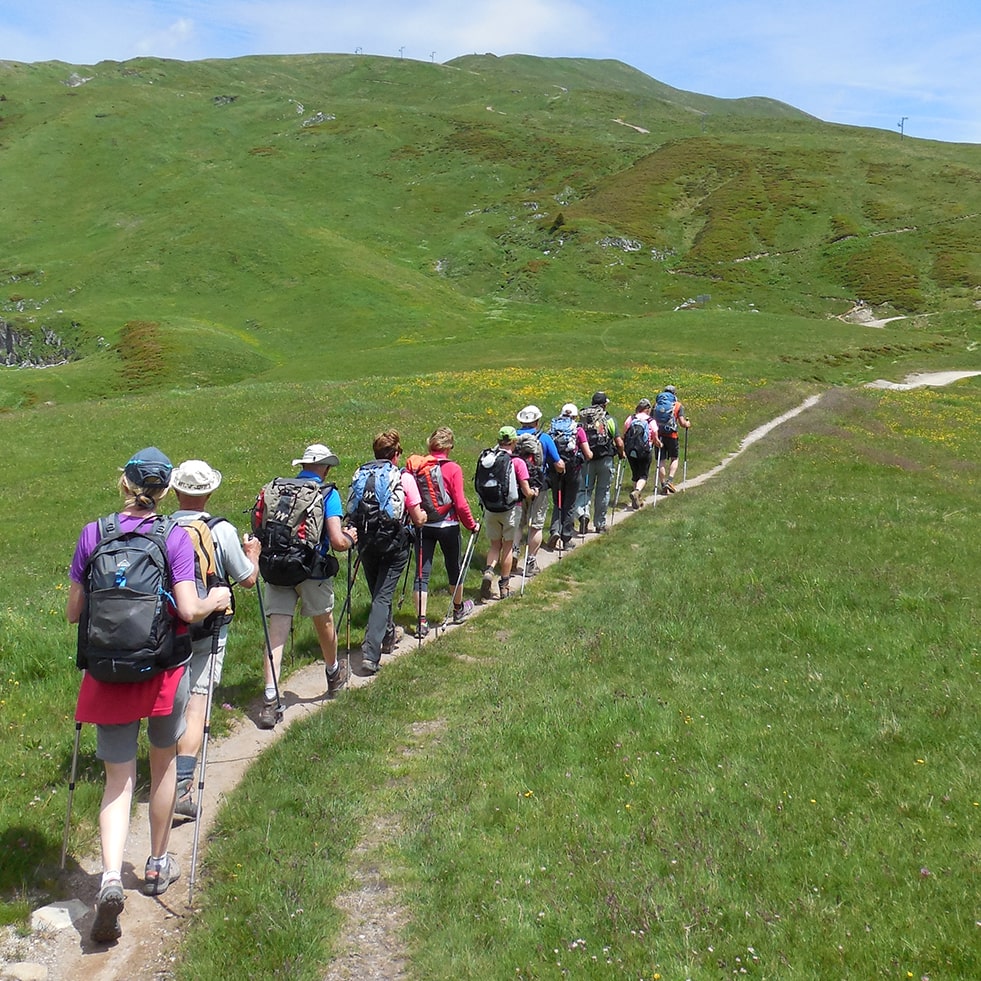
Day 3: Les Contamines – Les Chapieux
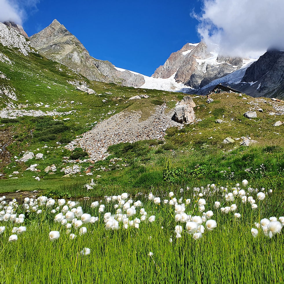
Day 4: Les Chapieux – Courmayeur
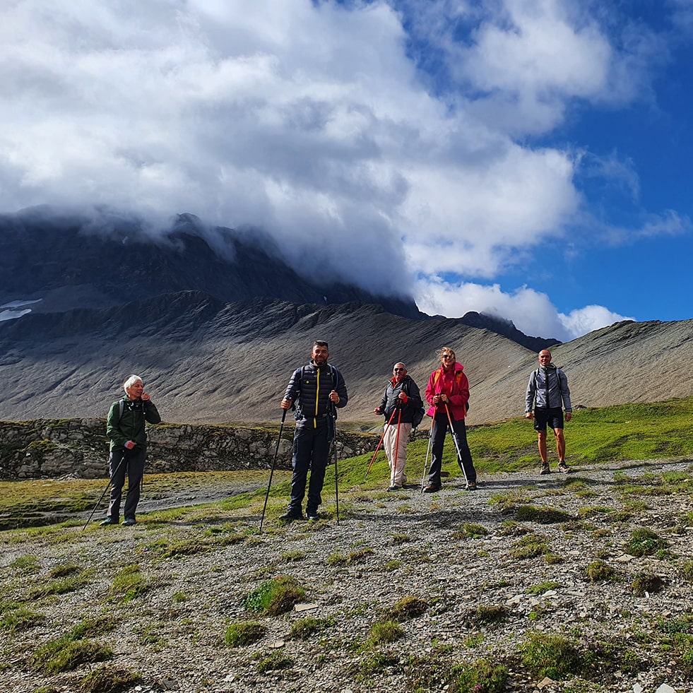
Useful information
Luggage transport.
Between 6 and 8 hours’ walking per day throughout the trek, with some more difficult sections, particularly at the start of the season when the snow is still present. You should be able to climb at least 1,000 m (3 200ft.)a day for several days in a row.
Directions and accommodation
Directions to the starting point : Meet at Bellevue cable car station at 9 am on Day 1.
You can leave your vehicle in the Prarion car park a few meters above. It is a free outdoor car park.
> Map to get to the starting point
Return to the starting point: Bus from Place Monte Bianco in Courmayeur to Chamonix, or taxi. Then bus, train or taxi from Chamonix. Return from Courmayeur not included in the price of the stay.
Bus timetables at the Chamonix tourist office ([email protected] +33(0)4 50 53 00 24) or Courmayeur ([email protected] 00 39 01 65 84 20 60).
Accommodation before and after the trek:
- Hotel Saint Antoine – 7 route Napoléon, 74310 Les Houches – 04 50 54 40 10
- Hotel du Bois – 475 Avenue des Alpages, 74310 Les Houches – 04 50 54 50 35
- Gîte Michel Fagot – 2 Allée des Sorbiers, 74310 Les Houches – 04 50 54 42 28
Even if you choose to do it in summer, it can get cold on the TMB! We strongly recommend that you pack clothes suitable for a multi-day hike, such as:
- A windproof and waterproof jacket
- Walking trousers.
The terrain is varied and we recommend you wear walking boots that protect your ankles.
The accommodations provide blankets and pillows, but you will need a silk sheet, for hygienic reasons.
For more information, voir notre our special TMB equipment page.
The Comfort cancellation contract covers you in the case of cancellation before your departure and/or a missed flight.
The Comfort multi-risk contract includes:
- Cancellation before departure and interruption of your trek
- Missed flight and flight delay
- Luggage and personal belongings option
- Worldwide repatriation and travel assistance
- Search and rescue costs up to €15,000
- Individual travel accident option
- Third-party liability abroad
- Impossible return and early return
The COVID contract includes:
- Cancellation due to illness 30 days before departure
- Cancellation due to denied boarding
- Remote consultation before departure
- Medical repatriation
- Hotel costs and medical fees
- Psychological support
- Grocery deliveries and home help
To book, you must:
- Click on one of the “book this trek” links and select the insurance, and date options.
- To pay by cheque : please make it out to WATSE and send to: WATSE – 63 avenue de la gare – 74170 Saint Gervais les Bains Le Fayet – France.
- To pay by bank transfer : contact us for our bank details.
- To pay by debit card : your invoice will be in your online account as soon as your payment has been confirmed by the bank. You will then be able to pay the balance directly from your account.
- Pay a 30% deposit or the balance for your trek
- Print out the booking form then fill it in, sign it and send it back to us by email or post. Your reservation will only be effective when 30% of the total cost is credited to WATSE’s bank account.
- The balance must be paid at least one month before departure without a reminder from us.
Dates and prices
Included in the price.
- Supervision by a qualified mountain guide
- Accommodation in dormitories, as described in the trek programme
- Half board, as described in the trek programme
- Packed lunches prepared by a chef
- Dried fruit and nut snacks prepared by a chef
- Luggage transfer every night
- Showers in the accommodations
Not included in the price
- Transport to and from the start of the trek
- Drinks other than water served with meals
- Any private transport or cable car tickets not included in the trek programme
- Assistance and cancellation insurance, to subscribe at the time of booking
- Anything not listed in “Included in the price”
You will also like:
Full tour du mont blanc in 10 days.
Embark on the full TMB and see the very best it has to offer.
Tour du Mont Blanc in 7 days
The iconic TMB through France, Switzerland and Italy, circling the highest summit in the Alps.
Tour du Mont Blanc in 7 days (comfort)
Walk the paths of the TMB enjoying every evening accommodation selected for their comfort.
Tour du Mont Blanc High-level route – 7 days
A wild and alpine itinerary over high mountains and across glaciers. Not for the faint-hearted!
Trail running the Tour du Mont Blanc – 5 days
For those who want to do the TMB (almost) as fast as Kilian Jornet!
Tour du Mont Blanc camping – 7 days
Experience nature at its most authentic as you camp your way round the best-known trek in the Alps.
From Chamonix to Courmayeur, get away from it all with this trek through varied landscapes offering breathtaking views.
Tour du Mont Blanc in 5 days
From Courmayeur to Chamonix, the northern part of the Tour du Mont Blanc will have no secrets for you!
Contact us!
I have read and accept the terms and conditions.
- Trail Guides
- App Features
- General FAQs
- Subscription FAQs
- How-To Guides

170km / 105 miles • The Alps of France, Italy & Switzerland
Official companion app to trailblazer’s tour du mont blanc by jim manthorpe.
Download our guide to access the Tour du Mont Blanc map, tracks, waypoints, and comments! Trek the European Alps through the epic peaks and stunning valleys of the Tour du Mont Blanc. The Tour du Mont Blanc is one of the world’s most famous hiking trails. This loop route passes through seven stunning mountain valleys around the spectacular Mont Blanc. This amazing scenery is classic European Alps: rugged spiky mountains, lush green valleys, strenuous mountain passes, and photo-worthy vistas. Hikers can start the loop from a variety of points in France, Italy, and Switzerland, including in Les Houches in the Chamonix Valley, Les Contamines in the Montjoie Valley, Courmayeur, Champex, and Martigny. The route also passes Chamonix, the famous resort which hosted the first Winter Olympic Games in 1924.
$14.99/£14.99 A TRAILBLAZER GUIDE
Buy Once, Works Everywhere
Works Offline
Trusted Trail Data
Detailed Waypoints
Built for Community
Tailored to You
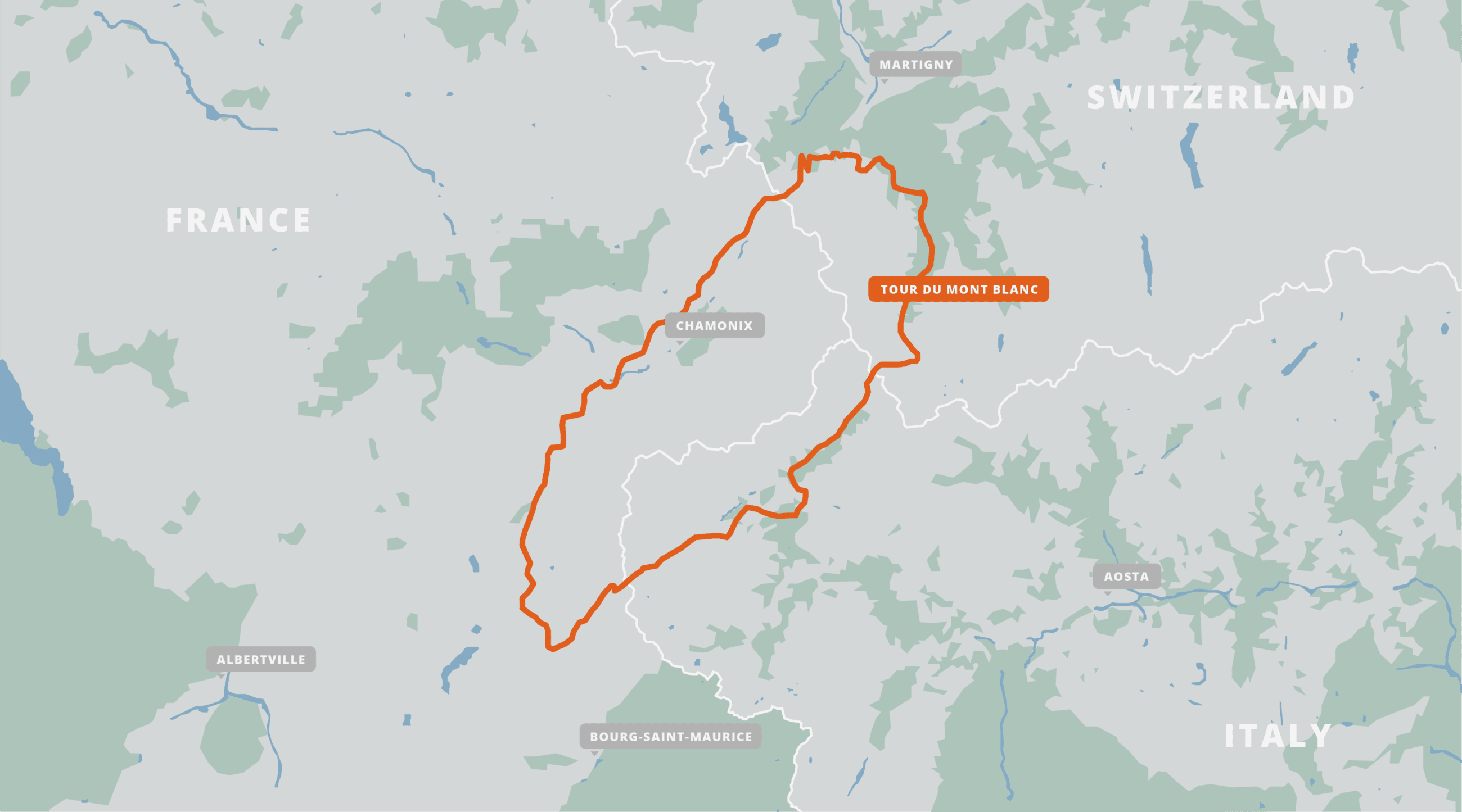
Available on
- Desktop browser
- Android tablet

Trailblazer Special
Purchase all Trailblazer apps in one package. Includes South Downs Way, Coast to Coast, West Highland Way, Hadrian’s Wall Path, The Cotswold Way, and The Ridgeway. Purchase now and you will receive any new apps we add in the future at no additional cost.
$34.99/£34.99
Tour du Mont Blanc
The Tour du Mont Blanc is one of the world’s most famous hiking trails. This loop route passes through seven stunning mountain valleys around the spectacular Mont Blanc. This amazing scenery is classic European Alps: rugged spiky mountains, lush green valleys, strenuous mountain passes, and photo-worthy vistas. Hikers can start the loop from a variety of points in France, Italy, and Switzerland, including in Les Houches in the Chamonix Valley, Les Contamines in the Montjoie Valley, Courmayeur, Champex, and Martigny. The route also passes Chamonix, the famous resort which hosted the first Winter Olympic Games in 1924.
$14.99/£14.99
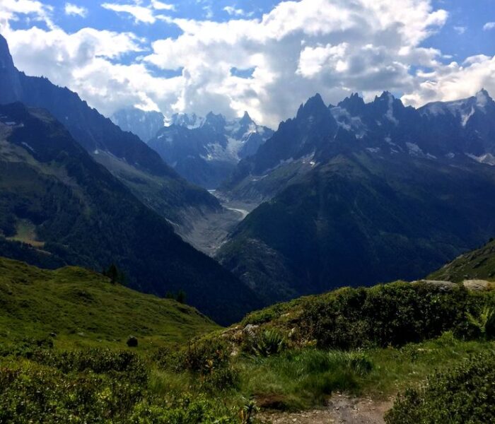
About Our Partner
Trailblazer was started in 1991 by traveller and author, Bryn Thomas. In his travels since the 1980s he has used a lot of guidebooks and firmly believes that it is the detail that makes guides most useful. Walkers need to know the nut and bolt detail of a walk – timings, distances, gradients and prices – rather than have to read long descriptions of views they can see for themselves. So Trailblazer guides focus in on really detailed information for only a single long-distance walk or a select few trails rather than general information on a large network of trails. And our authors have a voice – they tell it like it is. These are guides are written by walkers for walkers. Trailblazer is proud to have been associated with FarOut since 2014 and we work closely together.

Hiking the Tour du Mont Blanc: An Overview Guide
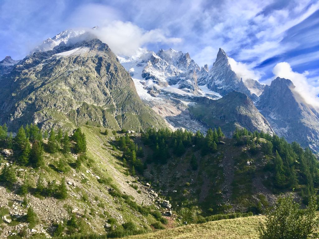
Top tips and recommendations to hiking the Tour du Mont Blanc
[Updated April 2020]
This post contains affiliate links for which Expedition Wildlife may receive a commission (where applicable) at no additional cost to you.
Tour du Mont Blanc Statistics
Distance Total: 105 miles (170 kilometers).
Total Elevation Gain : 8,900 meters (29,200 feet).
Total Elevation Loss : 9,100 meters (29,855 feet).
Duration : 11 days .
Physical Difficulty Level : High – the consistent elevation gain and loss requires hikers to be in good physical shape prior to the trek.
Mental Difficulty Level : Low – well-marked trails, ample food and lodging availability, and lack of isolation on the trail give hikers a better peace of mind.
Gear Necessity : Good hiking shoes and trekking poles will be your most cherished pieces of gear on the TMB. Acquire sturdy layers, especially a high quality rain coat and rain pants.
Recommended Guides: Cicerone’s T rekking the Tour of Mont Blanc by Kev Reynolds is an essential, step-by-step guide to the trail. *This is our recommended guide to take with you on the trail!!*
The Tour du Mont Blanc website , montourdumontblanc.com has information about all of the refuges and their contact information and availability. The Tour du Mont Blanc Facebook page is a great place to ask others about their experiences and recommendations for the trail as well as keep up with trail conditions and news as you prepare for your journey around Mont Blanc.
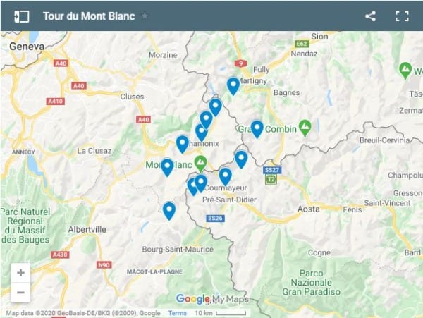
Click the Google Maps image to see all the stages listed on this trek.
About Mont Blanc and the Tour
About the tmb: a quick look.
The Tour du Mont Blanc (aka the “TMB”) traverses the alpine environment surrounding the stunning and imposing Mont Blanc. It leads through three countries: France, Italy, and Switzerland.
This famous trek has been listed as one of the top long-distance treks in the world time and time again, and for good reason.
The elevation gain and loss are what make this trek more challenging, but overall the path is well-worn, well-marked, and wide enough that serious safety issues largely aren’t a concern.
Distinctive yellow diamonds with “TMB” inscribed in the center and red-and-white blaze marks are your hiking route markers. Note that some of these markers look like street signs, with a red and white blaze, and a direction towards a specific location. Because of this, knowing the main points along your hiking route will come in handy throughout the day.
You’ll walk through sweet towns, into remote mountain passes, through cow and sheep paddocks, along beautiful streams, and so much more. If you love hiking, this is definitely a trek for you!
About the Mont Blanc: A Quick Look
Mont Blanc is the symbol of the Alps, stretching high above the valley and imposing over everything in its wake.
The Mont Blanc, meaning “white mountain” after its year-round white peaks and glaciers, stands at 15,771 feet (4,807 meters) and is the tallest mountain in the Alps and Europe , outside of those found in Russia. Quite literally during this trek, you will ascend and descend the equivalent of about 8 mountains , so the elevation gain and loss throughout the trek is no joke!
The Mont Blanc had been circumnavigated through its adjoining valleys and mountains by people for centuries. It wasn’t until 1786 that two men, Jacques Balmat and Dr. Michel Paccard, summited the beast.
While you won’t summit the Mont Blanc on this trek (summiting is for those with mountaineering experience, a permit, and (usually) a guide), you’ll certainly experience everything this beautiful region and its people have to offer.
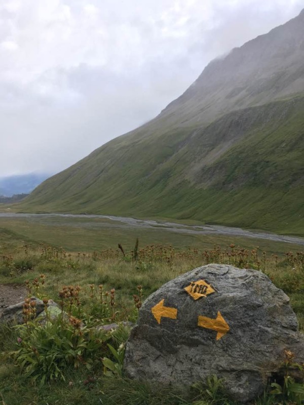
Follow the yellow diamonds labeled “TMB” for “Tour du Mont Blanc,” or the red-and-white blaze paint, as your route throughout the duration of the trek. Photo by Christa Rolls
Hiking the Tour du Mont Blanc: An Overview
The Tour du Mont Blanc was a shock to my system after hiking the wilderness trails of Washington State.
This is a hut-to-hut hike
Most people “hut-hike,” or hike from hut (or hotel) to hut. Tent camping is limited along most sections of the TMB, including in the Vallee de l’Arve, the Vallee des Galciers, and in the Swiss and Italian valleys along the route.
The TMB is very popular
The trail will be busy – and I mean BUSY, especially in summertime. If you’re looking for more solitude, you won’t find wilderness or alone-time here. However, the experiences with your fellow hikers and the sights you will see make this a once-in-a-lifetime experience.
Directionality matters
The most common direction of travel is counterclockwise . This affords hikers the best views of the surrounding valleys as you come over the handful of passes from the west. However, it is, of course, possible to hike clockwise and go against the flow of traffic.
Chamonix is the popular starting point
Most people use Chamonix as their home base. It is a resort and mountain-side town famous for its association with the Mont Blanc.
The tramway that takes visitors halfway up the mountain to the Nid D’Aigle for the Mont Blanc views is popular among day visitors. The Tour du Mont Blanc trail itself, however, officially starts in Les Houches, a quick bus ride outside of Chamonix.
Weather can change quickly in the mountains
If the weather looks bad, DON’T opt for the high routes along the trail, such as through the Col de Tricot to Refuge de Miage.
Of course, if you choose to stay at this refuge and others along high routes, this will prove more difficult to avoid. The route is very exposed and can be dangerous in inclement weather.
On the first day, we ended up taking the low route through Bionnassay because thunder and lightning shrouded the mountains the entire day of our hike. Don’t worry, you’ll still have a beautiful hike on the low routes!
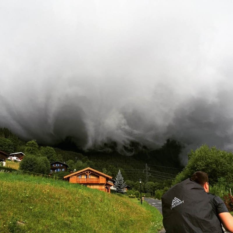
Dark thunderclouds shroud the mountains over Les Houches on day one of our trek. Photo by Christa Rolls
When to Go/Best Season to Hike the TMB
Late June to Late September i s the typical time frame for hiking the TMB . This is entirely dependent on snow leftover from the previous season and winter weather that comes into the mountains in the autumn.
The high season is July and August, largely because of the more reliable weather and because this is the prime vacation period for most European countries.
The weather is very unpredictable in the mountains and can change extremely quickly. Keep this in mind as you plan your trip.
The Refuges, gites, and hotels will begin to open in June and will remain stocked and open in September. If snowy weather comes in early, it is possible for accommodations to close their doors early. A lot of these places require mules or helicopters to re-stock, or driving along winding mountain roads, hence why they might close earlier in inclement weather.
Avoid Ultra-Trail Season, if possible
The end of August is the ultra-marathon race around the TMB (the Ultra-Trail du Mont Blanc).
I recommend avoiding traveling during this time (unless you plan to do the Ultra, of course!). Otherwise, book your accommodation ahead of time, yield to runners, and prepare for things to be busy.
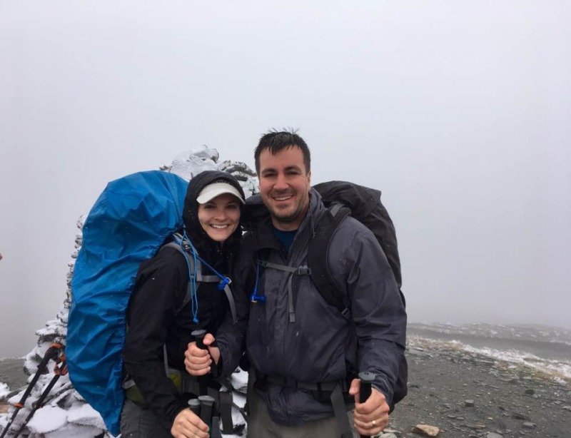
Even at the beginning of August, we experienced snow and cold, windy weather on the Col de la Seigne high pass. Photo by Christa Rolls
Cost of hiking the Tour du Mont Blanc
Plan for around 1000 Euro for the whole trek , including half-board accommodation (which includes a bed, breakfast, and dinner) and lunch options and snacks.
Upscale accommodation and luggage transfers cost more
You’ll pay about 500 Euro extra for more upscale accommodations, or private rooms, and luggage transfers.
Yes, LUGGAGE TRANSFERS. It might cost quite a bit extra to get, but you’ll save a TON on weight carried. Remember all those mountains I said you would have to climb up and down?
Luggage transfers are possible only to other towns that have a connecting road, so there may be a night that you wouldn’t have your bag with you. In this case, you’ll want a decent sized day pack (around 30L or so) to hold your lunches/snacks, water, toiletries, and an extra change of clothes along with your layers and sheet liner.
There are a number of options for luggage transfers along the trail – Mont Blanc Treks , Taxi Mont Blanc , and AlpenWild are just a few of the options.
Added costs at refuges
Contact your on-trail accommodations to see whether you are required to bring your own linens and towel. Some will provide these to you at extra cost, and others you must provide for yourself.
In the event that you need to provide them for yourself, purchase a travel sheet liner and a lightweight, packable travel towel .
We didn’t experience issues with bed bugs, but note that the blankets provided in refuges and gites aren’t washed between uses. This is why you would need the cover sheet.
Money on the trail
You will switch from Euro to Swiss Francs (CHF) along the trail. Swiss accommodations will usually accept Euro, but if you change out for CHF ahead of time you’ll be guaranteed a better rate.
When you contact the refuges for your reservation, ask them ahead of time if they accept credit card. Many locations outside of main cities do not accept them. People have also noted that the Swiss territory, in comparison to the French and Italian sides, are comparatively more expensive.
Banks and ATMs can be found in Chamonix, Les Houches, Les Contamines, Courmayeur, and La Fouly.
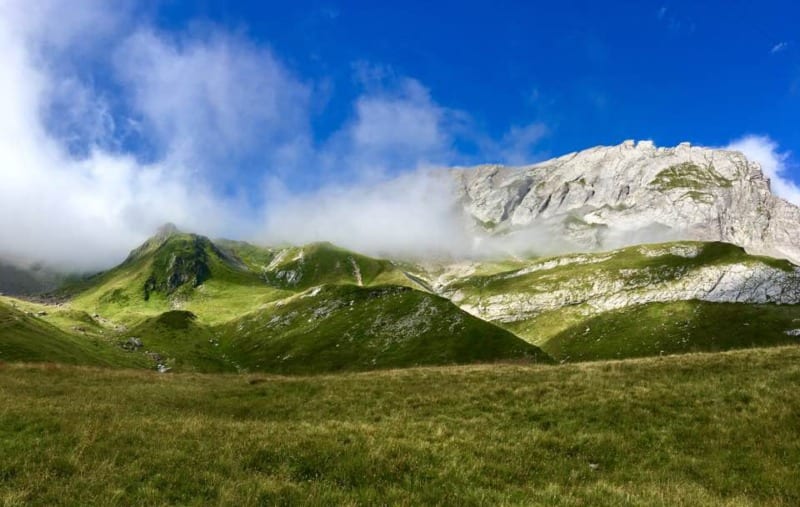
The mountains and surrounding scenery is stunning at every turn along the Tour du Mont Blanc. This is the view walking up the Bon Nant Torr. Photo by Christa Rolls
Getting to Chamonix
Again, Chamonix is the primary location where people stay to prepare for the Tour du Mont Blanc trek. The trailhead, however, starts in Les Houches, so select which town you prefer. Chamonix is busier, but also has more shopping and other sights.
We flew into Geneva (the closest, large airport) and took a FlixBus to Chamonix. FlixBus actually ended up being an easy and inexpensive way to get to the trail, for around 30 Euro round trip. OUIbus , SwissTours , and EuroLines buses will also make the trip from Geneva to Chamonix-Mont Blanc. The main bus station drops you off in the middle of Chamonix, about two blocks from the centralized, pedestrian walk of the town.
Use a Rideshare
If the timing lines up with your flight arrival, you can also look into using BlaBlaCar , a ride-share app where locals will charge a reasonable fare for a spot in their car to a pre-specified end-destination. BlaBlaCar is a good option if you arrive at an odd time in the day, especially later, when the bus tickets are substantially more expensive.
Take the Train
The regional TER and TGV trains connect from main cities to Saint Gervaid-le Fayet. From here, you can hop on a local SNCF train, specifically the Mont Blanc Express, that goes to multiple villages in the area, including Saint Gervais-le Fayet to Martigny, Les Houches, Chamonix, Argentiere, and Vallorcine. Keep in mind, however, that trains have the potential to be affected by any government shut-downs, as well as funding and personnel staffing issues.
Want more epic hiking destinations? Check out our post on other long distance hikes, such as the GR 20!
Staying near and Getting to the TMB Trailhead
Staying in chamonix.
Our favorite place to stay in Chamonix-Mont-Blanc is the Chalet Hotel le Prieure – Chamonix .
If you book ahead of time, you can get insanely good deals on their recently updated rooms. Inquire about getting a mountain view room, for STUNNING views of the mountains at sunset!!
The rooms are spacious, clean, comfortable, and have a balcony. The location is such that you won’t be right in the middle of the loud pedestrian walk.
They also offer luggage storage for a reasonable cost of 5 Euro per day if you want to leave one of your big pieces behind during your trek. This is what we did, as Nathan brought his camera gear for the second leg of our trip to Spain, but he didn’t want to hike with all of it.
The Carte d’Hote, or Guest Card
Your accommodation in Chamonix should provide you with a Carte d’Hote , or Guest Card, upon your arrival.
With this, you’ll have access to free services, including the buses that transport visitors around the Chamonix Valley (including to Les Houches!) and train travel between Servoz and Vallorcine.
You really won’t need this if you are just in town to hike the TMB. However, there are discounts to the Alpine and Mountain Museums, car parks in the Saint-Michel and Mont-Blanc region, and the Richard Bozon Sports Center.
If you are using an Airbnb or staying in another kind of private accommodation, you will have to visit the Town Hall or Tourist Office to acquire this card for 10 Euro per person for a weekly stay. Again, this isn’t worth it unless you plan to extend your stay in the Chamonix area to visit some of the other sites and museums. This is why staying in one of the hotels in Chamonix can be worth the cost!
Getting to the trailhead
The official trail of the Tour du Mont Blanc begins in Les Houches, at the Telepherique de Bellevue. Hike up the forest trails from town, or take the tram up. The hike starts heading uphill right away – It’s a long and arduous hike nearly every day, so prepare yourself.
It is up to you whether you would like to hike to Les Houches from Chamonix or start in Les Houches to end your trek in 12 days in the Chamonix-Les Houches region. Some people will opt to go straight to Les Houches to spend the night.
We took the free bus (with our Carte d’Hote) from Chamonix to Les Houches to get us started.
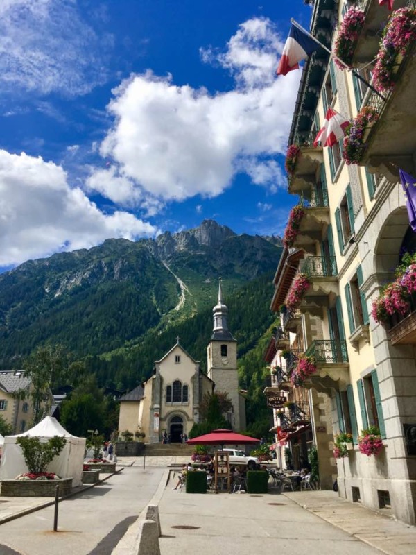
Chamonix is a beautiful and fun town to explore before or after your trek. Photo by Christa Rolls
Where to stay on the Trail
Planning out your accommodations for the trail is quite time-consuming, and likely why many people end up pre-purchasing a guided or self-guided tour.
In planning out our days, I mostly stuck to what the Cicerone guide recommended for us .
The challenge is ultimately contacting each refuge/hotel and keeping track of the following:
Deciding Which Refuge to Stay in
Consider the total distance you will need to travel between your starting and ending locations, and whether that distance is feasible for you.
A variety of room types may be available at various locations on the trail. Private rooms with shared or private bathrooms to ten person shared bunk rooms can be booked. If you have a preference, ask about availability during your correspondence.
Contact Each Refuge
To contact the refuges/hotels, some will have online forms available on the TMB website. Others may only respond via email or phone line.
If your French is minimal, emailing is a good option, as you both can use Google Translate if needed.
I contacted all refuges/hotels by email and created a separate “Tour du Mont Blanc” folder in my Gmail account to keep track of TMB-specific correspondence with refuge/hotel personnel.
How Much Money is Needed per Refuge
Determine whether the refuge/hotel accepts credit card or cash only. In addition, keep track of those you pay for ahead of time and those who want you to pay on arrival.
I kept an excel spreadsheet with the locations I still needed to pay cash for on the trail. This way, I made sure to take out the appropriate amount prior to starting our trek.
What you Need to Stay at Each Refuge
Certain refuges provide linens and towels and some don’t. Ask during your correspondence whether this is something you will have to bring along with you.
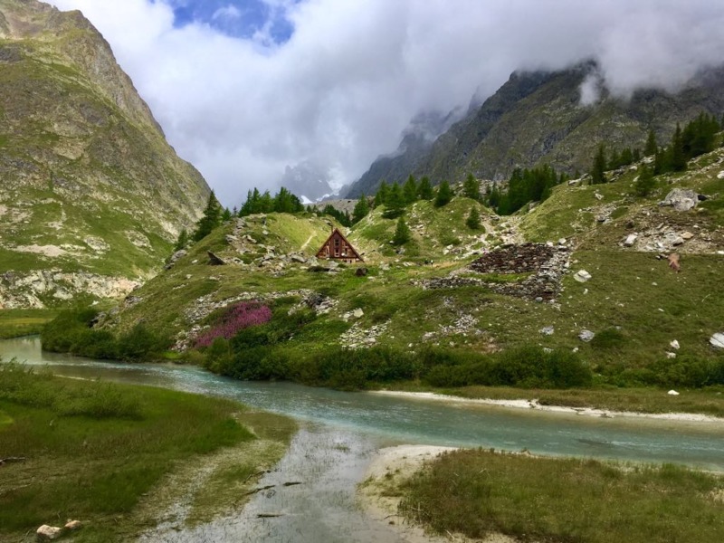
The Caban du Combal sits along the Val Veni next to Lac Combal, a stunning, clear blue, glacial lake. This was one of our favorite places to stay during our entire trek. Photo by Christa Rolls
The main reason why you would want to book accommodation ahead of time is to secure yourself a bed without the worry of having to beat everyone else to the refuge.
Some people do this – get up first thing in the morning and hoof it as quickly as possible to their next refuge site.
As I mentioned before, I’m a pretty slow hiker and would always tend to arrive at my destination by mid-afternoon even after getting up earlier in the day. It was for my peace of mind that we had spots secured. Even though it took time to coordinate, it was worth it.
If you don’t book anything, you have the freedom to continue on or stop short on your hike whenever you would like. Otherwise, you risk losing a deposit to the places you’ve booked ahead of time.
Check out the embedded map found at the top of this post for the primary recommended huts, hotels, and refuges along the Tour du Mont Blanc.
Food on the TMB
You won’t ever run out of food availability on the trail (unless you go in the off-season and huts are closed until the following summer). There are so many places that offer snacks and full meals along the way in summer.
Of course, some breakfasts and dinners are better than others along the way. Our most favorite dinner was at Les Chambres du Soleil in Les Chapieux. Even if you don’t end up staying the night here, consider taking them up on their fabulous dinner and dessert.
Breakfast typically comprises of a hot beverage, bread with butter and confiture (jam), and sometimes some yogurt, cheeses, and meats.
There largely aren’t kitchens that are open to visitors in these locations, so if you’re attempting to save money by just renting a bed and cooking your own food, keep in mind that you’ll need to bring your own equipment.
The dining areas of refuges at dinnertime will be for those dining in ONLY, so if you’re making your own food you’ll need to do that elsewhere. Some places are pickier about this than others. Dinner always consists of salad or soup, a main course, and a desert.
Water on the TMB
Because of all the grazing land around the trail, DO NOT drink the water in streams without filtering it first. Cow, horse, and sheep feces can be found all along the trails and streams on the Tour du Mont Blanc. Consuming tainted water can give you a nasty stomach bug.
You will frequently come across accommodations where there will be potable water to fill up your bottles or Camelback. Given this, you really only need to fill up for the day when you embark each morning.
If you’re planning any side excursions, however, and tend to drink a ton of water during your hikes (like me), it might be worth it to bring along a Sawyer Mini or Lifestraw , or water purification tablets . I always hike with a 3L Camelback on longer day hikes. Despite the added weight (every 16 oz. of water is about a pound of weight), this is worth it to me since I hydrate so much.
Some streams along the trail may stop flowing in late summer, but you really won’t have an issue with filling up along the way.
TIP: Consider doing some longer day hikes prior to your trip to gauge your water intake.
All potable water locations will be clearly marked as such with “ Eau Potable . ” Avoid water sources that say “ Eau Non Potable ,” as the “ non ” (meaning “ no “) indicates it should not be consumed.
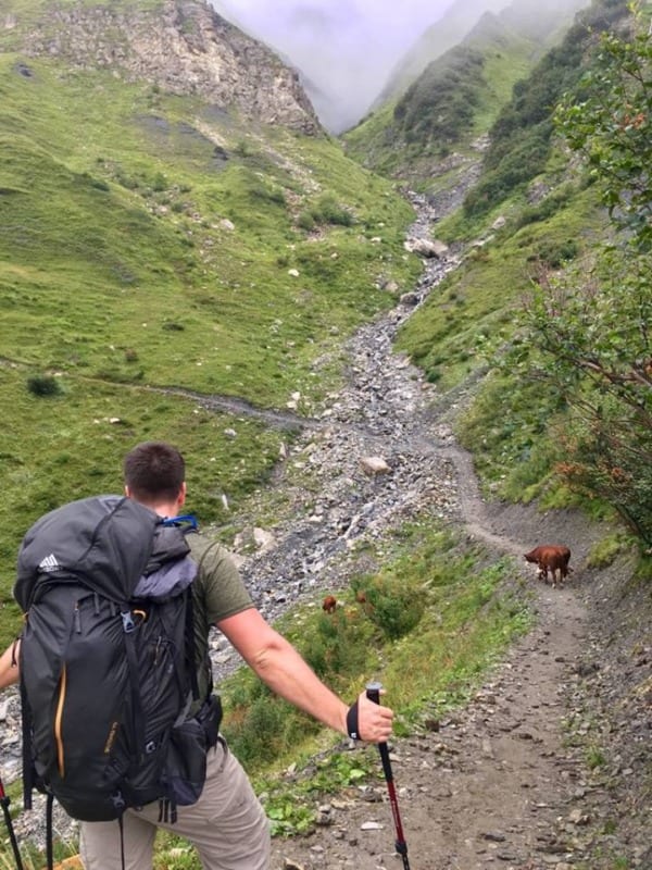
Livestock of all kinds can be found literally on the trail along the Tour du Mont Blanc. Exercise caution when passing animals with young. Photo by Christa Rolls
Miscellaneous Tips for Hiking the Tour du Mont Blanc
Be mindful about where you end up hiking.
And follow the TMB trail blazes (a yellow diamond or red-and-white blaze).
The extensive number of hikers and subsequent erosion has created some meandering trails that lead off of the main trail. Most eventually lead back to the main trail, but some don’t. These have the potential to create other unwanted trails from people hiking all over.
Learn some French
I know, I know, learning languages is hard. But learning a few phrases will make speaking to some of the locals a lot easier.
Many people will be speaking English on the trail, as people from countries all over the world will be hiking the trail. However, refuge personnel may speak less English.
Although you’ll pass through Italy, French is still widely understood in this bordering region next to France. In addition, the region you will be hiking through in Switzerland is the French-speaking side of the country.
At the very least, learn to say the basic phrases, such as: hello ( bonjour or bonsoir ), please ( s’il vous plait ), and thank you ( merci ).
Get good hiking poles
The consistent elevation gain and loss can be especially hard on your knees and legs. Hiking poles will alleviate the pain somewhat. These are my favorite .
Get good hiking shoes
You’ll be walking in your shoes A LOT over a two-week time frame. While good hiking shoes or boots can be expensive, it’s worth it to get a pair that fit your feet well and are comfortable.
I swear by my Vasques , and I never have to break them in.
Take time to explore some of the towns and villages along the way
You’ll come across some wonderful valleys and alpine prairies, as well as plenty of places to do a side hiking trip.
This is another reason I like to book my accommodation ahead of time. My mind is on exploring and taking my time along the trail instead of racing to the next hut!
Take time for a rest day
If you need it, there’s absolutely nothing wrong with giving your body a break.
This is a long trek, so listen to what your body needs and modify your hiking days accordingly.
For a halfway hike, Courmayeur is a good place to stop if you don’t have as much time to hike. Buses go through the mountain pass straight back to Chamonix, costing around 15 Euro per person.
By the time you get to Courmayeur, your body will likely be ready to keep on trekking!
Don’t take the hiking guide to heart 100% of the time
While guides are there to help you with some navigation, logistics, and accommodation information, everyone hikes differently.
The difficulty level and hiking times for each day may vary from person to person. I tend to hike an hour or two longer than the suggested hiking times, while some people I know hike about two hours faster than the suggested hiking times.
Be kind to yourself and recognize you can hike your own hike!
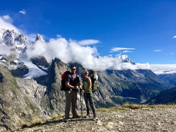
The sun is a welcome friend after getting snowed on in the high mountains! Note that layers are incredibly important for this trek, as the weather can change very quickly. Photo by Christa Rolls
Gear Recommendations for the Tour du Mont Blanc
My pack weighed about 10 kg without water – your pack should only be about 20% of your body weight . The full list of the gear I brought is as follows.
Backpacking Gear
- Deuter Lite 60+10 SL Hiking Pack with Rain Cover (her)
- Gregory Baltoro 85L Pack (him)
- Small, lightweight, collapsible day pack (for day hikes)
- Black Diamond hiking poles
- Petzel Headlamp
- Collapsible cup /mug
- T itanium spork other eating utensil
Food and Water
- Camelback 3 L bladder
- Lunch and/or snacks for day-time hiking on the trail
Clothing and Footwear
- Vasque hiking boots
- Three pair hiking socks ( SmartWool and Darn Tough )
- Reef flip flops (or other house shoes)
- Three pair Patagonia hiking underwear (originally purchased on discount at REI)
- Two hiking bras (originally purchased on discount at REI)
- One pair Columbia convertible pants
- Two moisture-wicking long sleeved shirts
- Two moisture-wicking short sleeved shirts
- Patagonia fleece (given to me by a mountain hut manager after someone left it for a month)
- Smartwool long john pants (originally purchased on discount at REI)
- REI puffy jacket
- North Face rain jacket
- Columbia Rain Pants
- Buff neck warmer
- North Face glove liners
- Prana ear warmer
Emergency and First Aid
- First Aid kit : alcohol wipes, antibacterial ointment, antidiarrheal, antihistamines, ibuprofen, Dramamine, antacid, epipen, gauze, medical tape, small round of duct tape, safety pin
- Hiking whistle (check the chest buckle on your hiking pack – some have a whistle built in)
- Travel Insurance – we recommend this for every trip you take!
Health and Hygiene
- Toiletries: wet wipes, face wipes, toilet paper, hand sanitizer, nail clippers, contacts and glasses, sunscreen, mini toothbrush, toothpaste, concealer wand (for after trip), sunscreen lip balm, collapsible hair brush, care plus clean bio soap (biodegradable; for skin, hair, dishes, and clothes)
- Lightweight camping towel
- Sac a la viande/sleeping bag liner , or travel sheet liner
- Sunglasses and baseball hat
- Cicerone guide to hiking the Tour du Mont Blanc – excellent guide for the surrounding area’s accommodations, food options, alternative routes, and natural features
- Waterproof trekking map of the Tour du Mont Blanc
Tools and Repair items
Backpacking extras.
- Eye mask and earplugs (if you are a light sleeper, definitely don’t forget ear plugs if you’re sleeping in dorm style rooms)
- Phone charger and battery charger pack
- Dry bag and large trash bag to line the inside of our our packs (in addition to rain cover)
- Stuff sacks for organizing gear (e.g., one sack for kitchen, one for food, one for clothes, etc.)
Personal Items
- Credit cards and ID/passport
There are a few other gear considerations to keep in mind for your trip
- We did not end up deviating from the regular route to alternative routes or climbs, so we didn’t end up using the detailed trail map. If you decide you want to go on some of the higher routes or add climbs to your trip, consider obtaining IGN 3531 ETR and IGN 3630 OTR waterproof maps to assist in your navigation.
- We monitored the online forums prior to our trek to ensure there was no snow left on the ground. By mid-to-late July most of the snow has begun melting away. If you anticipate there being snow on the trail, bring crampons or yak-traks along in the event that things get slick and icy.
- Accommodations will provide you at least with a pillow and wool blanket, but they may not wash them or put covers on them. This is what the travel sheet liner is for.
Tourist Office Locations and Information
For more information on activities in the surrounding area, contact the region’s corresponding tourist information office.
Chamonix Tourist Information Center
Address: 85 Place du Triangle de l’Amitié, 74400 Chamonix-Mont-Blanc, France
Phone: +33 4 50 53 00 24
Website: chamonix.com
Tourist Office Les Houches
Address: 9 Place de la Mairie, 74310 Les Houches, France
Phone: +33 4 50 55 50 62
Website: leshouches.com
Courmayeur Tourist Information Office
Address: CSC Centro Servizi, Viale Monte Bianco, 10, 11013 Courmayeur AO, Italy
Phone: +39 0165 842060
Website: lovevda.it
Champex-Lac Tourist Information Office
Address: Route du Lac 38, 1938 Orsières, Switzerland
Phone: +41 27 775 23 83
Website: champex.ch
Get ready for an incredible display of stars at night if the sky remains clear. Photo by Christa Rolls
The Tour du Mont Blanc is one of the top treks in the world for good reason. It’s a stunning, fun, and unforgettable way to experience the Alps.
After your trip, consider visiting the Aiguille du Midi and Mer de Glace to see the Mont Blanc up close .
Tell us about your TMB experiences in the comments and feel free to message us with any questions or for more details!
Happy Hiking!
Christa and Nathan
About the Author: Christa
Related Posts
Ethical Safari Guiding Experience: The Wild Source
Must-Visit Dark Sky and Stargazing Destinations Worldwide
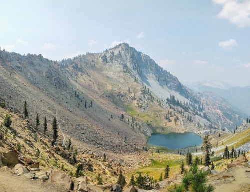
Trinity Alps Weekend Getaway: Northern California’s Four Lakes Loop

Must-visit Dark Sky Parks in the USA
Cairngorm Mountains, Scotland Must-do Activities
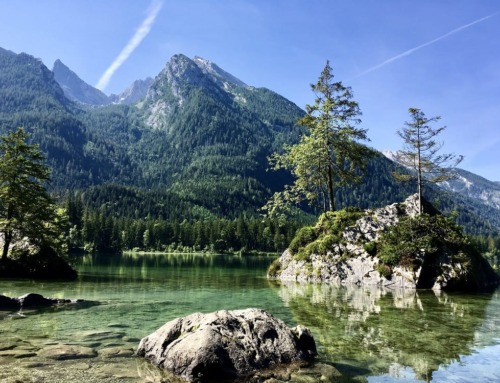
Must-visit Mountains in Europe
I’m off to hike the TMB at the start of August so I really appreciated your article. Whilst we are doing a 7 day itinerary there is some really useful information in here which i will be using for our trip, thanks for taking the time to write this piece. Cheers and happy hiking!
Ceri, so glad some of the information was useful for you! Have a safe and wonderful trip, and please let me know how it went when you get back!
Leave A Comment Cancel reply
This site uses Akismet to reduce spam. Learn how your comment data is processed .
Hike | Switzerland, Italy, and France
Hiking the tour du mont blanc, text | anninka kraus photography | tobias kraus.

The Tour du Mont Blanc is one of the world’s most spectacular long-distance alpine hikes. The 170 km trail circumnavigates Europe’s highest peak, the 4’808 m Mont Blanc, traverses three countries – France, Italy, and Switzerland – and packs 10’000 m of cumulative elevation gain into a 7-10-day hike.
The TMB doesn’t require technical skill, but its elevation profile resembles a relentless up and down hill roller coaster ride – which doesn’t stop some from running the entire circuit in less than 21 hours in the UTMB (Ultra-Trail du Mont-Blanc) race. You can take as much time on the trail as you like though, also add some rest days in Chamonix and Courmayeur for instance, because unlike many other popular trails, a permit is not required.
jump ahead.
Hike the Tour du Mont Blanc in 8 days.
1. Les Houches – Le Brévent
2. Le Brévent – Argentière
3. Argentière – Champex-Lac
4. Champex-Lac – La Fouly
5. La Fouly – Courmayeur
6. Courmayeur – Refuge de Mottets
7. Refuge de Mottets – Les Contamines-Montjoie
8. Les Contamines-Montjoie – Les Houches
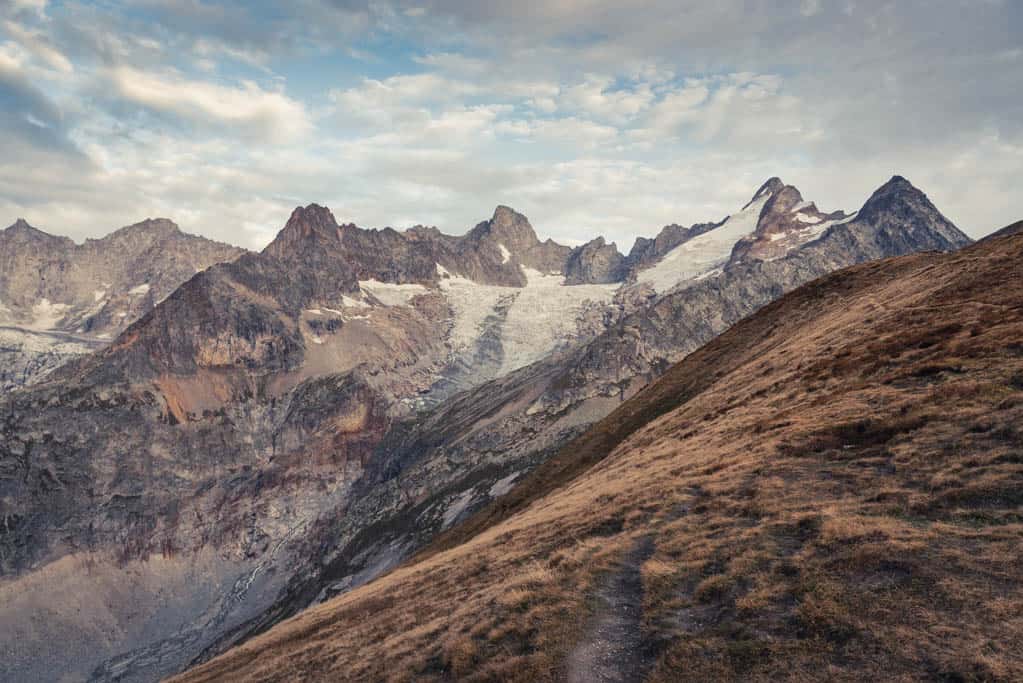
Tour du Mont Blanc map
What to expect..
One of the world’s most spectacular long-distance alpine hikes
Breathtaking mountain panorama of Europe’s highest peak, the 4’808 m Mont Blanc • The legendary 170 km trail traverses 3 countries: France, Italy and Switzerland
Excellent hiking infrastructure and snug huts all along the way, but at times, this comfort comes at the cost of tranquility
A hike with a total height gain of 10’000 m that does not require technical skill
location & trail information.
Accommodation on the TMB: On this hike, you can stay in private accommodation, huts or camp/bivouac.
One advantage of the TMB, I believe, is the combination of a multiday hike at higher altitudes with the comfort of hot showers and comfortable beds every night. Thus, whenever possible, we stayed in hotels, guesthouses and refuges with private accommodation and I cannot speak to the dorm rooms because we only stayed in one, nor to camping /bivouacking on the TMB.
When to hike the TMB: Most huts open mid-June to mid-September, when the risk of snowfall and ice at higher altitudes is low. We didn’t know at first and were surprised that when we researched accommodation for the 3rd week of September some refuges (mountain huts) were already closed or closing for the season the following week.
We also thought they’d adjust to present weather conditions – sunshine and temperatures in the mid-twenties were forecast for a fortnight when we started our hike – and extend the season, but they didn’t.
With the season being short, this hike requires careful planning well ahead of time if you want to avoid the crowds in the European summer holiday period and instead go mid-June to mid-July, or as we did, in late September. You also want to avoid the time of the popular trail races, the Marathon and Ultramarathon (UTMB) du Mont Blanc.
Autour du Mont-Blanc website was very useful to us when planning our tour and we booked most of our accommodation on this website. The official TMB track is 170km long but has many variants. Most hikers follow an 8-10-day itinerary but you can spend considerably less or more time on the trail, taking shortcuts or side trips, or adding rest days. In our case, we only had one week off work but 7.5 days suited us just well.
Food on the trail: Huts typically provide half-board with basic breakfast (bread, butter, jam and cereal) and a 2 or 3-course dinner. Vegetarians were well catered for where we stayed, but I’m not sure if that also applies to food allergies.
You’ll pass by many villages with restaurants and shops, and huts along the way, so there’s no need to carry food with you except for a 2-3 days’ supply of snacks on which you can easily restock along the way. If you’re a rather picky eater, know that in more remote areas, eating in the hut may be your only option. It’s usually also the cheapest if you’re on a budget.
Those camping and preparing meals themselves, who need some help with planning, this post may be useful.
Hiking clockwise or anticlockwise: As the Tour du Mont-Blanc is a loop circuit, you’ll hike either anticlockwise (the traditional route) or clockwise (less common). We decided to walk clockwise simply because with only a few huts still open, this was the only way we could complete the circuit. However, walking against the flow actually granted us hours of quiet before and after passing the rush of anticlockwise hikers around noon each day. The choice is yours: If you like more company when walking and want to meet up with more or less the same people every night, go anticlockwise, if not, go clockwise.
We prefer self-guided hikes and as the TMB is a well-marked and an oftentimes busy trail, it’s well suited to explore without a guide. Taking a guide book or detailed map and downloading gpx files of the route (learn how to use GPS for hiking) will be very useful nonetheless.
Many Americans we came across were on guided daytrips with luggage transfers between accommodations, which allowed them to walk with daypacks only and enjoy the comforts of a hotel every night. The TMB is predestined to pick out the crème de la crème stages for day walks as the track frequently passes through towns and villages or intersects with cable cars running to said towns and villages. So, if you’re short on time, don’t want to carry much luggage, or prefer more comfortable accommodation, day walks are what I’d recommend.
Les Houches - Le Brévent
Chamonix is one of the most renowned skiing destinations in the French Alps, holding a famed place in sport history by hosting the first ever Winter Olympic Games in 1924. Its old town exudes a Belle Époque elegance to match its prestige and despite being located just across the border from Switzerland, Chamonix is still quintessentially French, at least judging by the well-assorted specialty cheese shops and the croissants that are buttery chewiness enveloped in crispy flakes. It is also one of the starting points to the famous long-distance Tour du Mont-Blanc trail.
Being a loop trail, the TMB has several starting points and Chamonix or rather Les Houches, a community ten minutes south-west of Chamonix, was the most convenient for us. There’s a large parking lot, free of charge, where you can leave your car, or you can use public transport, also at no charge when you stay at a hotel in Chamonix, entitling you to a Carte d’ Hôte, a Guest Card.
We set off on a gorgeous late summer’s day, breathing warm air imbued with the scent of pine needles baking in the sun. The previous week had brought heavy rain leaving the ground soaked and mushrooms, almost as bright as the kites of the paragliders soaring above the treetops, broke through the forest floor in all shapes and colours.
Though my enthusiasm never waned on this first day, the unrelenting 3-hour climb up 1500 m through the woods to Tête de Bellachat at 2276 m, with hardly a few meters on the flat to break the ascent, was a tough leg to adjust to the hiking and we were glad only to be wearing day packs. At the Refugio de Bellachat at 2151 m, the sound of the motorway bouncing off the sides of the valley, a constant reminder of the nearby civilization, suddenly abated. What’s more, once out of the woods, we were no longer sneaking peeks of the surrounding mountainscape through gaps in the foliage. Suddenly, we were at the center of a spectacular 360° panorama culminating in a viewpoint at Le Brévent with the Mont-Blanc mountain range vis-à-vis and in its midst the famous ‘White Mountain’.
From Le Brévent, one would usually continue to La Flegère hut to spend the first night, but as the hut was being renovated at the time, we made use of the cable car that runs from Le Brévent upper cable car station at 2525 m down to Plan Praz at 2000 m, then changed to a gondola lift to Chamonix. The only potential downside of staying two nights in Chamonix, is the short return journey you need to make to Le Brévent the next morning. But to enjoy the outdoorsy feel of the village for the rest of the afternoon, we thought it was definitely worth it.
Start: Les Houches parking lot, where you can leave your car free of charge
End: Le Brévent upper cable car station; return to Chamonix via gondola
Route: Les Houches – Le Coupeau – Parc animalier de Merlet – Refuge de Bellachat – Le Brévent
Distance: 11.3km
Time: 4:15 hours
Elevation gain: 1540m / loss: 70m (lowest point: 987m / highest point: 2488m)
Alternative: Hike to La Flegère hut
Difficulty: low
Info: The ticket for a round-trip on the cable car and gondola Chamonix-Le Brévent was 33.50€ at the time. Please note that the cable car and gondola are not open all year around and in 2019 closed for the summer season on 15th September.
Hotel & Restaurants: Helopic Hotel, Pizzaria Des Moulins, Pastry House Richard, Le Fournil Chamoniard
gpx file of the Tour du Mont Blanc
Le brévent - argentière.
The next morning, we were squeezed tightly between four locals and their enormous paraglider packs in one of the first gondola cabins ascending to Plan Praz. While they headed off to a nearby launch site, we changed to the aerial car to Le Brévent and from there set out in the direction of Col du Brévent. TMB signage is frequently missing in the French part of the tour, so taking a map and downloading gpx tracks can save you from needless detours.
We were playing peekaboo with marmots, large ground squirrels that are very shy but still curious, and promptly went off-trail, following the GR5 trail instead of the TMB towards Plan Praz.
Back on track a half-hour later, we steadily descended to 2100 m and the start of the TMB’s masterpiece section ‘Grand Balcon Sud’. It’s just a 1.5-hour stretch really, downhill and on the flat, to Refuge La Flégere at 1877 m, but it’s the most magnificent 1.5 hours on the entire trek. This section indeed resembles a balcony running the length of the valley at just such an altitude as to best showcase the world-famous mountain panorama vis-à-vis.
Past La Flègere, the trail climbed slowly towards Chalet des Cheserys and La Tête aux Vents, crossing the only stream where we could fill up our water bottles on the entire leg. It being a hot day, we sorely missed the taps and fountains you’ll find along even the most remote of mountain paths in Switzerland and hikers coming our way complained about water at Lac Blanc costing 6 €/litre. The lake is a side trip forking off west at La Tête aux Vents trail junction, where a cairn marked the 2150 m summit and the polyglot, vociferous babel buzzing back and forth on the trail also hit a crescendo as several hiking parties had chosen this spot for a break. The TMB’s unique geographic location, spanning three countries and language areas, is reflected in the mix of languages spoken on the trek and its popularity in the many US hikers that rivalled the French in numbers.
We skipped the detour to Lac Blanc and embarked on what Tobi announced a “gentle descent” towards Argentière, but was actually a 45 min scramble on metal footholds and handrails affixed to the vertical mountain face. I make it sound worse than it is, but I’m not a great fan of vertical ladders and anyone with a serious fear of heights might want to consider the path descending from Chalet des Cheserys towards Argentière.
After the climb and a fair bit of whining, I was back on flat ground and felt exhilarated at having overcome this ‘obstacle’ – for all of two minutes, when I spotted two climbers sitting on Aiguilette d’Argentière (Needle of Argentière). From the top of this needle-thin stone pillar, they watched (and laughed at, I’m sure) chicken-hearted hikers, like me, crawl down perfectly safe ladders. Once we’d passed this slightly technical section, it was indeed a gentle downhill walk to Argentière.
Start: Le Brévent upper cable car station
End: Argentière (Boerne)
Route: Le Brévent – Grand Balcon Sud – La Flégère – Aiguilette d’Argentière – Boerne near Argentière
Distance: 15km
Time: 5:40 hours
Elevation gain: 580m / loss: 1630m (lowest point: 1463m / highest point: 2519m)
Side Trip: Lac Blanc
Difficulty: medium
Stay in/near Argentières: We stayed at Auberge la Boerne, in their only private room, but cannot recommend the accommodation as it was very crammed and dark. The center of Argentière isn’t far (approx. 20 min on foot, buses are also running) if you consider getting accommodation there.
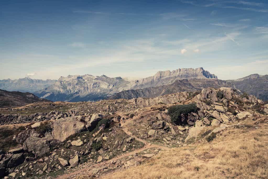
Argentière to Champex-Lac
On day 3, the most challenging on the TMB for us, you’ll cover over 30 kilometres in the 9.5-hour leg from Argentière to Champex-Lac. Two long, steep ascents, each followed by an equally long and steep descent add up to a total difference in altitude of 2000 m. As there are people who run the entire TMB route in less than 24 hours, you may also think this day is a breeze, but not me.
Early in the morning, I was still blissfully ignorant of the drudgery to come and eagerly striding uphill through the woods. The sodden forest floor was strewn with fallen leaves, rotting wood and moss cushions, glistening wet with tiny droplets of dew, and oozed a damp, earthy smell that slowly muddied my vivid recollections of the claustrophobic, stuffy rooms of Auberge la Boerne.
The scent and slight chill lingering in the air dissipated along with these memories when we reached a high plateau bathed in sunshine and overgrown with short leafy shrubs that on closer inspection revealed a sea of wild blueberries. The small berries were an intense, matt shade of dark blue and coated with a shiny film of morning dew that gradually evaporated into a fine mist. The path traversing the plateau had not yet fully absorbed the heavy rains from the previous week and the moisture and sunshine were bringing forth an astonishing plentitude of wild raspberries, strawberries, and blueberries.
After three hours, somewhere in the high alpine meadows, we crossed the border to Switzerland. Although hikers we met the previous night had encountered a border patrol unit, we simply noticed that signposts were suddenly in German. Once there, you’ll have tackled the first up-and-downhill part for the day.
Unfortunately for us, the peace and quiet we’d enjoyed also came to a temporary end for on the 2-hour descent from the border to Trient, we faced a caravan of large hiking groups charging towards us. Today’s leg was further confirmation that almost no one was walking clockwise like us and that the busiest time you’ll face when walking in that direction is midday with its surge of anti-clockwise hikers.
Once they’ve passed, solitude returns even in the villages. As it was the end of the hiking season, Trient was completely deserted, the wooden window shutters closed on many houses and nobody walking the streets. We’d been craving a piece of cake for the better part of the day, but finally in Trient couldn’t find a single open shop or restaurant, much less a bakery. Being hungry, I had a hard time trying to conceal my frustration and tackling a 200m steep incline towards Col de la Forclaz, but then, at long last, we were seated outside Hotel de la Forclaz, half an hour out of Trient, indulging in delicious fruit tart.
Our stomachs full of cake, we followed the trail winding uphill through woodland and reached the second summit of the day, Collet Portalo at 2040 m. There’s a working dairy farm, Alp Bovine, just past the summit that was closed, but from its backyard offered great views of the Rhône Valley to the north-east. In the remaining 2.5 hours, the TMB led through beautiful high alpine pastures, but the closer we came to Champex, the less I noticed anything but my badly hurting feet.
Dubbed “Switzerland’s little Canada”, the little village of Champex is set on the shores of crystal-clear Lac de Champex at the foot of Le Catogne and La Breya mountains, two peaks well over 2000 m high. It exudes a nice, laid-back mountain resort charm, which again I didn’t really appreciate until much later when we sat at the lake front after a short rest, wearing flip flops not boots.
Start: Argentière
End: Champex-Lac
Route: Argentière – Aiguilette des Posettes – Chalet du Col de Balme – Trient – Col de Forclaz – Alp Bovine – Champex d’en bas – Champex d’en haut – Champex-Lac
Distance: 29.4km
Time: 9:20 hours
Elevation gain: 1960m / loss: 1900m (lowest point: 1341m / highest point: 2238m) Alternative between Trient and Champex: you can also follow a different, more difficult route via Fenettre D’Arpette
Stay & Eat in Champex-Lac: Hôtel Mont-Lac & Mimi’s Lounge
Champex-Lac to La Fouly
The elevation profile on day 4 is a breeze and the scenery of lush pastures, traditional mountain villages and grazing cows equally gentle. The first hour to Issert is downhill, then in the remaining four hours the trail gradually winds uphill through the Swiss Val Ferret. The uphill part involves an elevation gain of 1125 m, which may sound like much, but spread across 16km is very feasible.
It was almost 10 am when we set off on the Sentier des champignons (mushroom trail), descending into the valley. As we’d seen mushrooms aplenty in the past days, we expected a true mushroom eldorado on this trail, but oddly enough, the only mushrooms we saw were ones carved from wood. It reminded me of wildlife in the US and South America where bears and guanaco seemed to much rather roam outside national park boundaries, not inside where you’re led to expect them.
We arrived on the valley floor and one of the lowest points of elevation on the TMB trail at Issert at 1070m, the first of a string of hamlets set along the La Dranse de Ferret river. In the valley, we found a nice mix of closely guarded tradition and untouched nature as we followed the turns of the wide natural river bed with white boulders and pebbles. Traditional wooden chalets, set at the back of lovingly tended vegetable and flower gardens, were watched over by colonies of garden gnomes.
It was all very peaceful and serene yet somehow still fitted well with the snowcapped rock faces rising to the left and right, all untamed and rugged, and encroaching on the narrowing valley as we approached La Fouly at 1600 m at the foot of Dolent Mountain. We passed the last couple of houses at Ferret, then climbed switchbacks through alpine meadows dotted with grazing cows for 90 minutes to our destination for that night, Gîte Alpage de La Peule at 2065 m. It was our only night in a mixed dorm room, hence the comparison to other accommodation on the track falls short, but the musty smell of the matrasses and lack of friendliness from the tenant family running the farm over the summer months, really did not speak for La Peule.
Start: Champex-Lac
End: Alpage de la Peule near La Fouly
Route: Champex-Lac – Issert – Arlaches – Praz de Fort – La Fouly – Le Clou – Les Granges – Ferret – Alpage de la Peule
Distance: 20.9km
Time: 5:30 hours
Elevation gain: 1125m / loss: 540m (lowest point: 1069m / highest point: 2065m)
Champex-Lac: Stock up on snacks and bread at the local store and bakery
Difficulty: easy
Stay near La Fouly: Alpage de la Peule
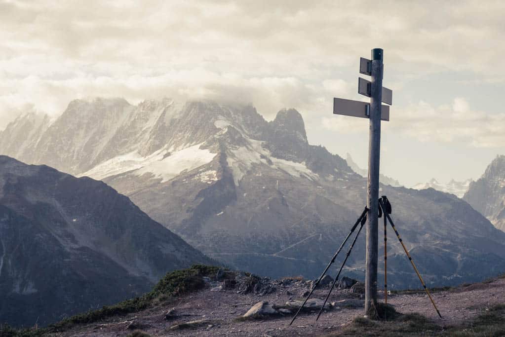
La Fouly to Courmayeur
We readily escaped the smelly bunkroom and ferocious snorers before dawn broke and had just gained some elevation towards Col-Ferret when the fleecy clouds scattered across the night-blue sky coloured pinkish-purple then bright orange. As darkness gradually disappeared, the black mountain silhouette gained contours, depth, and detail and a baby blue sky spread across the valley. The sun spotlighted one mountaintop in magnificent golden alpenglow while cows, drowsy with sleep still by the looks of their unsteady steps, staggered along a trampled dirt path in single file to some chosen meadow.
The varied height profile of the TMB brings about a continuous change in vegetation and with the 500 m elevation gain in a little over an hour’s hiking to Grand Col Ferret at 2537 m, green pastures were once again replaced with alpine tundra. At the top, a sharp breeze whipped across the exposed mountain plateau, surging against a stone cairn marking the summit and border to Italy. Rarely do you get to look down into two parts of a valley that belong to two different countries and transfixed we braved the cold to admire the impressive views of the Val de Ferret – the Swiss side of the valley to the northeast, the Italian side to the southwest. I had buried my hands deep in the pockets of my down jacket, but when we set out on the steep twisting descent to Refugio Elena, my fingers had still gone numb.
Gusts of wind continued to howl through the valley as we hurried along the path and while I donned a windbreaker to stop trembling with cold, we spotted two hikers walking towards us in T-Shirts and shorts. To brave the freezing temperatures in that attire they had to be either Australian, Kiwi or British, I thought, and indeed they introduced themselves as an Australian father and son with unmistakable Aussie intonation. They really were oblivious to the cold, for they stopped to chat and told us that Refugio Elena, where we’d hoped to get some hot chocolate, was already closed for the season but that Chalet Val Ferret hotel, further down the valley, may still be open, ‘mate’.
By the time we passed the hotel, however, the sun had quenched our hot chocolate craving and we continued towards Refugio Gorgio Bertone. The elevation profile suggested a leisurely walk through the valley but the almost straight topographic line, in reality, consisted of countless small but adamant ups and downs. When finally, we sat on the refugio’s terrace, on a ledge just above Courmayeur, we both agreed that this is one of the nicest spots to rest on the TMB and it was easy to put off the steep 700 m descent into town for another ten minutes, and another. Eventually, we were on our way and a beautiful walk it was, descending into the valley through pine forest, but also steep and my knees were wobbly when we arrived at Maison Le Saxe, a family-run boutique hotel in the Le Saxe neighbourhood.
To Le Saxe, don’t follow the gpx track into the centre of Courmayeur but turn right at a sign pointing towards that neighbourhood once you’ve passed the first couple of houses. The old town, a cobblestoned alpine resort village, is a further 15-20 min leisurely walk. Courmayeur becomes very busy with foreign tourists in winter, we were told, but in September, we had no trouble getting a table in a restaurant. On our TMB itinerary, this was the only night we spent in Italy and that had to be duly celebrated with a dinner of pizza and pistachio gelato.
Start: Alpage de La Peule near La Fouly
End: Courmayeur
Route: Alpage de La Peule – Grand Col Ferret – Refugio Elena – Chalet Val Ferret hotel – Refugio Gorgio Bertone – Courmayeur
Distance: 25 km
Time: 7:20 hours
Elevation gain: 1110m / loss: 1910m (lowest point: 1262m / highest point: 2512m)
Note: Courmayeur is bilingual and French and Italian official languages.
Stay in Courmayeur: Maison La Saxe
Courmayeur to Refuge de Mottets
The leg from Courmayeur to Refuge de Mottets has a similar elevation profile as that of day 3 with two relentless ascents. From Courmayeur at 1224 m, you climb to 2400 m, then descend again to Lago Combal at 1940 m. The second climb follows to Col de la Seigne at 2516m, marking the Italian-French border, with a final drop to Refuge de Mottets at 1864 m. It’s a long day, but one I enjoyed most on the TMB because the scenery is remarkable, albeit saddening at times.
We set out early, working our way uphill through open meadows and forest to the right of a skiing area that lay abandoned in summer. Except for some maintenance workers at the ski lifts it was eerily quiet. Even when we passed Maison Vieille hut at 1956 m there was still no one about, only a pony grazing out front that occasionally pokes its head through the door at dinnertime we had been told.
By mid-morning, walking above the tree line, we paused often with our eyes peeled on the rutted Mont Blanc massif across the valley. Deep fissures have once been carved into the granite by the adamant erosive might of glacier tongues. Nowadays, what remains of this force are small heaps of ice hiding at the back of huge scree fields, the terminal moraine, that trickle away into a creek running like a thin line in the path of the shrinking glacier.
On the TMB the reality of glaciers in retreat is painfully tangible and the tree line, where dark green pine fends off the grey rubble, is very distinctive.
After we passed today’s highest point, it was a gentle downhill walk to Lago Combal, a turquoise lake in Val Veny. Once you reach the lake, the trail continues on a dirt road running alongside the lake shore, then cuts through wetlands dotted with small tarns. There was no wind and Aiguille de Tré la Tête and Aiguille des Glaciers mountains reflected mirror-like water surface. At the end of that road and a little zigzag uphill lies Refugio Elisabetta at 2195 m. Even if you don’t need a rest, go there for the outstanding views: their verandah is like that bench in museums just in front of a famous masterpiece – in this case Val Vény.
On the way to conquer the second peak of today, Col de la Seigne, we passed the Pyramides Calcaires, limestone rock formations that doubled as adventure playground for an extended family of marmots. You’d think the novelty of seeing these shy squirrels wears off, but no – I was still looking out for them when we reached the pass. Not so much afterwards though, when there was only an hour left on the twisting trail dropping into the valley and my legs were starting to feel very heavy. The switchbacks dragged on, turn after turn, when eventually after one more twist of the trail, Refuge de Mottets at 1864 m in the Valley of Glaciers came into view. It stood sheltered on green pastures half-way down into the valley to the backdrop of Aiguille de Glaciers, Mont Tondu and Têtes de Bellaval mountains.
I stayed back and watched as the late afternoon sun, almost scraping the mountaintops, draped the hikers milling about in the courtyard outside the hut in a paling golden glow. It was a welcome sight at the end of a long day and the double ensuite we’d booked didn’t disappoint either – 210€/night for a room with half-board apparently warranted a nice room even in a refuge. The building was new, the room small but clean, the sheets washed and the ensuite shower bliss.
Giant glaciers on a Cruise to Cape Horn
Start: Courmayeur
End: Refuge de Mottets
Route: Courmayeur – Maison Vieille – Lago Combal in Val Veny – Refugio Elisabetta – Pyramides Calcaires – Col de la Seigne – Refuge de Mottets
Distance: 23.8km
Time: 7:10 hours
Elevation gain: 1830m / loss: 1220m (lowest point: 1185m / highest point: 2486m)
Stay: Refuge de Mottets / You have the choice between more affordable but crowded dorm rooms and private rooms without/with ensuite shower and toilet for 158€/214€ per night and room. Half-board is always included.
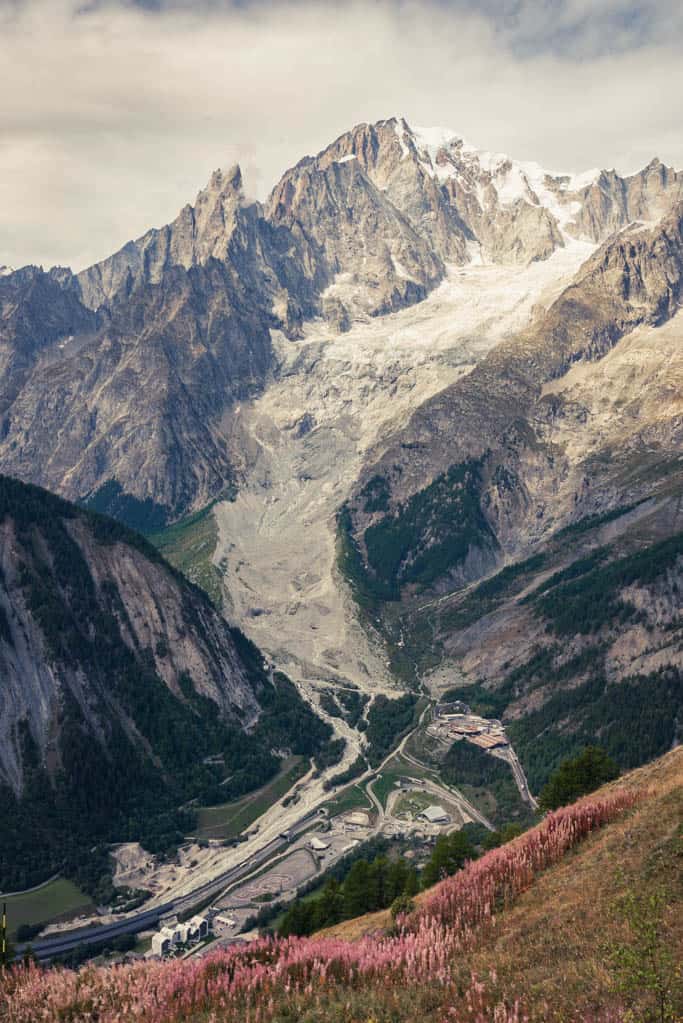
Refuge de Mottets to Les Contamines-Montjoie
While dinner in the refugios was mostly good, breakfast was always disappointing, even when taking the remote location into consideration. This morning there was one kind of cereal and slices of very stale bread, leftovers from the night before, with butter and jam. We said goodbye to the donkey that appeared unperturbed by the marmots racing back and forth across its paddock and was watching us set off on a gentle downhill walk into the valley towards Les Chapieux at 1550 m.
The hamlet didn’t offer much besides a couple of auberges and a sweet last repose before we followed long switchbacks up a fairly steep slope to Refuge de La Croix du Bonhomme at 2443 m. As the refuge had already closed for the season, it was quiet and we had the sweeping panorama of the Vanoise and Beaufortain to ourselves. Minutes after the refuge, you’ll reach Col du Bonhomme at 2329 m, at the junction of the GR5 and TMB long-distance hiking trails, again with beautiful views of the Contamines-Montjoie Nature Reserve to the north and the Beaufortain to the west.
The 3-hours descent into Les Contamines-Montjoie, our destination for the night, dragged on a little and I was glad to learn we were only 45min out of Contamines when we passed Baroque style Notre Dame de la Gorge church set beautifully right on the forest edge. Contamines itself has some carefully restored wooden chalets and extruded a mountain village charm, but was deserted.
The feeling of happening upon a ghost town was substantially intensified when we found the supermarket shelves almost empty. A 30% discount was given on veggies and fruit but there was none left. A notice fixed to the entrance door announcing that the supermarket would be closing – for the season we assumed – somewhat explained the food shortage.
Start: Refuge de Mottets
End: Les Contamines-Montjoie
Route: Refuge de Mottets – Les Chapieux – Refuge de La Croix du Bonhomme – Col du Bonhomme – Les Contamines-Montjoie
Distance: 24.6km
Time: 7 hours
Elevation gain: 1040m / loss: 1760m (lowest point: 1164m / highest point: 2469m)
Stay in Les Contamines-Montjoie: Hotel Gai Soleil / basic 3-star chalet-hotel with good breakfast.
Restaurant/Bakery in Les Contamines-Montjoie Aux Delices de Montjoie bakery, L’O à la Bouche restaurant
Les Contamines-Montjoie to Les Houches
On our TMB itinerary, there were only two hours left on the trek this morning and in no hurry, we wandered through wildflower meadows draped still under a fine layer of morning mist lingering in the shadow of the Mont Blanc massif rising to our right. As we walked, the sun conquered one mountain peak after the other, flooding more of the valley in light and warmth and dissolving the moisture in the air.
At La Vilette the track disappeared into the woods, climbing steadily towards Col de Voza, a skiing resort situated on a small plateau at 1657 m. Though popular for winter sports, the mountain pass covered with grass and bathed in bright sunshine was a lovely spot also in summer and I struggled to picture the lush green meadows buried deep under the snow. We then came to the last stretch, an hours’ downhill walking mostly on a dirt road, dropping 600 m in elevation to the parking lot we’d started from, which was rather unspectacular and I was glad this hadn’t been our opening stretch.
An hour later, reflecting on the past week over patisseries at Richard’s, we agreed that the TMB is what they claim: a great long-distance alpine hike with outstanding mountain panoramas. We’d been very lucky to catch a week of bright sunshine, clear skies and 20+ degrees at the end of the hiking season when it wasn’t very crowded, especially when walking clockwise. This initial limitation, of having to walk clockwise to complete the circuit with many huts already closed for the season, had actually granted us much solitude before and after passing the rush of anticlockwise hikers every day.
Based on our experience, we can thoroughly recommend the TMB to those valuing the mix of a challenging multi-day hike at mid-altitude with comfortable accommodation every night; perhaps less to those seeking a remote wilderness adventure.
Start: Les Contamines-Montjoie
End: Les Houches
Route: Les Contamines-Montjoie – La Vilette – Col de Voza – Les Houches
Distance: 16.8km
Elevation gain: 865m / loss: 990m (lowest point: 1033m / highest point: 1686m)
Visiting Denali State Park and Hiking the Curry Ridge Trail
Delicate arch hike in arches national park, devils garden trail with landscape arch (full circuit).
- Route planner
Hiking on the roof of Europe – Tour du Mont Blanc
The Tour du Mont Blanc (TMB), one of the most well-known GR footpaths in Europe, takes you 170 kilometres (105 mi) along magnificent trails between France, Italy and Switzerland. Three countries, seven days of walking, and a succession of breathtaking landscapes. The scenery changes frequently, allowing you to discover the Alp’s true variety. You plunge into the heart of glacial valleys, climb sumptuous passes, cross alpine pastures, forests and mountain villages, all while enjoying breathtaking views of Mont Blanc. This hike is impressive. In this Collection, I propose a seven-step itinerary which is quite challenging but also leaves plenty of time to enjoy all that the route has to offer. You can of course do the TMB at your own pace. There are many refuges and gîtes along the way, allowing you to tailor the hike to your needs. The TMB has few technical passages and is suitable for anyone who is in good shape. This itinerary follows the main route of the TMB in the classic direction of walking (counter-clockwise). Each stage of this hike ends at a refuge, which is part of what makes the TMB so special. You can enjoy delicious local food and products, but you’ll need to have a certain affinity to cheese to fully enjoy it. For those who prefer to pitch a tent, I suggest bivvy and camping options wherever possible. I did part of the TMB with a bivvy bag and would strongly recommend splitting the nights between camping and refuges. Bear in mind that bivvying is not permitted across the TBM. The rules concerning bivvying are as follows: - In France, bivvying is authorised in dedicated areas; - In Switzerland, it is forbidden to bivvy; - In Italy, bivvying is allowed above 2,500 metres (8,200 ft) of altitude. The route starts at the train station in Les Houches. You can get there by train or by bus. If you drive to Les Houches, you can park in the free parking dedicated to the TMB next to the Prarion gondola, and join the trail directly from there. If you arrive a day before you set off, you can easily find a place to stay in Les Houches either in a campsite or hotel. The trail also ends at a train station. In addition to the maps in this Collection, you regularly find road signs with the letters TMB along your hike, indicating that you are on the right track. I recommend doing the TMB between mid-June and mid-September when the mountain huts and gites are open. Book your nights in a refuge, especially if you plan to hike during the high season between 14th July and 15th August. From the end of June until the beginning of September, the TMB is calmer and the temperatures are milder. Avoid planning your hike during the last week of August when the series of races of the Ultra-Trail du Mont-Blanc (UTMB) take place. General information about the TMB (accommodation, map, reservations): autourdumontblanc.com Information about the bus lines to Les Houches: chamonix.montblancbus.com/fr/ligne-de-bus
Do it yourself
Ready to get going? Create and customize your own version of this adventure using the full Tour below as a template.
Le Tour du Mont Blanc
Last updated: May 7, 2024
Step 1: from Les Houches to Refuge de la Balme — Tour du Mont Blanc
This first day starts at Les Houches SNCF station, where you can arrive by bus or train. If you come by car to Les Houches, you can park in the parking lot dedicated to the TMB, next to the Prarion cable car, and join the path directly.
Step 2: from the refuge de la Balme to rifugio Elisabetta Soldini Montanaro — The Tour du Mont Blanc
A very nice stage that takes you to the top! From the Balme hut, you start by going up to the Col du Bonhomme, at 2,329 m altitude. A superb path then takes you to the Col de la Croix du Bonhomme and its refuge, at an altitude of just over 2,400 m. The panorama is splendid, you can see from the Haute … read more
by Chloé Perceval
Sign Up To Discover Places Like This
Get recommendations on the best single tracks, peaks, & plenty of other exciting outdoor places.
Step 3: from rifugio Elisabetta Soldini to rifugio Giorgio Bertone — The Tour du Mont Blanc
A magnificent third stage, which I personally really loved. You start in the Italian Vény Valley, surrounded by glaciers, alpine lakes and towering peaks. A mountain path takes you to altitude. This is a passage that I personally found quite unreal. I had this great feeling of walking alongside the glaciers … read more
Step 4: from rifugio Giorgio Bertone to gîte alpage de la Peule — Le Tour du Mont Blanc
A superb stage through the Italian Val Ferret, which takes you to Switzerland.
Throughout this stage, you take superb mountain trails, surrounded by glaciers and peaks. The views never cease to be breathtaking. It is not uncommon for you to come across a few herds of cows as well.
The challenge of the … read more
Step 5: from the alpage de la Peule hut to Champex-Lac — The Tour du Mont Blanc
On this fifth day, a little less elevation gain on the program. From the Peule alpine gîte, you descend into the Swiss Val Ferret.
Total change of scenery as soon as you arrive at La Fouly. You then cross a series of very typical small villages and hamlets. Traditional wooden chalets, flowered windows … read more
Stage 6: from Champex-Lac to Tré-le-Champ — The Tour du Mont Blanc
A very beautiful stage, between passes and villages, which will bring you back to the Chamonix Valley. There are many water points on this section.
From Champex-Lac, you start by going up to Col de la Forclaz via a pretty mountain path. From there, you begin your descent to Trient, a pretty little very … read more
Step 7: from Tré-le-Champ to Les Houches — Tour du Mont Blanc
This is your last stop on the TMB. Today, you will rally Tré-le-Champ to Les Houches in an incredible setting.
You start your day by going up to the Aiguillette d'Argentière. You are then in the Aiguilles Rouges national nature reserve. With a little luck, you may come across ibex on this section. After … read more
Like this Collection?
Questions and comments.
Sign up for a free komoot account to join the conversation.
Collection Stats
- Distance 105 mi
- Duration 68:57 h
- Elevation 31,125 ft
You Might Also Like
The Most Beautiful (and Skippable) Stages of the Tour Du Mont Blanc
Purchases made through some links on this page may provide The Detour Effect with commissions (at no extra cost to you). Thank you!
We all hope to complete a long trek like the Tour du Mont Blanc mile-for-mile, but life happens. You may decide it’s best to skip a section of the hike due to dangerous weather conditions or a nagging injury. You may intend to do every stage as planned, but find yourself worrying that you’re missing out due to a foggy, viewless forecast. When taking real-time obstacles into account and considering your plan of action, it’s helpful to know which stages of the Tour du Mont Blanc are the most scenic and which stages are a bit more…skippable.
For Reference: My Tour du Mont Blanc Itinerary
Last week I finally completed my circuit of the Mont Blanc massif through the French, Italian, and Swiss Alps. Back in 2019 when I aimed to complete five long-distance solo treks back-to-back , my Tour du Mont Blanc attempt was foiled by the Planpincieux glacier scare. I was determined to come back and finish it the next year, but then COVID happened. Now in 2022, I’m grateful to be able to finish what I started.
I completed 100 miles in 10 days going anti-clockwise, starting from Les Houches. I camped most nights and carried a large backpack full of camping gear, but also stayed at two refuges (Bonatti and Elisabetta) and one hotel (Hotel Ottoz in Courmayeur; two hotels if you count the final night after I was done hiking back in Chamonix). I am now officially qualified to offer my opinion on which stages have the best views on the Tour du Mont Blanc , as well as the sections that were my least favorite.
💸 Read my cost comparison of how much you’ll spend on a self-guided Tour du Mont Blanc hike via tent camping vs. booking hotels, hotels, or refuges.
There are many alternative variations you can choose to take on the TMB. I didn’t plan all my navigational choices out in advance. When I was in the midst of my hike, sometimes I would consult my guidebook , other hikers, or Google for opinions on the best course of action for the following day, especially if it looked like we might have bad weather or if I was hoping to avoid piling stress onto my temperamental knees. I hope this article will be an asset to other hikers approaching their TMB in the same manner.
In comparison to other long hikes, I think it’s very important to have a bit of flexibility on the Tour du Mont Blanc. The alpine weather can change on a dime and the forecasts are not always correct. It’s also essential to be kind to your body in light of the repeated and sometimes grueling ascents and descents so you don’t burn out too quickly. On the TMB, almost every day you will go up, up, up over a mountain pass, and then down, down, down back into a valley. By Day 9 I was losing some of my enthusiasm for this pattern.
For reference, my Tour du Mont Blanc itinerary looked like this:
Day 1 : Les Houches to Les Contamines (camping at Le Pontet ) Day 2 : Les Contamines to Les Chapieux (camping for free in the field) Day 3 : Les Chapieux to Refugio Elisabetta Day 4 : Refugio Elisabetta to Courmayeur ( Hotel Ottoz ) Day 5 : Courmayeur to Refugio Bonatti Day 6 : Refugio Bonatti to La Fouly (camping at Camping des Glaciers ) Day 7 : La Fouly to Champex (camping at Camping Les Rocailles ) Day 8 : Champex to Col de la Forclaz/Trient (camping at Hotel de la Forclaz ) Day 9 : Trient to Tré-le-Champ (camping at Auberge La Boerne ) Day 10 : Tré-le-Champ to Chamonix ( Hotel La Chaumière Mountain Lodge )
*If you don’t have time to complete the entire 10-day trek but still want to see some of the best views of the Tour du Mont Blanc, check out my article for France Today about day hikes you can reach along the TMB via public transportation.
The Most Beautiful Stages on the Tour du Mont Blanc
You’ll notice a pattern in my selected favorites; I really enjoyed the Cols, or mountain passes, and generally any high points along the trail.
The first half of Day 4 (Refugio Elisabetta to Courmayeur)
Upon descending to the valley from Refugio Elisabetta, you’ll have a flat, relaxing road walk, which is a surprisingly peaceful start to a day on the TMB. Then you’ll start climbing up towards Mont Favre, the high point of the day. The sweeping panoramic views will change with each step, giving you a million opportunities to stop and take photos from different perspectives. Towards the east the rolling green hills nourish sheep and cows. A shepherd who lives on the hillside during the summer will come out to greet you and chat about the ibex and wolves he’s seen this year. Towards the west, the dramatic Mont Blanc massif is unrelenting in its stark and imposing beauty. You’ll behold Mont Blanc itself, supported by surrounding peaks which shelve glaciers and expel waterfalls from the melt. All of this combines to make the first half of Day 4 one of the best stages of the Tour du Mont Blanc.
There is one section of downhill switchbacks with loose rock where you’ll want to be careful with your steps, but at a certain point you are not really going up or down much anymore, just traversing mountainside meadows and enjoying your surroundings. I was impressed all the way until we reached a forested area where it’s time to descend towards Maison Vieille. From here you’ll meet with a lot of day hikers and the landscape becomes less and less wild. Once at Maison Vieille, you have the option to take a chairlift down into Courmayeur, which is what I advise below under “Least Rewarding Stages”.
Day 3 Col de la Seigne
The journey to Col de la Seigne is long and arduous, but stunning and worth the effort. You might be leaving from the Col des Fours variation the previous day, which means you’re starting around Refuge des Mottets. If you’re starting from Les Chapieux like me, there is a long, straight walk from there to Mottets first (as a side note, please take the actual TMB for this section. It’s a lovely grasslands walk. I don’t understand why I was the only one who followed the TMB sign to get off the road while everyone else walked on the highway from Chapieux to Mottets, how boring!).
From Mottets you begin a series of endless switchbacks up into the mountains. It blurs together, but there are a few distinct places where you finally leave one series of switchbacks, walk a flatter section that will bring you around a bend to a different mountain view than you had before, and onto….another series of switchbacks. Rinse repeat. I liked that new views were provided with each new cluster of switchbacks, slowly winding you further into the fold of the mountain range. Just don’t get too excited when it appears that your current set is ending; most likely, you have not yet reached the Col. There is one particularly cruel cairn of rocks about 15 minutes prior to the actual Col that I was working towards for a long time, believing it to be the end. At least it wasn’t too far off!
The vistas throughout the ascent are so elegant that eventually I stopped minding how hard my lungs and legs were working and simply surrendered to the process. I would not conquer the mountains, only witness them. I would not fly through them effortlessly, but take many breaks. Perhaps this is the stage that set a much-needed tone of reverence for the rest of my Tour du Mont Blanc.
Reaching the Col is a moment for the scrapbooks because you are officially crossing from France into Italy. It really struck me how immediately the language changes; it wasn’t five seconds after crossing the Col that everyone on the other side was suddenly speaking Italian instead of French. It’s also at this point that you see Mont Blanc for the first time (unless you’d done an alternate variation previously), and the view into Italy is picturesque. At Col Ferret a few days later, the view into Switzerland is not especially jaw-dropping (that day has other things to offer). At Col de la Seigne the view into Italy does give you a nice pat on the back.
I included some pictures of Refugio Elisabetta in the gallery as well. The descent from Col de la Seigne to Elisabetta wasn’t much to write home about, but the glaciers around the refugio itself were pretty special.
Day 6 Col Ferret
To begin Day 6 there is a long descent away from Refugio Bonatti leading to Refuge Elena. After Elena, the fun begins. It’s time to ascend up to Grand Col Ferret. At first the views are mainly back towards the way you came and not particularly exciting, but as you continue uphill you’ll become immersed in the rolling hills of your more immediate vicinity, which I loved. Each one forms a new layer in front of the last, like a collage. I felt enveloped by the land, less of an observer and more a part of it.
By this point I was used to the ascents, so my memory of the journey to this Col is that it wasn’t any more difficult, neither physically nor psychologically, than those of the previous days. I’m sure I was breathing hard and taking breaks, but in retrospect nothing particularly strenuous sticks out to me. It’s just a good challenging day without any hiccups, with some of the best views on the Tour du Mont Blanc. When you finally reach Col Ferret, it feels hard earned. Swaths of hikers and runners rest at the pass to gear up for the descent down the other side into Switzerland. Like at Col de la Seigne, knowing that you’re standing on the border between two countries adds an extra layer of accomplishment and novelty to the pass. Hikers greet each other with “Welcome to Switzerland!” or “Bienvenue en Suisse!”.
Note that the ascent to this Col from Elena is all completely exposed to sunshine with no shade, and it gets very hot (at least when I was there in August). Everyone I spoke to commented on it. I suppose my hikes in the desert southwest of the United States had prepared me well because I didn’t feel particularly stressed about the heat, but it was still noticeable. It’s a good idea to start hiking early on this day to get some mileage under your belt before noon.
Day 2 Col du Bonhomme
The stage from Les Contamines to Les Chapieux I completed both in 2019 and 2022. In 2022 it was rainy and misty all day and I couldn’t see farther than my own two feet, so I am really glad I remember what Col du Bonhomme was like when it’s clear. The gallery above is 2019 and mainly features the world class views seen directly from Col du Bonhomme. The gallery below is 2022 and features surrounding areas (I didn’t take too many photos in 2022 until the fog finally started to clear. If I had attempted to recreate the photos from 2019 it would have just been a wall of fog). In good weather, you can see out over vast expanses of mountains on both sides of the pass and take in some of the best views on the Tour du Mont Blanc. Arriving at the Col is already a feat, but then to see a whole new world awaiting you on the other side is quite the reward. Then you have new views again once you reach Col de la Croix du Bonhomme.
Something about the little wooden hut at the Col really adds some character to this pass. It’s a keeper of memories. In 2019, when I arrived at the hut it was only me and one Frenchman who shared his hot coffee with me as we attempted to communicate in broken Franglais. It served as a perfect vantage point and a gathering place for like minds. In 2022 it was freezing at the pass, so the hut was able to serve its intended use as a refuge from the elements. I piled inside amongst other shivering hikers as we pulled jackets out of our backpacks, discussed the best route to take from there, and pondered whether the haze would lift. The hut at Col du Bonhomme is my horcrux.
Travel Fails: When Weather Obscures Famous Viewpoints
Day 10 tré-le-champ to la flégère.
I was a bit nervous about the ladder section because a large pack tends to shift your gravity, and because for 9 days prior, every time I checked the weather forecast it said we were expecting rain for this day. Thankfully it cleared up completely and was gorgeous outside, so I decided to go for it with the ladders instead of taking a variant. In practice I found the ladders to be fun and exciting, and completing them gave me a sense of triumph.
The views throughout this entire section, especially after Tête aux Vents, rivaled everything from the rest of the trip and make Day 10 one of the best stages of the Tour du Mont Blanc. It felt like a reward for all my hard work and a welcome back to the Chamonix valley. The word “aiguilles” will pop up often during the Tour du Mont Blanc, as it’s the moniker of different mountains or sections of mountain ranges – Aiguilles Rouges, Aiguillette des Posettes, Aiguille des Glaciers. “Aiguilles” means “needles” or “spires”, which makes sense when you see the peaks this name describes. They have sharp, jutting angles that look quite forbidding. As you leave Tête aux Vents and head towards La Flégère, these climactic formations tower before you and remind you the true scale of the Alps.
I would have liked some extra time at the end to check out more viewpoints. From La Flégère I took the cable car down into Les Praz and then the train to my hotel in Chamonix. To truly complete the circuit, I would have needed to continue hiking past La Flégère towards Le Brévent and down into Les Houches. Initially this was my plan, but it would have been an extremely long day (and another knee-grinding downhill) and I needed to clock in for a work meeting back at my hotel at 5pm. Le Brévent is supposed to be beautiful though, and there is another cable car opportunity there. Another stunning option from Tête aux Vents is to take a variant up to Lac Blanc. With enough time I would have done both. I am not too disappointed though because on my final day, I was both tired and pleased with everything I had accomplished, and adding more on would have felt like I was just ticking boxes. I’m not sure my heart would have been in it, but if I were to return to the area again, I would visit these locations as day hikes.
If you’re worried about burning out towards the end, I might recommend beginning somewhere other than Les Houches so that this final stage near La Flégère and Le Brévent is in the beginning or middle of your trip where you can fully appreciate it. I did meet many hikers who started somewhere other than the “classic” start point, including someone who began in Trient and someone who began in Courmayeur.
The Least Rewarding Stages on the Tour du Mont Blanc
If you’re a purist like me, the idea of skipping a stage of the Tour du Mont Blanc is initially unthinkable. Perhaps it’s an American thru-hiker mentality; you must walk every single mile! No zero days! If you have a healthier mentality, you balance this ambition by reminding yourself that a backpacking trip is supposed to be fun and awe-inspiring. We are not paid athletes competing under a set of rules. If there is a section that’s widely known for not being scenic while also being treacherous or physically brutal, there is no shame in deciding to bypass it to save your energy for the other more rewarding sections to come. This is especially true if you’re already nursing an injury or feeling like you need a bit of a break; if you have to skip something, clearly you’d want to pick a less exciting section to skip, if you can. The following sections of the Tour du Mont Blanc were my least favorite and I personally feel that you wouldn’t be missing much if you needed to skip them.
The second half of Day 4 (Refugio Elisabetta to Courmayeur)
This is a stage of extremes. While the first half of the day was one of my favorite sections of the entire Tour du Mont Blanc, everything past Maison Vieille was reported to be brutal, and, quite frankly, ugly. I read online that it was other hikers’ least favorite part of the trail because it’s nothing but steep and relentless downhill through a scarred and manmade ski lift area. People advised that it would be a good idea to “save your knees” by taking the chairlift past this section and straight down into Courmayeur. Remembering how painful my knee problems can get when I don’t have enough respect for sections like this, I decided to take the chairlift down.
I felt guilty and like I’d copped out, but over the next few days it became apparent that I’d made the right decision. One hiker bloodied her knee by taking a fall during this section. Another hiker said she must have overextended muscles or tendons in her knees because she proceeded to be plagued by knee problems for the entire rest of the trail. Knowing my own past issues with steep downhills, I have no doubt I would have experienced something similar.
Day 8 Champex to Forclaz/Trient
My guidebook made Day 7 to Champex sound like it might be boring; it said the day was mostly through a flat meadow. In actuality it has much more variation than expected. You’ll follow along a riverbed, go through cute Swiss alpine villages, and climb up through a forested area before arriving at the peaceful lakeside village of Champex. Instead, it was the next day from Champex to Forclaz that I found to be lacking in points of interest.
This day is mostly under the cover of forest and it is extremely humid and buggy. I did enjoy the views from Alp Bovine, but likely because of the cows, this section is filled with flies that would not leave me alone for even a moment. Views elsewhere along this stage are not particularly breathtaking. Through the trees you will have some glimpses of mountains, but they do not come close to rivaling the striking vistas found throughout the rest of the trek. I rushed very quickly through this stage to be able to make camp before some expected rain, and I don’t feel bad about it.
I really liked camping at Hotel de la Forclaz, which has a backdrop of glaciers, although my fondness for it may be circumstantial. I’d made some friends by this point in the trek that I enjoyed camping with at the end of the day. We cheered for UTMB CCC runners as they passed through town and then ordered Swiss fondu at the hotel restaurant. One member of our roving gang of gypsies took a train and two buses (or was it two trains and a bus?) to join us here from Champex because she wasn’t feeling well enough to hike that day, and I think she got the best out of the day by doing this. She didn’t miss much by skipping the hike, but got to partake in the evening festivities.
If you walk a bit further past Forclaz and towards Trient you can camp for a cheaper rate at Le Peuty, which supposedly has less amenities. This was my original plan and would have saved me the fondu money too, but honestly the fondu was the best part of Day 8. Camping at Le Peuty might have made the whole day a wash (though of course I might have made new friends at that campsite and had an entirely different fun experience, who knows?). If you do camp at Le Peuty you will have a bit of a jump on Day 9. From Forclaz you ramp up to the day by hiking along a flat bit and then downhill to arrive at Le Peuty. From Le Peuty the trail immediately starts going upwards towards Col du Balme.
Day 6 Variant to La Fouly
I obviously can’t speak to every single variant opportunity, but this one seems like a popular choice. On Day 6 from Refugio Bonatti to La Fouly, I mostly did the main route for the entire day, right up until the last moment. Once you reach La Peule, you now have two options. You could take the farm road the rest of the way to La Fouly, which is straightforward, if a little boring. I hate road walking, so I opted for the “high route” variation. This variation is supposed to give you prettier scenic views of the mountains.
I actually have an old version of the Cicerone guidebook from 2015 which describes the variant as being the new recommended “main route” while the farm road is the old route. A friend has a newer version of the book which has flip-flopped back to calling the farm road the “main route”. Now I understand why.
The variant has a couple sections that are washed out, perhaps from some kind of landslide or rock fall. It made the trail very skinny, slippery, and full of loose rocks, right next to a cliffside drop. This kind of thing makes me nervous, especially with my large pack. I had be be extra careful where I chose to put my feet, and a few times I crouched down so I could scoot and get my hands on the rocks to steady myself better. I got that feeling in my chest where my breath seizes up from fear of falling. Looking back it really wasn’t that bad, but in the middle of it I was worrying that this might be a sign of worse things to come. I knew there was supposed to be a long, sharp descent towards the end of the variant that brings you right down into La Fouly; if that part was going to be on a cliff edge too, I knew I wouldn’t like it. Thankfully that downhill was not treacherous at all, so really it’s just 3 or 4 brief points earlier on the trail that you have to get past and then it’s smooth sailing.
The views of the mountains on the variant were indeed beautiful, but I’m not sure they were enough to make the dicey trail worth it. The campsite already has great views of these same mountains. If you’re looking for excitement you will probably enjoy this variant, but if you have any hesitancy about exposure then it’s not ideal.
>> Note on Route Variations What I learned throughout the Tour du Mont Blanc, and heard reinforced by other hikers who took various alternative routes, is that as long as you stick to what’s described as the “main route”, you’re fine. It’s really not a technical trail at all (except for the ladder section on Day 10) and there are rarely any spots that should make you nervous about exposed edges. As soon as you choose a variant, though, all bets are off. It might be just as simple as the main route, but it might not, and guidebooks don’t do a great job of explaining the obstacles you could encounter on these sections (likely because alternate routes are not often maintained and conditions are always in flux). Another friend did a variant on Day 6 as well, but much earlier in the trail. I believe it was an alternate trail option starting from Col Ferret. The further they got into it, the less defined the trail became, until they couldn’t even spot it anymore. They became disoriented and needed to consult the map often to find their way back. That said, it does sound like some variants are worth it. Other hikers mentioned how glad they were to have taken the variant from Col de la Croix du Bonhomme to Col des Fours instead of descending down to Les Chapieux. One person said their favorite part of the entire hike was a variant on Day 1 from Les Houches to Les Contamines which avoided the boring uphill the trek starts with. Speaking of…
Day 1 Les Houches to Les Contamines
I’ve now done this section twice, god bless me. In 2019 I did it in sunshine and in 2022 I did it in pouring rain. Both times it wasn’t particularly scenic. A lot of it is under forest cover and you haven’t entered a wilderness area yet; you are crossing through villages and road walking a lot. However, it is a great ramp-up and introduction to the Tour du Mont Blanc and for that reason I think it’s important to actually hike the entire thing and not take the chairlift up to Col de Voza. It’s the first taste of what’s to come in terms of a relentless ascent up to a Col to start each day on the TMB. At least for me personally, it was important to get my ass kicked on Day 1. I needed this kind of welcome to get my head in the game. If you are really just looking to see only the best possible views on the TMB route though, or you’ve had some kind of travel issue pop up and delay your start, you could skip this entire day and not miss much.
Another hiker said Day 1 was their favorite because they took some kind of variant that was more beautiful. This must be the route to Col de Tricot and Refuge de Miage (which is not advised in bad weather, according to my guidebook).
The Stage I Regret Missing
Besides taking the cable car from Maison Vieille to Courmayeur, the only other time I felt like I copped out was on Day 9. From the start of my TMB, the weather forecast had always predicted that the last 3 days would be rainy. As a result I had it in my head that I would do the easier variant on Day 9 down from Col du Balme to Le Tour instead of taking the main route from Col du Balme to Aiguillette des Posettes.
When Day 9 rolled around, it was actually perfect weather and I could have changed my plan and done the main route. Unfortunately I was feeling extra tired during the ascent to the Col that day, and I think I didn’t eat enough breakfast to fuel me. I had also read on someone else’s blog that Aiguillette des Posettes isn’t a good idea for anyone who gets scared on exposed cliff drops, and I still remembered being nervous a few days prior on the variant to La Fouly. It just wasn’t in me that day, so I proceeded via the Le Tour variation, which was nice at first but mostly rather boring. My friends who did the main route said it was spectacular and had some of the best views of the whole hike. When I asked if it was a narrow trail with sharp drops on both sides, they said not really, there was plenty of space and they didn’t feel nervous. Figures.
On the one hand I really wish I had gone the normal route that day, but on the other hand I do think it’s important to listen to your body. If I had pushed it and worn myself out on Day 9, perhaps I would have been too rundown to enjoy Day 10. Maybe I would have skipped the ladders or made some other regrettable choice.
From my conversations with other hikers, the Aiguillette des Posettes section of Day 9 should probably be listed under Best Stages of the Tour du Mont Blanc.
Tips for Hiking the Tour du Mont Blanc
There are a thousand resources online for how to plan your Tour du Mont Blanc itinerary, whether you prefer staying at refuges, hotels, or camping. My aim is not to beat a dead horse by repeating these tips, but to offer a few items that occurred to me on the trail that I hadn’t previously read anywhere.
👕 Bring your own laundry clips. Some of the refuges and campsites had lines up to hang wet clothes, but limited clips.
🚿 When you stay at a refuge, you are given a coin that you must insert into a machine to start the hot water for your shower. It gives you four minutes of hot water, after which time the water either goes freezing or just turns off. Take this very seriously and strategize your shower, lol. Multiple people were taken by surprise at how short 4 minutes really is, or the fact that instead of gradually fading out as a sort of warning, it just suddenly goes freezing. Don’t get stuck mid-shower still covered in soap.
🗺️ The GAIA map I downloaded for offline use is mostly wrong. It’s got the general direction correct, but includes a lot more road walking than is necessary. It didn’t really matter because the real TMB path was always on the topographical map for reference, it just wasn’t being featured as the highlighted route. The signs were also pretty easy to follow (although a few parts are unclear; I wouldn’t say the TMB is the most well-signposted trail I’ve ever done, but it was very adequate). If this makes you nervous, maybe download your gpx files from another source like AllTrails or better yet, The Hiking Club .
🍳 Breakfasts are not a big focus along the TMB in comparison to dinners. I remember at Refugio Elisabetta, they fed us well at night but breakfast was a few slices of toast. That’s really not enough to fuel a hiking day. Meanwhile the big dinners are enough to plague you with regurgitation when you lie down to sleep an hour later. If you go Half Board at refuges, you might want to supplement with your own food for breakfast. That said, Refugio Bonatti did do a larger continental style buffet breakfast, and that’s also where I had the best dinner during my Tour du Mont Blanc.
🥧 Get the apricot and almond tarte at Refuge du Col de Balme. 🥖 I stressed about not being able to find food between certain stages, particularly because I’d read that Champex was the last place to stock up. This really isn’t a concern. There were shops or cafes at every single stage. It would only be a concern if: 1) you have plans to camp every night, even the nights when most people are at refuges, because in order to do so, you are forced to go further afield from the main trail to find places where you’re allowed to pitch; 2) you are hiking the Tour du Mont Blanc off-season when shops are closed; 3) you are hiking very early in the day before some shops open (I couldn’t order food at Alp Bovine because I hiked past it at 9am); 4) you have something against ordering hot meals and only want to buy groceries. Which leads me to the next point. 💸 Being a stickler about money is sort of futile on the Tour du Mont Blanc. I thought I would only buy groceries and dehydrated camp meals to save money, but these things were not less expensive than just getting a nice meal, and they add extra logistical headaches. I thought I would only use the cheapest possible campsites, but paying an extra measly CHF 10 for a campsite that has power outlets and food sounds like a no brainer after a long few days. 🚌 You are never far from transportation. This is both a bummer and a relief. When hiking I like to feel like I am really out there in the wilderness, and the Tour du Mont Blanc does not fit that bill. However, it provides peace of mind to know that you always have options. At one point I was worried about not being able to find an ATM as I started to run out of physical Euros. I was camping at Auberge La Boerne and there is no ATM in Tré-le-Champ, but it turns out there is one in nearby Argentière. Argentière is farther than you want to walk, but you can hop on the train at the Montroc stop and ride one stop over to Argentière for all kinds of amenities. Some friends I’d made on the trail even rode all the way back to Chamonix to watch the first UTMB marathon runners finish, then hopped back on the train and returned to La Boerne. It sort of takes away some of the symbolism of waiting until the last day to make it back to Chamonix, but c’est la vie. If we wanted a true thru-hike we’d be on the Appalachian Trail. Hike your own hike.
🔌 You will have opportunities to shower and charge your phone at every stage. This really surprised me and strikes me as a little ridiculous; who showers every day on a camping trip? All the campsites I used had nice shower facilities too, they weren’t nasty. Hot water is not always guaranteed, but surprisingly, the hot water situation is generally better at campsites than at refuges. Note that I said, “all the campsites I used “; I can’t speak to the ones I didn’t stay at. I hear Le Peuty campsite in Trient doesn’t have many outlets or amenities.
🏃 Check race schedules! I’m clueless enough to have not known the UTMB ultra marathon race was happening during my hike. I hiked from August 18-28th. The main UTMB event started on August 26th, but other events like the CCC started earlier in the week. When I learned about it I was worried I’d become extremely annoyed at sharing the trail with the runners, but it ended up being fun. You may not feel the same way, though.
🏠 Even if you think a refuge is sold out, go ahead and walk in as you pass by and ask if they happen to have any last minute openings. I know a few people who planned to stay at Elena or camp because Bonatti was supposedly full, but managed to get into Bonatti at the last second without advance reservations.
*Don’t feel comfortable solo hiking the Tour du Mont Blanc, or prefer someone to take care of the logistics for you? Wildland Trekking offers a guided hike of the TMB.
Recommended Gear
If you’ve hiked the Tour du Mont Blanc, how does your experience compare to mine? What do you think are the best stages of the Tour du Mont Blanc? I’d love to hear what your favorite sections were, and even commiserate with you about your least favorite. If you got to tackle it again, what variations would you make next time?
🏨 Find budget hostels near Chamonix here , and standard hotel options here . ✈️ Coming to France from further afield? Use an Airalo eSIM for affordable international cell data and don’t forget to protect your investment with travel insurance .
Cost Comparison: Tour du Mont Blanc Camping vs. Hotels
Recap: solo trekking five trails across europe, how to plan a self-guided hiking trip, free download | the kerry way: self-guided, self-guided: backpack slovenia via the alpe-adria trail, how my american hiking gear handled solo trekking europe, 5 easy day trips from paris without a car, how to use an esim for easier international cell coverage, visiting castles in the loire valley without a car, subscribe to newsletter.
Sign up to receive the Monthly Location Independence Newsletter! Once a month I interview a "Pin Pal" about their adventures and share tips on living nomadically (visas, vanlife, remote work, and more).
We don’t spam! Read our privacy policy for more info.
Thanks for requesting to receive news and updates from The Detour Effect! Check your inbox or spam folder to confirm your subscription.
My dream is to write travel and hiking content full-time. All of my guides and itineraries are free and my travels are self-funded. If you enjoy my site and would like to support, you can donate any amount to my Ko-fi page. Thank you!!
Great info! I am hatching a plan with 5 friends to go early next Sept, booking flights/lodging now. We are doing self guided, but looking for someone to do luggage transfers for us, trail running/lightest packs possible :). Do you recommend a specific company? Thanks-Barbara
Nice blog, thanks. I did this a few years ago. Did you do the Fenetre d’Arpette? Perhaps your blog should mention this variant for readers who are planning. It was tough but one of the most memorable aspects of my TMB. Happy Travels.
I didn’t, this post is more about the classic route. I’d love to go back and try all the different variants, I hear Fenetre d’Arpette is a real jaw-dropper!
What a fabulous blog! So happy I found you! Could you clarify some advice for hiking the TMB in early to mid June? 1. We want to avoid any stages that have snow/ice, needing crampons for shoes/dangerous drops etc. I can’t seem to find a definitive list about which stages those are. 2. Also, will the public transport options be running at that time? I have seen conflicting info about that. Which stages will/won’t have public transport available at that time? 3. Lastly, if we want to camp, do we need reservations at campgrounds and where do we find a listing for campgrounds at each stage? Thank you again!
Thanks for reading! If snow or ice is lingering anywhere, it would be at the Cols, or high mountain passes each day. I suppose which Cols can vary quite a bit based on what kind of winter they had, and the weather patterns are even different from one mountain to the next despite their proximity. The only place I consistently saw snow even late into the summer was at Col du Bonhomme, although never widespread enough that I had to step in it. But I’ve never hiked it as early as June and I think the microspikes are a good idea. I would recommend checking the regular updates at thehiking.club, every year they post trail conditions in the early season to let people know how snowy it’s looking and which areas are passable.
Some of the campgrounds don’t allow advanced reservations (Camping Les Rocailles, Le Peuty, the field at Chapieux, Les Arolles), so you just show up and pay when you get there. I was a little nervous about the first-come first-served aspect of this, but in my experience they were never crowded enough to worry about missing out so it was fine. A couple of them do allow reservations, so I took advantage of that just to be on the safe side, but it probably wasn’t necessary.
I referenced these posts for campground info: https://tmbtent.com/guide-camping-tour-mont-blanc/ https://slingadventures.com/destinations/france/camping-the-tour-du-mont-blanc-tmb https://www.nomadswithapurpose.com/tour-du-mont-blanc-camping/ https://www.finnsaway.com/hiking-and-camping-tour-du-mont-blanc/
And this is a good one for public transport: https://tourdumontblanchike.com/tour-du-mont-blanc-public-transport/
This is a wonderful blog! I love the details, sincerity and advice. Thank you.
My adult daughter and I are looking to do this summer of 2024, self-guided. I’m thinking Tre-le-Champ anti-clockwise to La Fouly is the best of the best. Do you agree? But how to get back to Chamonix from there?!
Thanks so much Mei-Mei! You guys are in for a treat, it’s a gorgeous route and a great choice for self-guided hikers. Starting in Tre-le-Champ sounds like a good way to enjoy multiple detours like Lac Blanc while you’re still fresh! If you go anti-clockwise straight from Tre-le-Champ to Tête aux Vents you’ll miss out on Aiguillette des Posettes, you might think about briefly backtracking clockwise from Tre-le-Champ first to see Posettes. That’s the one I skipped and wished I hadn’t. That said, the view from Tête aux Vents may be very similar to the view from Posettes since they are so close to each other, I’m not sure.
I agree that if you end in La Fouly you won’t miss too much by not seeing Champex or Trient. Transportation to/from La Fouly does look sparse though. Apparently there is a bus from La Fouly to Orsières, and then from Orsières you can go a few different ways. It may be more expedient to hire a shuttle service.
As always, this is so thorough and helpful! Thank you for sharing your tips. I’m with you on splurging for the “nicer” campsites and prepared meals. Well worth it from time to time after a long day. Congrats on finishing this after having to cut your trip short pre-Covid!
Thanks Susan! It had been nagging at me since 2019 lol. Yeah when you compare the difference between a basic campsite and a nice campsite ($10 or less) vs the difference between a campsite and a hotel ($60 or more), it’s silly to feel bad about such a small upgrade
Leave a Reply Cancel reply
Your email address will not be published. Required fields are marked *
Save my name, email, and website in this browser for the next time I comment.

Everything You Need To Know About Hiking The Tour du Mont Blanc
A s an avid hiker, you’ve probably heard of the Tour du Mont Blanc or TMB hiking trail. You might even have plans to conquer this popular hiking destination one day. If so, here’s everything you need to know before you go.
In 1760, a Swiss Geologist and physicist, Horace-Bénédict de Saussure, then living in Geneva, discovered the TMB hiking trail. Saussure wanted to explore the Mont du Blanc Mountains to examine and document plant specimens. Also called the Mont Blanc massif, the mountain range is 60 miles by 20 miles long, with 11 summits over 4,000 meters high. Though he discovered it in 1760, Saussure first walked around the entire TMB hiking path in 1767.
Unfortunately, the Swiss scientist failed to climb one of its peaks on that initial journey around the path. The first to achieve this feat were Michel Paccard and Jacques Balmat. The two found a path to the apex in 1786 through the Grands Mulets route. Sausurre became the third person to reach the summit shortly thereafter.
Trail Overview
Though Pacard and Balmat first reached the peak of the Mont Blanc massif via the Grands Mulets route, the Gouter route is today’s standard path. This trail is 105 miles long and passes through 3 countries: France, Italy, and Switzerland . The Gouter Route (also known as the Voie Des Cristalliers and Voie Royale) is one of the two most commonly utilized routes to reach the summit of Mont Blanc in the Alps. Though the Gouter route reaches an elevation of 15,774 ft, it is considered the most straightforward ascent. The route lies on the north side of the mountain, in France, seeing thousands of mountaineers annually.
The Tour du Mont Blanc difficulty level is somewhat subjective to the hiker. The Gouter route is relatively easy because it takes about two days to reach the ascent and does not require extensive technical skills. Nonetheless, it is physically demanding and mentally challenging if you lack athletic ability. The most difficult aspect of this route includes a narrow passageway of unstable rocks on the mountain’s edge. Seventy-four have died, and 180 were injured in accidents along this dangerous segment between 1990 and 2011.
Once passing this tricky part, the Gouter route is smooth sailing. It steadily increases in steepness while crossing exposed terrain. Hazardous weather conditions are the most dangerous aspects that remain. Cold and wet conditions can cause hypothermia and frostbite. Therefore, visiting the Tour du Mont Blanc for Summer hiking, Mid-June to mid-September, is safest. During the summer, temperatures will range from 40 degrees at night to 80 degrees during the day. Some days require shorts beneath a warm, sunny sky ; others might entail brisk, wet conditions.
Permits And Regulations
No permits are required for the TMB and there are no regulatory restrictions. However, some believe a technical skills test could reduce deaths and injuries along the path. Additionally, residents are disturbed by the amount of trash that hikers inevitably abandon to lighten their loads on the ascent. What’s interesting about the Tour du Mont Blanc is that there are many comforts along the path in the form of hotels and huts. Several companies offer self-guided packages that include accommodations, detailed hiking guides, and set itineraries.
Trail Highlights And Points Of Interest
The Tour du Mont Blanc hike is considered one of the world’s top ten “bucket list” hiking trails. In addition to the soothing sounds of waterfalls , there are glaciers, streams, high alpine meadows, and the natural beauty of the Mont Blanc landscape. Among the most beautiful and visible flora are the rare Slipper Orchid, the Martagon Lily, Aquilegia Alpha, the famous Edelweiss, and rare Campanula thyrsoides. Though heavily impacted by human presence, the animals that remain in the wilderness of the Mont Blanc massif include Marmots, Ravens, Goats, Mountain Hares, Vultures, and Eagles, among others.
Safety Considerations
On the Tour du Mont Blanc hiking trail, the most important considerations will be comfortable shoes and a good quality backpack with appropriate dimensions and weight. What qualifies as an appropriately sized bag will depend on whether you stick to hiking the trail or detour slightly to local huts and hotels. The former will require a 60L bag, and the latter will require a 30L bag. Remember to break in your footwear a few months in advance and buy shoes larger than usual to accommodate swollen, achy feet. Trekking poles will help lessen aches and pains experienced in the knee and leg muscles. Hiking crampons are a “better safe than sorry” item to add to your Tour du Mont Blanc packing list. They will help maintain balance and avoid slipping across waterways and snow patches, which might even save a life!
In case of an emergency, administer first aid, note location and grid reference on a map, call for help (cell phone service is generally available along the TMB). If no phone is available, blow a whistle or flash a flashlight six times. If there is an injured person, carefully consider whether to go for help or stay with the injured. If the injured party stays behind, leave them with food, water, and warm clothes.
Planning and Preparation
Being physically prepared for the TMB hike is a necessary safety precaution. Training should start at least three months in advance and should be in layered clothing, hiking boots, and a fully packed backpack to best simulate trail conditions. Other things that require planning include booking accommodations along the trail and deciding how many days to stay. An itinerary will vary depending on whether two days, two weeks, or even two months are set aside to experience the beauty of TMB.
Most hikers can ascend the Tour du Mont Blanc self-guided if interested. The trail is easy to follow, with well-maintained paths, directional markings, and clearly understood signs. However, map reading skills are essential, and hikers should also carry a guidebook.
People Ask: Hiking the Tour du Mont Blanc
Q: What is the Tour du Mont Blanc hiking trail?
A: The Tour du Mont Blanc is a 170-kilometer hiking trail that circles the Mont Blanc massif in the Alps, passing through France, Italy, and Switzerland.
Q: How long does it take to complete the Tour du Mont Blanc?
A: The entire trail takes about 10 to 12 days to complete.
Q: What is the best time of year to hike the Tour du Mont Blanc?
A: The best time to hike the Tour du Mont Blanc is from mid June to mid September, when the weather is typically mild and the trails are clear of snow.
Q: Are there any accommodations along the trail?
A: Yes, there are many accommodations available along the Tour du Mont Blanc, including hotels, hostels, and mountain huts.
Q: Is it necessary to hire a guide for the hike?
A: No, it is not necessary to hire a guide for the hike. The trail is well-marked and there are many resources available for hikers.
Q: How difficult is the hike?
A: The hike is considered to be moderately difficult, with some steep ascents and descents.
Q: What should I pack for the hike?
A:You should pack appropriate hiking gear, including sturdy boots, warm clothing, and rain gear. You should also bring a map, a compass, and plenty of water and snacks.
Q: Are there any safety concerns I should be aware of?
A: Yes, there are some safety concerns to be aware of, including potential hazards such as steep drops, loose rocks, and unpredictable weather. It is important to stay on the marked trail and to be prepared for changing conditions.
Q: Can I hike the trail in sections?
A: Yes, it is possible to hike the Tour du Mont Blanc in sections, with many hikers choosing to focus on one or two sections at a time.
Q: What are some of the highlights of the hike?
A: Some highlights of the Tour du Mont Blanc include stunning views of the Alps, charming mountain villages, and the opportunity to experience the unique cultures of France, Italy, and Switzerland.
The Tour du Mont Blanc is a renowned hiking trail accommodating hikers from across the globe. It is mentally and physically challenging, but efforts will be rewarded with breathtaking views along the route. The TMB is accessible with or without a guided tour, as there is food, water, emergency services, accommodations, and other modern amenities along the path. With a reasonable amount of advanced preparation, physical training, thoughtful packing, and a conscientious “Leave no trace” mindset, this unforgettable journey is worth experiencing for yourself.

2 hr 28 min
The Trail Show #141: Tour du Mont Blanc The Trail Show
Show #141 – #allthingsgatos – On this month’s Trail Show, special guest Michael “Nano” Chamoun joins us to talk bidet cows, hiking with pizza boxes, and hiking (running also!) Tour du Mont Blanc, POD speaks on men pushing over rocks again, destroying the stairway to heaven, and yet another norovirus outbreak on the AT, OOO runs Cleveland and has a coffee disaster, D-Low thru-walks a cemetery, Disco speaks on professional bag krinklers, the Hotline rings, All Things Gatos is debuted and subsequently cancelled, we hear of the Frisco fiasco during mailbag, and we hear a new tune from AXYL! Very Special Guest Glen Van Peski joins us to discuss his new book “take less. do more.” and helps us brainstorm a question from Phil Collinz during Ask-A-Hiker. Beer O’ Da Month: Fine beers courtesy of Trail Show Nation! Music on this month’s Trail Show was from The Surfites….get all the tunes at Double Crown Records! Trail Show t-shirts for sale now….once again!!! *Disclaimer: The Trail Show is a comedy podcast that sometimes talks about hiking and always talks about beer, and absolutely nothing we say should be taken at face value or misinterpreted as truth. Enjoy!
- Episode Website
- More Episodes

Weather Tour du Mont Blanc (TMB)
Tmb summer months.
The “summer” months are June, July, August and September. Each month is unique, so the type of weather you’ll experience will depend on which month you choose to come.
June is typically quite dry and cool, with valley temperatures at around 18°C (64°F). In early June, there are often patches of snow on the high mountain passes.
As we move into July, the temperatures increase and we start to see afternoon showers and thunderstorms. The average valley temperatures are around 21°C (69°F).
August is the warmest month, with valley temperatures sometimes exceeding 30°C (86°F). Because of these high temperatures, August is often the wettest month. In August, there is a high risk of afternoon showers and thunderstorms.
By September, the temperatures start to drop again, and we have fewer storms. You might be surprised by this, but September is actually the driest month!
For more information about the “best time” to do the the Tour du Mont Blanc (TMB), read this post .

TMB Weather
Hazard risks.
We don’t normally get showers until the late afternoon. By this time, you can normally expect to be in the safety of your evening accommodation. That said, the mountains can be unpredictable ! A beautifully clear day can suddenly change, and with little warning. Because of this, it’s important to be prepared. Make sure you have a good quality waterproof coat, and we recommend using a waterproof bag-cover.
Another factor to consider is the altitude . In one day, it’s not uncommon to climb 1000 metres. The temperatures in the valley are significantly warmer than the temperatures up high. Make sure you have warm layers, and that they’re accessible. Pack them in the top of your bag, so that you can easily put on and extra layer if you get cold. A warm hat is essential, an we recommend that you pack a pair of thick gloves.
Inclement weather such lightning, flash floods, fog and snow may or may not be predictable. They may require immediate response for safety.
Safety in the Mountains (Self-Guided)
The vast majority of TMB trekkers complete the circuit without any problems. We’ve been guiding clients around the TMB for almost ten years, and we haven’t had a single incident. It’s safe to say that accidents on the TMB are rare ! That said, there are always objective dangers when out in the mountains, so here are a few “dos” and “don’ts” to help you keep safe in the mountains. These are especially important for self-guided trekkers, but guided clients might also find these useful.
Plan Each Day.
Study the statistics of each day, making note of the distance and elevation. Don’t over-estimate your fitness, or the fitness of your group. Make sure to give yourself enough time to get down safely. Re-evaluate at the end of each day. Plan to set off earlier if need’s be.
Check the weather forecast.
Check the weather forecast as often as possible. When you are in the towns, the easiest option is to use the online forecasts online (scroll down for more information). Alternatively, you the Tourist Information Centres will be able to give you a weather forecast. When you are up high, you might not have signal or internat. Most mountain refuges display the forecast in the dinning areas. If this is not apparent, you can ask the refuge guardian. While you’re on the trail, look for signs of weather deterioration. If you notice that the weather is quickly deteriorating, it’s better to go back or to wait for it to pass than to venture into dangerous, exposed areas.
Avoid lightning…
If a storm is forecasted for the late afternoon, make sure to set off early. Thunderstorms can normally be avoided with good planning. However, if you do find yourself on the trail during a thunderstorm, avoid mountain passes (“cols”) and exposed ridges. Don’t climb out of the forest, and don’t shelter under rocks. Instead, take your rucksack off and kneel on top of it. This keeps you safely off the ground. Put your head down, and put your hands on your knees. If you have been using poles, make sure to drop them; do not hold onto anything that is made out of metal.
Carry a first-aid kit.
Make sure to carry a first-aid kit. The following items are essential : plasters, blister plasters, alcohol wipes, a bandage that can be used for cuts or to strap up a strained ankle. We also recommend that you pack a foil blanket. If you’re doing a Self-Guided TMB , we’ll provide you with a simple first-aid kit and a foil blanket. Take a few extra rations of food, and carry more water than you think you might need. Be vigilant to signs of fatigue or sickness, in yourself and in others. Remember that the altitude can affect some people more than others. For self-guided trekkers, you could consider having one of your group do a simple First-Aid Training.
Accident protocol.
In the unlikely event of an accident, make sure the injured person is in a safe place. Keep the injured person warm by giving them warm layers of clothing, and putting them into a foil blanket. If you have signal on your phone, call 112. This number can be used in France, Italy and Switzerland. There are a few areas on the TMB where you might not be able to get phone signal. In these areas, you will always be close to a mountain refuge, so the best thing to do it to send one person (if possible) back to the refuge to seek assistance. For Guided-Trekkers, your guide will carry an emergency satellite phone.

Online Weather Forecasts
The TMB Classic Route passes through 3 different countries (France, Italy, Switzerland). This can be confusing when trying to find an up-to-date and accurate weather forecast. Here are the online forecasts that we use, and that we find the most accurate :
France: Chamonix – Meteo
Italy: Weather Forecast Autonomous Region Aosta
Switzerland: Meteo Swiss
When is the best time to do the Tour du Mont Blanc (TMB)?
Each “summer” month is uniquely beautiful. The best time to do the TMB is highly subjective, and will depend on your own personal preferences. For example, do you prefer warmer or cooler temperatures? How likely is it that you’ll want to shorten a day? Find out which month would be the best for you by taking this quiz.

When is the Best Time to do the Tour du Mont Blanc (TMB)?
Use this free personality quiz to find out when would be the best time for you to do the TMB.
Which of these best describes you?
How likely is it that you'll want to shorten some days on the TMB?
How would you feel if you didn't see many alpine flowers?
Which would you prefer, autumn colours or snowy mountains?
Would you like to try lots of different local dishes?
Share this Quiz!
Follow us on Social Media!
Restart quiz
- Tips & Tricks
- Tour du Mont Blanc
by Grant and Joel
Grant and Joel are local guides, and they are the co-owners of Happy Tracks. They both live in the Chamonix valley year-round. You can find more information about Grant and Joel on the Our Guides Page.
Leave a Reply Cancel Reply
Your email address will not be published.
Save my name, email, and website in this browser for the next time I comment.
Post Comment
Visit us on Social Networks
Availability for TMB 2024
We now have a few spots re-listed for this summer:
17 August Comfort TMB – 2 places
Contact us for booking and further info!

COMMENTS
Mont Blanc Hiking & Walking Tours. Sitting on the Italian and French border is Western Europe's highest mountain - Mont Blanc. At 4810m, some underestimate the scale of Mont Blanc and the other 4000m+ peaks in this region of the European Alps. Whether standing on the valley floor, or crossing a panoramic pass, the magnitude and beauty of ...
The fourth stage of the Tour du Mont Blanc is a day that offers a mix of challenges and relaxation. Your day begins with a climb of about 800 meters of positive elevation gain over a distance of 4 to 5 kilometers, depending on your starting point. This initial climb is an excellent way to wake up and prepare for the day ahead.
This classic Tour du Mont Blanc 11 day itinerary follows the traditional route of the TMB. Trek every step of this glorious 170km trail through France, Italy and Switzerland basking in the magnificent scenery of this once in a life time long distance trek. Our Tour du Mont Blanc 11 day itinerary eases you into the trail with a nice easy first ...
Tour du Mont Blanc. Tour du Mont Blanc Full Circuit. The Tour du Mont Blanc is one of the most popular long distance treks in Europe approximately 170 k in length with an accumulation of 9,500m of height gain. For those who have experienced this part of the world it is not hard to see why the Tour du Mont Blanc makes for an excellent multi-day ...
Full Tour du Mont Blanc. One trek, three countries, ten days, 160 kilometres (100 miles), and thousands of steps: even these impressive figures cannot fully reflect the range of emotions you will experience on the TMB! This circuit is the full version of the mythical TMB. It will enable you to discover the extraordinary diversity of landscapes ...
Tour du Mont Blanc Hiking - Routes, Maps and Itineraries. The Tour du Mont Blanc (TMB) is a 170 km trek that encompasses the whole of the Mont Blanc Massif; with nearly 10 000m of cumulative descent and ascent it is usually completed in a number of days. The TMB has a variety of accommodation facilities along the route (hotels and mountain huts ...
The Tour Mont Blanc easterly trek starts in Courmayeur and takes in half of the classic route anti-clockwise to Chamonix. It is a 6 day trek that covers approximately 100 kilometers through the Italian, Swiss and French alps. This walking holiday in the alps is ideal for those wanting to experience the Tour du Mont Blanc in a shorter period of ...
The Tour du Mont Blanc (TMB) is one of the world's classic trekking journeys, covering 166km (104 miles) and around 10,000 metres (32,800 feet) of up and down. At the heart of the European Alps, the massif of Mont Blanc straddles the borders of France, Italy and Switzerland and includes some spectacular mountain scenery.
The Tour du Mont Blanc or TMB is one of the most popular long-distance walks in Europe. It circles the Mont Blanc massif, covering a distance of roughly 165 kilometres (103 mi) with 10 kilometres (6.2 mi) of ascent/descent and passing through parts of Switzerland, Italy and France. It is considered one of the classic long-distance hiking trails ...
Our Guided Tour du Mont Blanc (TMB) follows the classic route through France, Italy and Switzerland. It starts in Les Houches and finishes in Chamonix, making an almost-complete circuit around Mont Blanc. The total distance of the TMB is around 170 kilometres (105 miles), with 10,000 metres of ascent. Typically, the TMB takes 10 days to complete.
Bare facts. The Tour du Mont Blanc is a walking trail in the French, Italian and Swiss Alps making a 180km (112 miles) circuit of Mont Blanc, starting and finishing in Les Houches near Chamonix. The highest point reached by the standard route is 2,584m (8,478ft) and the height gain (and therefore loss) around the whole Tour is around 10,600m ...
Day 1: Les Houches - Bionnassay. 5 hrs 30 walking time - Accommodation: refuge - 800 m (2,625 ft) ascent / 500 m (1,640 ft) descent. Today, you will meet the group and your guide in front of the Bellevue cable car at 9 am. The day begins with a climb through the forest, until you reach the summit of Prarion (1969m), from which you can ...
Official Companion App to Trailblazer's Tour du Mont Blanc by Jim Manthorpe. Download our guide to access the Tour du Mont Blanc map, tracks, waypoints, and comments! Trek the European Alps through the epic peaks and stunning valleys of the Tour du Mont Blanc. The Tour du Mont Blanc is one of the world's most famous hiking trails.
The Tour du Mont Blanc or TMB is one of the most beautiful and diverse long-distance trekking in the world and definitely a must do for every ambitious hiker. Hike this 4-day version of this world class hike by covering a distance of around 65 kilometers in 4 days. Circumnavigate the Mont Blanc massif passing through traditional and picturesque ...
The Tour du Mont Blanc (aka the "TMB") traverses the alpine environment surrounding the stunning and imposing Mont Blanc. It leads through three countries: France, Italy, and Switzerland. This famous trek has been listed as one of the top long-distance treks in the world time and time again, and for good reason.
The Tour du Mont Blanc is one of the world's most spectacular long-distance alpine hikes. The 170 km trail circumnavigates Europe's highest peak, the 4'808 m Mont Blanc, traverses three countries - France, Italy, and Switzerland - and packs 10'000 m of cumulative elevation gain into a 7-10-day hike. The TMB doesn't require ...
The Tour du Mont Blanc (TMB), one of the most well-known GR footpaths in Europe, takes you 170 kilometres (105 mi) along magnificent trails between France, Italy and Switzerland. Three countries, seven days of walking, and a succession of breathtaking landscapes. The scenery changes frequently, allowing you to discover the Alp's true variety. You plunge into the heart of glacial valleys ...
The first half of Day 4 (Refugio Elisabetta to Courmayeur) Day 3 Col de la Seigne. Day 6 Col Ferret. Day 2 Col du Bonhomme. Day 10 Tré-le-Champ to La Flégère. The Least Rewarding Stages on the Tour du Mont Blanc. The second half of Day 4 (Refugio Elisabetta to Courmayeur) Day 8 Champex to Forclaz/Trient.
The Tour du Mont Blanc difficulty level is somewhat subjective to the hiker. The Gouter route is relatively easy because it takes about two days to reach the ascent and does not require extensive ...
Tour du Mont Blanc Conditions : March 2024. On the French and Swiss sides of Mont Blanc, the weather has been more mixed than February. In Chamonix, the temperatures dropped below 0°c at the start of March, then rose to above 15°c. We got a dusting of snow in the Chamonix valley at the end of March - in fact, we got snow down to Les Houches ...
Tour du Mont Blanc, POD speaks on men pushing over rocks again, destroying the stairway to heaven, and yet another norovirus outbreak on the AT, OOO runs Cleveland and has a coffee disaster, D-Low thru-walks a cemetery, Disco speaks on professional bag krinklers, the Hotline rings, All Things Gatos is debuted and subsequently cancelled, we hear ...
Online Weather Forecasts. The TMB Classic Route passes through 3 different countries (France, Italy, Switzerland). This can be confusing when trying to find an up-to-date and accurate weather forecast. Here are the online forecasts that we use, and that we find the most accurate : France: Chamonix - Meteo.
Le Tour d'Italie 2024 (en italien : Giro d'Italia 2024) est la 107 e édition de cette course cycliste masculine sur route, l'un des trois grands tours de la saison. La course a lieu du 4 au 26 mai 2024 et fait partie du calendrier UCI World Tour 2024 en catégorie 2.UWT.